The Golden State will bear the brunt of a 'series of storms' expected to hit later this week
Don't Miss
Most Read
Trending on GB News
A barrage of Pacific storms poised to steamroll into the US threatens flood misery by unleashing a half-foot ‘surge’ of freezing rain.
California will bear the brunt of a ‘series of storms’ forecast this week, although much of southern and southwestern America face a drenching.
As up to half a foot of rain pelts the worst-hit regions, heavy snow will blanket the hills and mountains, forecasters warn.
Plunging temperatures around the Midwest will bring a risk of freezing rain turning roads into lethal ice rinks.

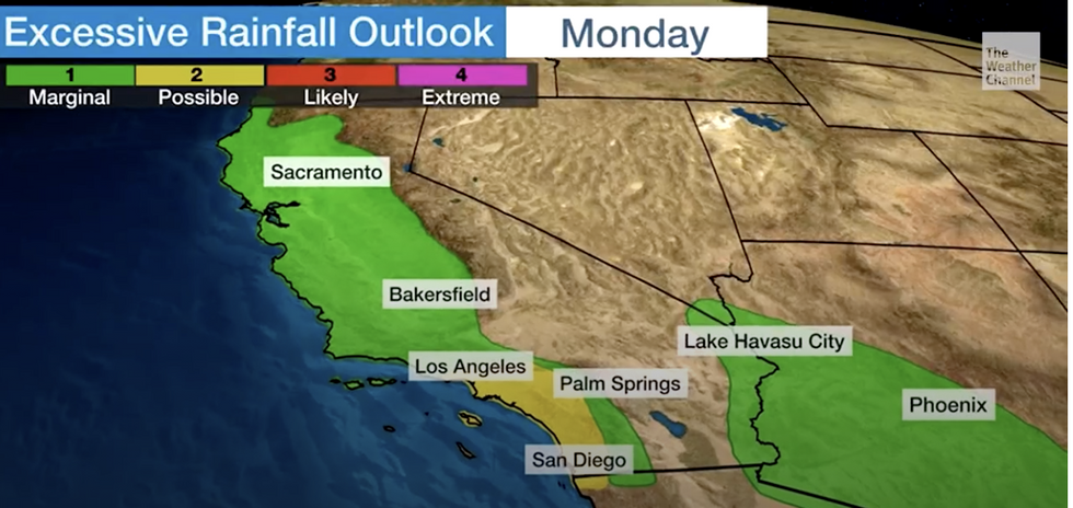
California will bear the brunt of a 'series of storms'
The Weather Channel
Weather Channel meteorologist Ari Sarsalari said: “There is going to be a lot of rain in parts of the south next week especially during the mid-part of next week.
“This is a storm system that is going to be dropping some freezing rain, some icing conditions in parts of the Ozarks and the Midwest.
“We also have some snow up in the norther tier, but if you live in the south it is going to be just rain.
“It is a slow movement from west to east for the next several days.”
Rising temperatures will melt piles of snow which, with heavy rain and thunder, will bring a risk of flooding, he warned.
He said: “We will have some rumbles of thunder, and with the heavy rain, flooding is going to be an issue especially during the early to middle part of the week.
LATEST DEVELOPMENTS:

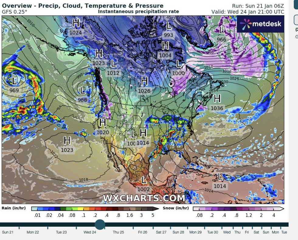
A pulse of warm air arriving as the US battles a near historic big freeze will trigger a deluge of freezing rain
WX Charts
“There is a lot of moisture that is going to stream into the west coast and we are also going to have snow melting, but there will also be snow falling up in the high terrain of the Sierra.
“Just about all of California is going to be under the gun for some pretty decent rain and on Monday, heavier rain is going to shift to the south.”
Weather models show around seven low-pressure storm systems lined up to smash into the west coast before the end of the month.
A strong jet stream ploughing in from the Pacific will become a conveyor belt, steering storms into the west coast.
To the east, clashing air masses will bring the risk of further heavy snow to the Great Lakes and surrounding regions.
A pulse of warm air arriving as the US battles a near historic big freeze will trigger a deluge of freezing rain.
The US National Weather Service (NOAA) warned ‘multiple’ storm systems will level an assault across western America.
A spokesman said: “Along the West Coast, multiple frontal systems arriving from the Pacific will bring more active weather onshore through the next couple of days.
"Heavy rain will likely continue across northern California today, followed by a brief lull this evening before the next surge of heavy rain expected to arrive on Monday.
“Meanwhile, heavy wet snow is expected along the Sierra Nevada during similar time frame.
“In addition, the influx of warmer air overrunning the trapped cold air near the ground will continue to bring the potential of ice/freezing rain for the Columbia Gorge for the next couple of days.”


