US weather warning: Heavy snow to hit parts of America as El Nino winter hits

US weather: Snow will hit parts of the USA
|The Weather Channel

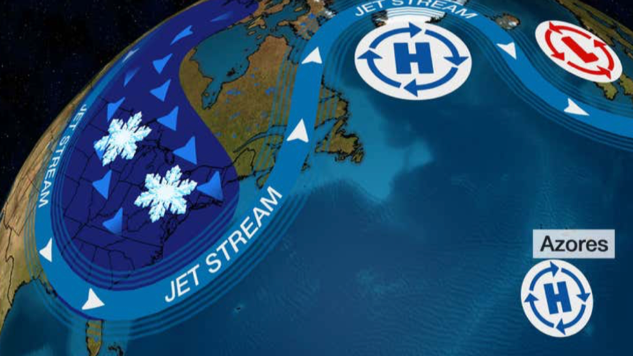
Cold air driving across southern states will collide with warmer air unleashing an Arctic deluge
Don't Miss
Most Read
Heavy snow driven by an unusual warming of the Pacific Ocean could be about to hit the United States as the nation braces for an ‘El Nino Winter’.
Cold air driving across southern states will collide with warmer air to the north creating a volatile mix to unleash an Arctic deluge, forecasters warn.
It will be driven by El Nino, a phenomenon triggered by rising temperatures in the Pacific off the coast of South America, confirmed earlier this year.
El Nino affects weather patterns across the world and could hold out until next spring, experts warn.

El Nino effect on the US weather
|The WEather Channel
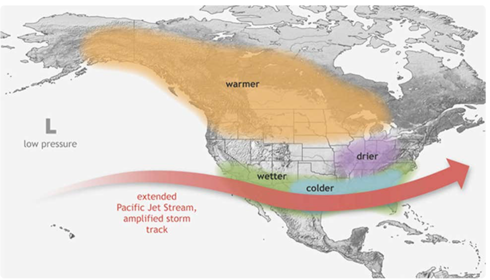
In the United States, it often drives winter snowfall across swathes of the country, although most at risk would be southern and central states.
Ari Sarsalari, meteorologist for The Weather Channel, said: “We are in an El-Nino pattern right now, and it is forecast to get stronger.
“It is unclear how strong this is going to get, but it is forecast to get stronger.
“In general, we tend to see more snow in the south during El-Nino years from the Mid-Atlantic, through the Tennessee Valley, the Plains, and then even out towards the Sierra.”
The northern stretch of the US including across the Great Lakes, the Upper Mid-west, and the Northeast, would see less snow, he said.
He added: “In general, especially through the Mid Atlantic in the Plains, snowiest seasons have been during the El-Nino Year.
“So, those are the hot spots to watch when we have an El Nino going on.”
The greatest threat of a winter deluge will arrive at the start of next year when the cold blast moves into moist, damp air over the US.
While parts of the country could be hit by heavy snow, northerly regions will be wrapping up for bitterly cold dry winds.
Jim Dale, US weather correspondent and senior meteorologist for British Weather services, said: “This is more likely into the start of next year, around January rather than during the start of the winter season.
“While there will be some heavy snow, there will be a lot of the United States that will be drier but colder.
“The snow will be the result not necessarily of the very cold air, but of the mixing of air masses.
“The real cold stuff is going to be north of the Great Lakes.”
El Nino is caused by a change in direction of the easterly Trade Winds in the tropical Pacific which stops warm water sweeping away from the coast of Peru.
Warmer than average sea surface temperatures surround the region, which in turn alter the pattern of tropical monsoons.
The phenomenon has a knock-on effect on weather patterns around the world, most notably the United States, Asia and Australia.
There is a 75-per-cent chance this year will see a strong El Nino, with a 95-per-cent chance it will last into spring 2024.
Tom Di Liberto, writing for the National Oceanic and Atmospheric Administration (NOAA), said: “According to the September El Niño-Southern Oscillation outlook, El Niño is expected to stick around, with greater than a 95-per-cent chance, at least through January-March 2024.
“There is now around a 71-per-cent chance that this event peaks as a strong El Niño this winter.”
El Nino will also affect pressure patterns across the North Atlantic, pushing it into its so-called ‘negative phase’ which would increase the risk of winter snow.
The Weather Channel said the US is gearing up for an ‘El Nino winter’, although other meteorological factors will play into America’s snow forecast.
The Weather Channel’s Jonathan Erdman said: “El Niño is likely to be in place through winter, and that could influence how much snow different regions of the US pick up this season.
“El Niño winters tend to be snowier than average in parts of the South and mid-Atlantic.
“They can be less snowy across the northern tier from the Northwest to New England.”


