


A STORM brewing off the east coast threatens to unleash an unseasonable Arctic assault as the US braces for winter to pounce early.
A bitter plunge after the weekend will plummet temperatures putting parts of northern America on alert for snow.
The frosty intrusion will be triggered by a ‘nor’easter’ or ‘East Coast low’ – a low-pressure storm in the western Atlantic dragging cold air down from the north.
Its arrival is even stranger coinciding with a summer resurgence fuelled by plume of Mexican air turning up the thermostat across western states.
However, the heat dome bringing 30C-plus temperatures to Texas, Nevada, Arizona, California and New Mexico is about to have its ignition cut with cooler conditions forecast widely.
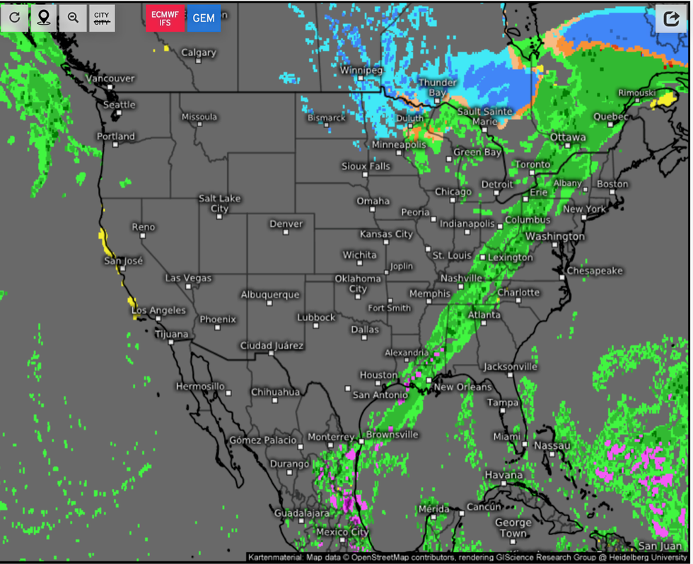
Bringing a risk of snow (blue) to the north
weather.us
Jim Dale, US weather correspondent and meteorologist for British Weather Services, said: “Cold air is going to come down from the north, through Canada and affecting north-eastern states first.
“This is a significant cold plunge and is going to be driven by a nor’easter system to which as its name suggests will bring winds in from the northeast.
“As it passes through Wisconsin, and over the Great Lakes, there may well be a risk of snow.
“This will probably be over higher ground, but if we were in winter now, we would be talking about this bringing around a foot of snow.”
Cold air will start to push in from the north over the coming days with the full thrust of the icy blast forecast next week.
Mr Dale said: “The real cold will arrive after the weekend.
“Northern areas will need to keep a close watch on this.”
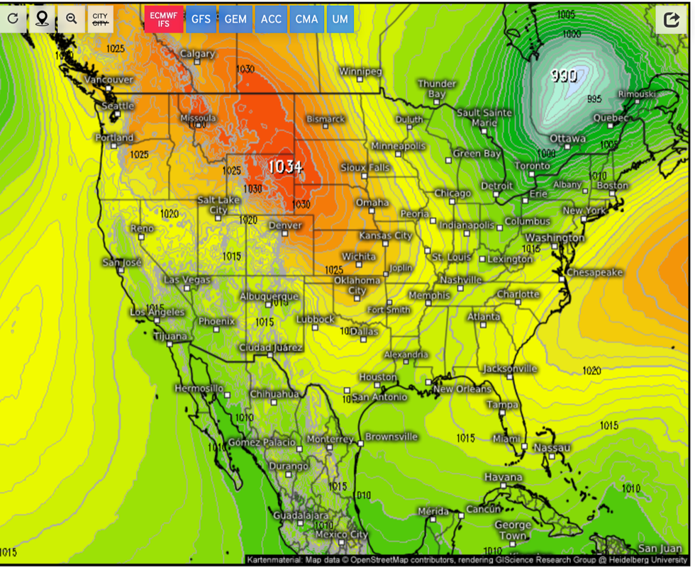
Temperatures drop as low pressure moves into the north east
Weather.us
Hot weather will hold out across the western US with records for the time of year under threat.
Unbearable temperatures are being driven by a ‘heat dome’ of high pressure acting like a greenhouse to keep the thermostat turned to max.
However, autumn will finally hit the region next week as a bitter northerly wind blows across the country.
Weather Channel meteorologist Orelon Sidney said: “A strong ridge of high pressure is in control in the west, and if you're wondering where fall is, hang on, you should see it next week.
“But as far as this week, we're talking hot temperatures in record territory .
“A low-pressure storm that's going to roll through as we end the weekend is going to break your temperatures.
“It will cool off, but also bring some relatively unsettled weather across the west, so look for return to cool windy and rainy.”
Long-range forecasters are keeping an eye on an El Nino Pacific ocean warming which may bring a colder than usual winter to parts.
El Nino is caused by a slowing of the easterly trade winds leading to warmer ocean temperatures around the South American coasts.
It is linked to global weather patterns, including the Asian monsoon and colder winter temperatures across the southern US.
Weather Channel meteorologist Chris Dolce said: “Temperatures this winter in the United States could have the signature of El Niño's influence.
“A strong El Niño is favoured this winter, which is typically associated with warmer-than-average conditions in much of the northern US.
“It also means parts of the southern US usually see temperatures somewhat below-average in winter.”
