Warm weather creeps up the south of the country
WX Charts
Don't Miss
Most Read
Trending on GB News
America’s weather is about to get a shake-up as the jet stream turns ‘zonal’ to drive a freak heatwave and a barrage of storms.
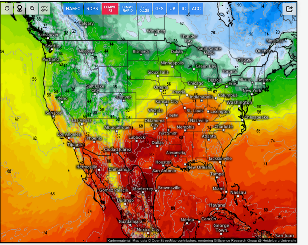
Southern states are braced for temperatures to rocket back into the 30Cs this week as tropical air floods the region.
However, it will crash into a swath of Arctic cold to unleash an eruption of ferocious storms particularly across Texas.
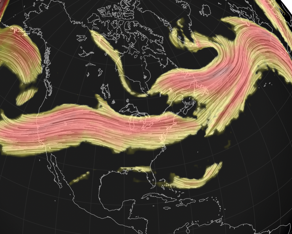
The culprit is the jet stream, which after firing up at speed and stretching across the US has triggered a so-called ‘zonal’ weather transformation.
Weather Channel meteorologist Chris Dolce said: “This simply means the jet stream will be flowing in a flat west-to-east fashion across the country.
“That's a change from where the jet stream was amplified north to south, which allowed shivering temperatures to grip the central and eastern US.

Heat to the south
weather.us
“The upshot of this zonal flow pattern is that rain and snow will be confined to the nation's northern tier, and it will help temperatures warm above average in many cities east of the Rockies.”
Southern states including Louisiana, Texas and Florida could hit 30C this week, forecasters say.
A north-south split will keep the northern third of the country in the chiller, with freezing winds and snow to persist.
Unstable atmospheric conditions sparked by the clash of air masses will put parts of the US under threat of violent storms.

Zonal jet sweeps across America
Netweather
Jim Dale, US weather correspondent and social commentator for British Weather Services, said: “Southern areas are going to feel the heat this week, with temperatures getting back up to 30C or slightly higher.
“The jet stream is going to bring a three-way split, with the north staying colder and the south getting much warmer.
“However, this is going to bring a risk of storms across Texas, Arkansas, Kansas and other states that lie in tornado alley.”
Storms will be turbo-charged by areas of ‘sub-tropical low pressure’ turning the atmosphere into a powder keg, he warned.
Texas will feel the full force of the assault, which could see tornadoes rip through the region, he added.
He said: “There will be sufficient heat in the south to bring a great deal of atmospheric instability and add to this the likelihood of sub-tropical lows coming out of the region, and with the warmth there will be high humidity.
“There could be some big storms in Texas by the end of the week, and this will be the state that bears the brunt of it.”
Meanwhile, north-western states face further risk of flooding this week as storms plough in from the Gulf coast.
Weather Channel meteorologist Ari Sarsalari said: “We have some more rain to go in the Pacific north-west and some snow up in the high terrain.
“On Thursday and into Friday, there is another batch of rain coming in and of course some snow up in the high terrain parts of the Cascades.
“The next batch of rain, is going to be a thinner batch of rain along a front so the risk of flooding will be low, but it is the rainy season so we are going to be seeing more of these storms coming in more often.”


