Rainfall in US as Hurricane Rafael looms
AccuWeather
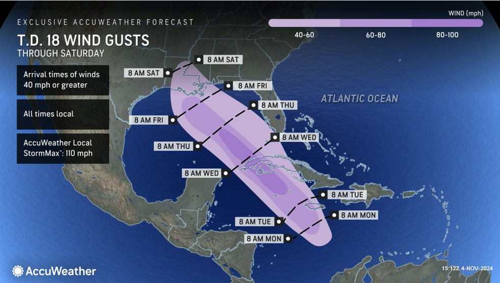
Winds of up to 100mph winds have been forecast
Don't Miss
Most Read
Trending on GB News
A multi-barbed attack bolstered with tornado-loaded thunderstorms will sweep the US as coastal communities brace for Hurricane Rafael.
Battling air masses will trigger violent outbursts across central and southern regions as a cold plume from the north crashes into the mild south.
The US National Weather Service has issued warnings across the country for gales, flash floods, and storms.
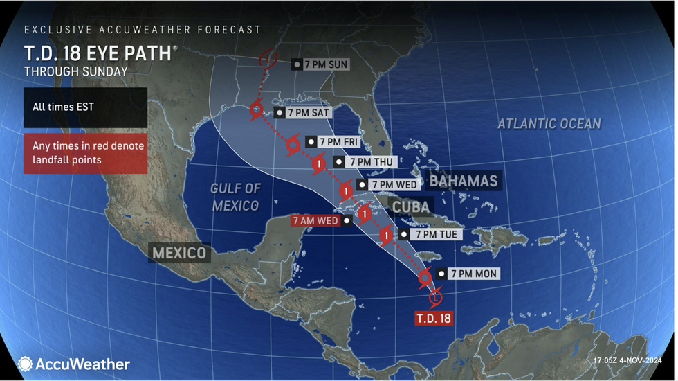
Meanwhile, newly formed Hurricane Rafael is barreling towards the Caribbean with US landfall expected at the end of the week.

Hurricane Rafael storm path
AccuWeather
The storm was last night upgraded from a tropical storm to a full-blown hurricane and is forecast to whip up 100mph winds.
A hurricane warning has been issued across the south coast of Florida, already devastated by Helene and Milton.
AccuWeather meteorologist Jon Porter said: “This is going to be a very stormy and impactful week for millions of Americans.
“There is a high risk of severe thunderstorms that could produce tornadoes, hail, and flash flooding in northeastern Texas, eastern Oklahoma, western Arkansas, south-eastern Kansas, and southwestern Missouri.
“The Gulf coast of Louisiana to Florida faces the greatest risk of tropical storm impacts later in the week and into the weekend.”
US LATEST: Rainfall in US as Hurricane Rafael loomsAccuWeather
Volatile atmospheric conditions threaten rare ‘nigh-time tornadoes’ – powerful twisters that rage through the small hours.
Americans have been urged to ‘not let down your guard’ as severe weather assaults come from all directions.
AccuWeather senior director of forecasting Dan DePodwin said: “The severe weather season is back in full force, so never let your guard down.
“There’s severe weather in the forecast, and the clash of warm and cool air season can trigger dangerous thunderstorms and violent tornadoes with the threat possibly extending well into the night, so please be prepared to receive warnings.”
North-western regions will feel the first bite of winter with temperatures through the coming days plummeting to below freezing.
To the southeast, the mercury will rise, with a huge weather front setting the stage for explosions.
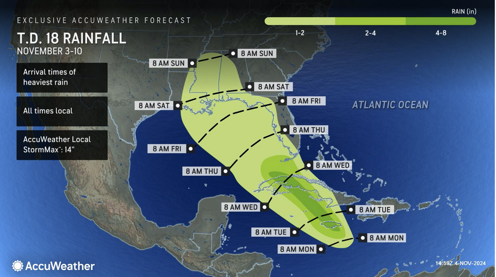
Torrential downpours across Kansas, Oklahoma, Texas and surrounding states threaten severe floods.
However, the main risk will come from explosive storms and tornadoes, whipped up by strong winds where hot and cold air meet.
Jim Dale, US meteorologist for British Weather Services and co-author of ‘Surviving Extreme Weather’, said: “There is a big region of low pressure that is particularly going to affect central regions, and this will bring the risk of thunder and tornadoes.
“Very unsettled weather will be driven by the clash of two airmasses, and here there will be the potential for severe outbreaks.
“This is the time of year we see a heightened tornado risk, and there is the potential for some serious damage.”

Hurricane Rafael: wind gusts
AccuWeather
Eastern coasts were this morning put on alert for Hurricane Rafael, which burst out of the tropical Atlantic to end the brief calm since Helene and Milton.
A spokesman for the National Weather Service said: “Residents along the Gulf Coast should pay attention to Rafael.
“Some moderate to heavy rainfall well ahead of Rafael could move into the Southeast by Wednesday night and continue into Thursday morning.”
Porter added: “We’ve had 16 named storms form in the Atlantic basin so far this season, plus the unnamed subtropical storm that made landfall in South Carolina.
“The numbers continue to add up.”


