US weather: Fierce storms set to roll over America as hail and thunderstorms set to strike
The Weather Channel
Severe storms could develop from tomorrow
Don't Miss
Most Read
Trending on GB News
A blob of cold air rolling into America will bump against a 110F heat dome detonating a spate of golf-ball-hail spewing thunderstorms.
US weather is about to take an explosive turn amid warnings for violent winds, tornadoes and torrential rain.
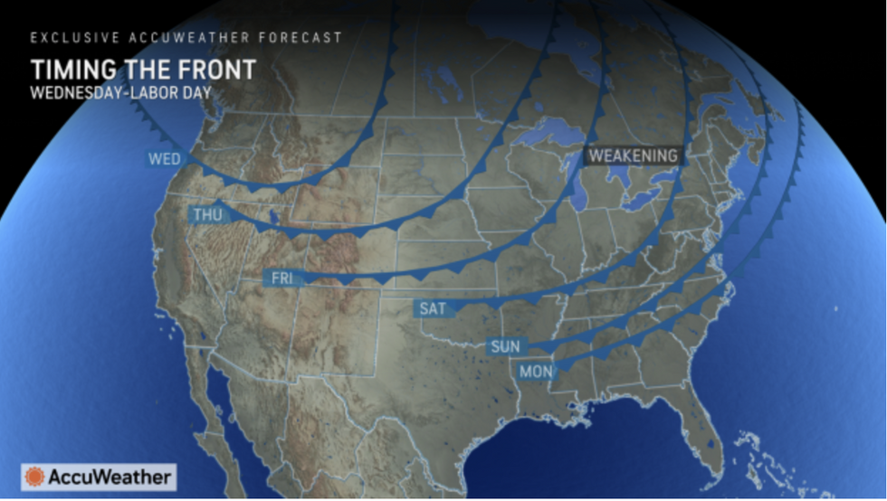
Cold air led by a ‘cold front’ will shift into parts of the country currently boiling in a record heatwave.
The two air masses, driven by extreme humidity, will clash to ignite fierce storms through the end of the week.
 US weather: Fierce storms set to roll over America as hail and thunderstorms set to strikeThe Weather Channel
Weather Channel meteorologist Chris Dolce said: “A cold front will shift east through midweek, taking the threat of severe weather into the mid-Atlantic and Northeast.
“Isolated severe storms might extend westward into the Ohio Valley, with Baltimore, New York City, Philadelphia and Pittsburgh some of the metro areas that might see severe storms.
“Damaging wind gusts and large hail appear to be the primary threats.”
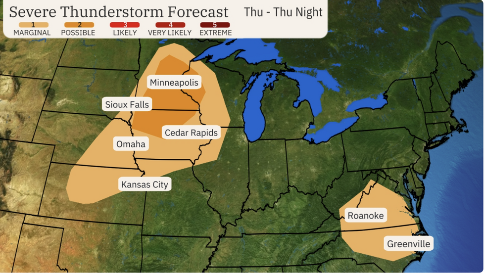
A second storm system will move through on Thursday ramping up the storm threat with outbursts forecast as far east as North Carolina and Virginia.

Cold front moves through the US
AccuWeather
It follows a stormy start to the week with ‘hail the size of softballs’ reported in Nebraska, according to Dolce.
He added: “A second weather system will track into the upper Midwest by Thursday, producing at least some severe weather in that region during the afternoon and evening hours. A few severe storms might also develop in North Carolina and southern Virginia.
“Parts of the Great Lakes and Midwest could see severe storms from this system on Friday.”
It comes as swaths of the country battle ferocious heat that has simmered the nation since the start of summer.
The National Weather Service (NOAA) has extreme heat warnings in force across eastern states and separate wildfire alerts covering Wyoming, Nebraska and Iowa.
A sweeping cold front will ease temperatures ahead of the weekend, although the risk of storms will rocket.
US LATEST:- ‘Never-ending chaos!’ Trump predicted to flood White House with ‘sycophants’ with ex-President free to launch ‘unhelpful eruptions’
- Walz won’t keep them out! Delegating migrant crisis to Minnesota governor would be disaster, strategist claims
- Biden punished Brexit Britain because Democrats wanted UK to ‘advance US interests’ in Brussels
A NOAA spokesman said: “This front will continue to press south-eastward Wednesday night bringing relief by Thursday to the heatwave for the Mid-Atlantic region into the Upper Ohio Valley.
“With moisture values expected to be much above average along and ahead of each of these fronts, locally heavy rain and isolated flash flooding is possible from the Ohio Valley into the Mid-Atlantic, and portions of the Northern Plains into the Upper Mississippi Valley late Wednesday into Thursday.
“In addition to the heavy rain and flash flood threats, these thunderstorms may produce severe weather, with large hail and high winds the greatest threat, and a lesser threat for tornadoes.”

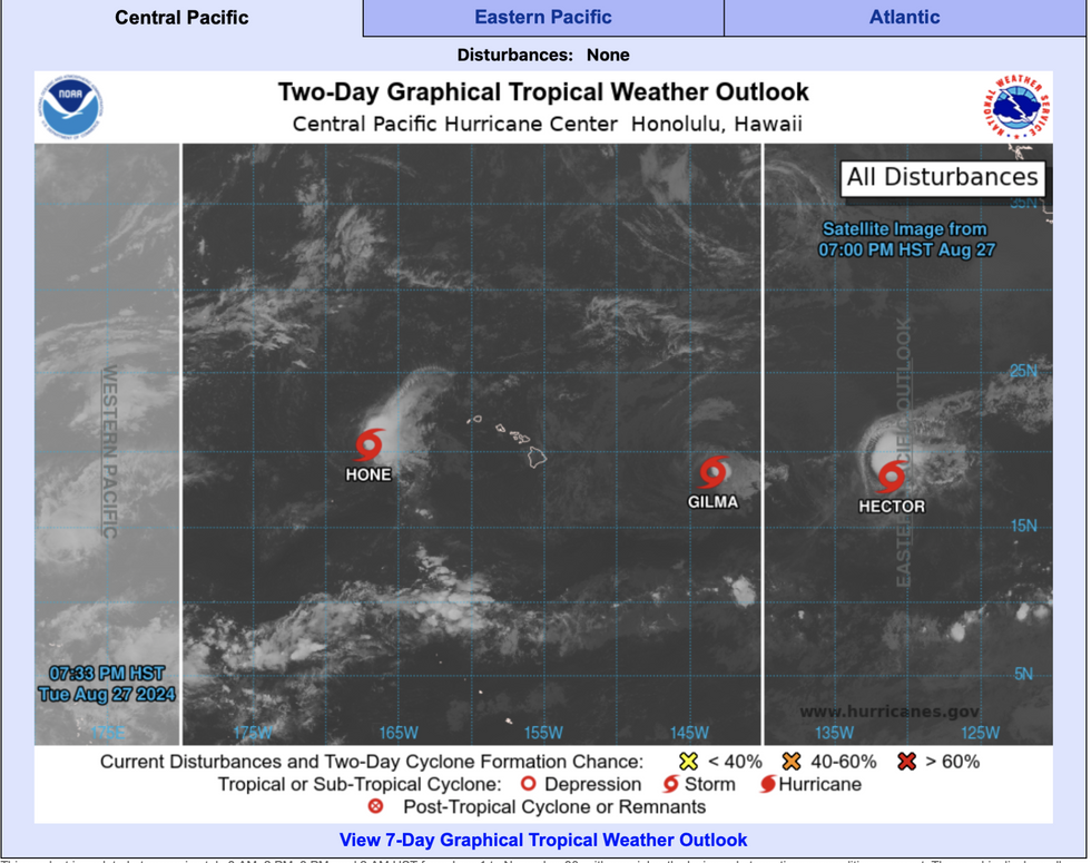
Hone, Gilma and Hector plough through the Pacific
NOAA
Jim Dale, US meteorologist for British Weather Services and co-author of ‘Surviving Extreme Weather’, said: “The upcoming storms will be quite scattered with the risk of thunder and perhaps some tornado activity.
“These will affect Florida, the Midwest and the surrounding regions as things turn a little bit cooler to the north and cold air meets with the very hot air.
“This causes instability and the risk of storms.”
The tropical storm count around the coast of America reached four with a new ‘disturbance’ forming off the coast of Bermuda.
It joins Tropical Storms Hone, Gilma and Hector which are currently heading westwards in the Central Pacific.
A NOAA spokesman said: “An area of low pressure a few hundred miles southeast of Bermuda is producing disorganised showers and thunderstorms.”


