


A ‘relentless frenzy of storms’ ploughing the United States will pursue its unyielding assault into mid-February.
Clashing Arctic and tropical airmasses fuelling heavy rain, wind and snow will drive the ‘stormiest stretch of winter’ to date.
As swathes of the US reel in the wake of winter storms Freya and Garnett, another two are on the way.
Stormy weather and heavy snow shows no signs of easing through the next two weeks, experts warn.
Americans brace for 'relentless storm frenzy' as Arctic air mass collides with tropical blast
ACCUWEATHER
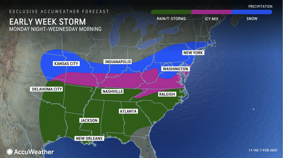
AccuWeather meteorologist Jonathan Porter said: “Two storms this week will bring the greatest risk of widespread plowable snow so far this season from Washington DC to New York City.
“Cumulative snowfall over the next two weeks could be two to three feet across a zone stretching from interior New York to parts of New England.
“Families and businesses across more than 20 states will face relentless rounds of winter storms and hazardous travel conditions that will linger into late February.”
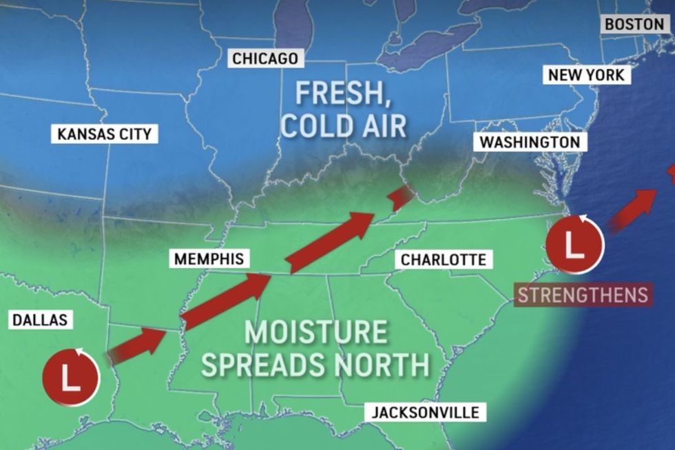
Torrential snowfall over the past days from Storms Freya and Garnett will this week give way to the ‘most intense’ of a trio.
South-eastern and north-eastern regions are most at risk as a moist tropical pulse from the Gulf of Mexico battles Arctic air over northern states.
LATEST DEVELOPMENTS: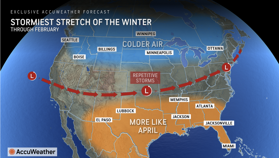
Accuweather's forecast is for a stormy stretch
ACCUWEATHER
Communities are warned to prepare for ‘significant’ snowfall with disruption expected on roads and travel routes.
Porter said: “The next winter storm stands out from the rest because it has the potential to be more intense and widespread, with a fresh supply of cold enough air to support significant and plowable snow across parts of the Northeast and mid-Atlantic.
“As one storm system over Texas moves north towards the Appalachians, another is expected to develop off the East Coast, and this is a recipe for significant snowfall.
“People in the Midwest, mid-Atlantic, and Northeast should be prepared for disruptive to significant snowfall accumulations.
“This is the stormiest stretch of the winter with a February frenzy of storms every few days in many places.”
Rain storms will hit the south but snow storms will hit the north
ACCUWEATHER
Arctic winds sweeping Canada into the US and over the Great Lakes will bring trigger additional Lake-Effect snow.
The US National Weather Service (NOAA) has winter-weather warnings in force across the northeast and at-risk areas.
A spokesman said: “Lake-effect snow will develop over parts of the Upper Great Lakes from Sunday into Tuesday.
“Moisture from the Gulf will stream northward intersecting old air moving south over the Plains, and this will produce a broad area of light snow over Northern and Central Plains, Middle Mississippi and Ohio Valleys and Upper Mississippi Valley.”
Warm and cold air straddling the jet stream will be the driver of volatile weather, clashing in the middle to spark winter storms.
A barrage of low-pressure storms rattling in off the Atlantic will add to the chaotic mix, experts warn.
Jim Dale, US meteorologist for British Weather Services and co-author of ‘Surviving Extreme Weather’, said: “There is some very intense cold air coming off the back of a series of lows from the Atlantic, and this will keep the cold winter weather in place across the north of the country.
“Where cold air meets warmer air to the south, however, here is where there is going to be the risk of storms and further heavy snowfall through the rest of the week.”
