


Blistering late-summer heat has plunged 10 states into the danger zone amid forecasts for record August temperatures.
Swaths of America are in their third month of an unbearable heatwave pushing thermometers to 110F-plus.
A simmering heat dome which settled over the country at the start of summer will remain wedged in place until later this week.
National Weather officials have issued a raft of extreme heat and wildfire warnings through the coming days.
US weather: Multiple states plunged into danger zone amid unbearable 110F heatwave
AccuWeather
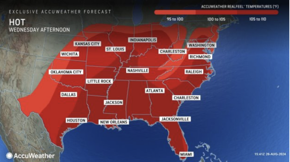
Weather Channel meteorologist Tiffany Savona said: “The last week of August is going to be a scorcher as a strong ridge of high pressure brings dangerous heat to the Midwest before shifting south and east.
“Feel-like temperatures could reach 110F, and this is when the risk for heat-related illnesses will increase, so take it easy and check on family and friends.
“Record highs will be under threat for many, including in Chicago.
“The heat dome shifts south by the middle to end of the week allowing Nashville and Atlanta to potentially break records.”
Extreme heat is expected to ease through the start of September, she added, with temperatures in parts dropping below average.
US LATEST:The National Weather Service (NOAA) has heat warnings in force across Missouri, Illinois, Indiana, Ohio, Iowa, Michigan and Wisconsin, with wildfire alerts covering Washington, Idaho and Montana.
‘Record high’ temperatures will bake the region into the middle of the week before the mercury plummets.
A NOAA spokesman said: “The combination of hot temperatures and high humidity levels will produce maximum daily heat indices of between 105F and 115F across these regions with major to extreme heat risks.
“Excessive Heat Warnings and Heat advisories are in effect across the Mid- to Upper-Mississippi Valley, the Mid West and southern New England, affecting nearly 61 million people.
“Further expansion of these warnings and advisories is possible into portions of the Mid-Atlantic over the next two days.”
Southern states will hold onto the heat through the week while cooler conditions arrive elsewhere.
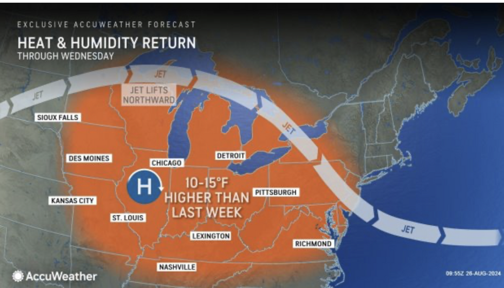
Weather map shows heat and humidity set to return
AccuWeather
A huge high-pressure area – heat dome – which has driven searing temperatures through the summer will continue to fire the thermostat.
Jim Dale, US meteorologist for British Weather Services and co-author of ‘Surviving Extreme Weather’, said: “The heat dome remains in place for the next few days, with the south of the country expecting the highest temperatures.
“Places like Arizona, Nevada and New Mexico will stay at around 30C all week before things cool down in parts.
“But as the cooler temperatures arrive, there is the risk of storms as the two air masses clash.”
Meanwhile, meteorologists are keeping their eyes on the east Pacific which in the past day has spawned a third potential hurricane.
Hot on the tails of Gilma and Hone, Tropical Storm Hector has joined the queue en route to Hawaii.
A NOAA spokesman said: “Hector appears to be holding steady.
“Gilma remains a resilient hurricane over the far western portion of the Eastern Pacific.”
