US weather forecast: Fierce cyclones threaten to smash America in next 72 hours

Winds hammer swathes of the US
|GB News

North-eastern and western states are braced for torrential downpours
Don't Miss
Most Read
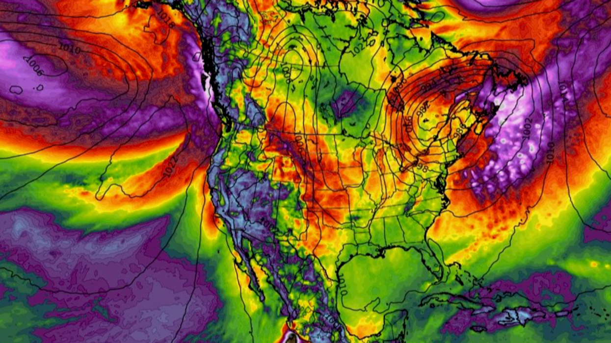
Fierce cyclones whipped up by the jet stream threaten to thwack the United States with a 100kmh storm deluge.
North-eastern and western states are braced for torrential downpours as hot and cold air collide to form a ‘storm factory’.
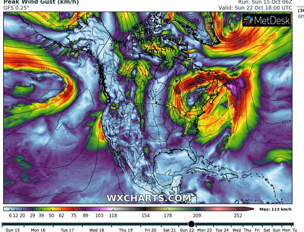
Winds of 100kmh will hammer exposed coastal regions while inland gusts could hit 75kmph.
Stormy conditions will be driven by a hot and cold temperature contrast across the States helping the jet stream fire up low-pressure systems.
Foul weather will set in during the middle of the week with the full force of the assault due at the weekend.
Jim Dale, US weather correspondent and meteorologist for British Weather Services, said: “It looks to be turning very wet and windy to the northeast, particularly around New England which does not look like the best place to be in the run up to and around the weekend.

To the west of the United States, the jet stream will fire up
|WX Charts
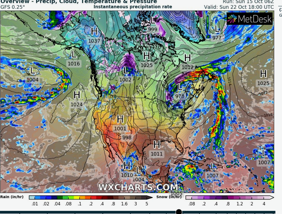
“Low pressure, which appears to dip down from north Canada, is hanging around in situ over the east of the country.
“This will bring the risk of floods to parts of the region, and the chance of some strong winds at times.”
Unsettled weather to the east of the country will be driven by a clash between hot and cold air masses.
Searing heat from Mexico will bake western states through the start of the week while a cold plunge from the north will chill the east.
The two bodies of air will mix to form a volatile storm ‘factory’ spawning low-pressure cyclones, he warned.
To the west of the United States, the jet stream will fire up over the country driving a separate deluge, he added.
He said: “The contrast in temperatures brought by separate air masses will form a factory for these very unsettled outbreaks.
“Also, into next weekend, very unsettled weather systems will start to come into the west of the United States.

The phenomenon forms from Pacific low pressure dragging trailing fronts
|WX Charts
“These will be driven by the jet stream, which will also have an influence across the country to drive the wind and rain this week.”
The warnings come as Florida battles a persistent deluge thanks to unusually high tropical storm activity in the Atlantic.
Forecasters are watching two storms moving across still warm ocean waters – the remains of Tropical Storm Sean and a separate disturbance off the coast of Africa.
Meanwhile, on the other side of the United States, a spate of ‘atmospheric rivers’ have dumped a deluge across California.
The phenomenon forms from Pacific low pressure dragging trailing fronts loaded with moisture into the west coast.
California has endured one of the wettest years on record with an El-Nino warming of the eastern Pacific threatening more rain.
A spokesperson for The Weather Channel said: “California just finished one of its wettest water years in recorded state history.
“That's thanks in part to a series of big atmospheric river events that dumped huge amounts of rain and snow on the Golden State.
“Another blockbuster water year could be coming courtesy of the El Nino climate pattern that we're in which typically favours a wetter than average winter in parts of the state.”


