


‘Firecracker’ heat and deadly storms will plague the United States for at least the next fortnight.
A 1,500-mile ‘dangerous’ heat dome will swell across the country as temperatures in parts soar to 110F.
Cold fronts sweeping eastwards will lock horns with tropical humidity to trigger violent storms, tornadoes and giant hailstones.
Millions of people are warned that ‘excessive heat’ and thunder next Thursday threatens to hamper Independence Day celebrations.
 US weather: ‘Firecracker’ heat and deadly storms to plague America for WEEKSAccuWeather
AccuWeather chief meteorologist Bernie Rayno said: “Excessive heat and severe thunderstorms could impact outdoor events and gatherings for millions of Americans celebrating Independence Day next week.
“Stubborn heat and storms will linger right into mid-July.
“It will be hot as a firecracker in parts of the mid-Atlantic, Southeast, and central United States over the holiday, with temperatures expected to climb above 100F.”
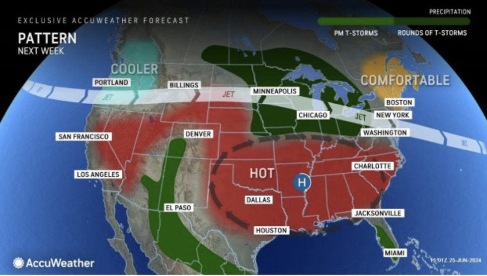
A huge dome of high pressure will stretch across south-central US states into the Mid-Atlantic.
Fiery heat will reach the far northeast with temperatures forecast to soar beyond the end of the month.
US LATEST: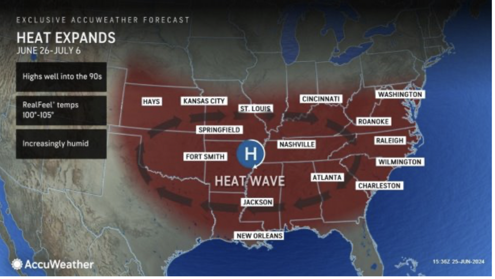
Heat dome spreads
AccuWeather
‘Intense and prolonged’ humidity will erupt into violent thunderstorms as it collides with cold air from the west.
AccuWeather lead long-range forecaster Paul Pastelok said: “From Kansas City to St. Louis, Nashville, Washington, DC, Richmond, and Raleigh, we’re expecting rounds of heat and humidity that will be quite intense and prolonged into early and mid-July.
“Overnight low temperatures won’t provide much relief in parts of the Southeast, so we’re looking at very uncomfortable and sometimes dangerous heat heading into July.
“Some storms could be severe across parts of the Midwest, western Ohio Valley and Tennessee Valley, producing damaging wind gusts, hail, and possibly some tornadoes.”
Storm warnings come just over three weeks into the Atlantic hurricane season, with two tropical storms already reported.
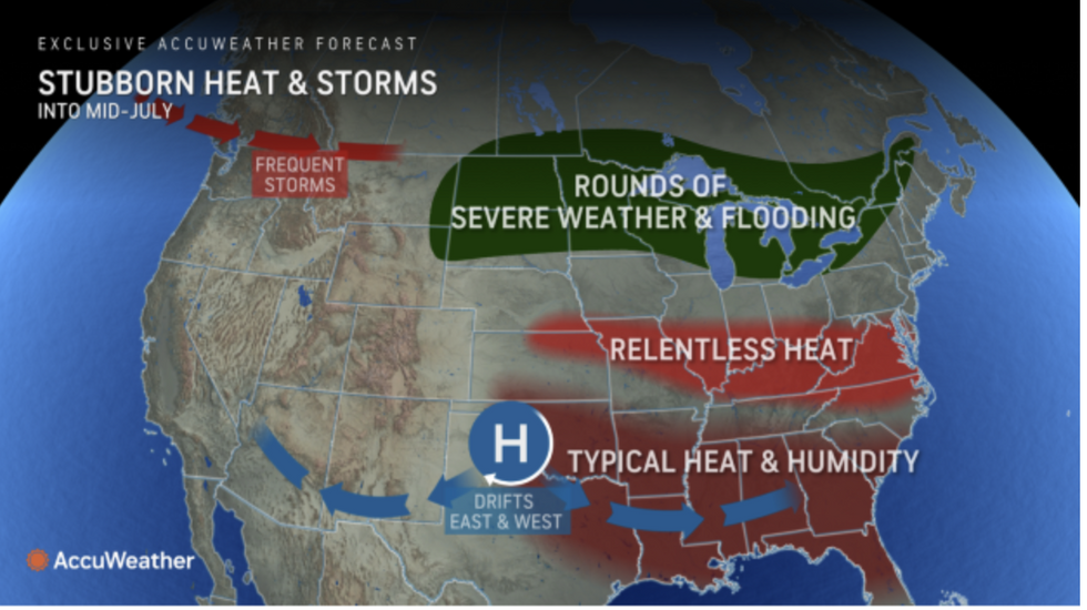
Frequent storms will affect the northwest
Accuweather
An active season is predicted by meteorologists thanks to high sea temperatures and the tail end of an El Nino warming of the east Pacific.
Ocean temperatures are expected to remain warmer than average through the summer as land temperatures soar.
However, a plume of ‘tropical-wave-eating’ dust from the Sahara could stifle the development of some storms.
Dust from Africa dries humidity from the storm and renders them unable to fully mature.
Weather Channel meteorologist Jonathan Belles said: “This hurricane season is expected to be very active but breaks in the season will still be likely.
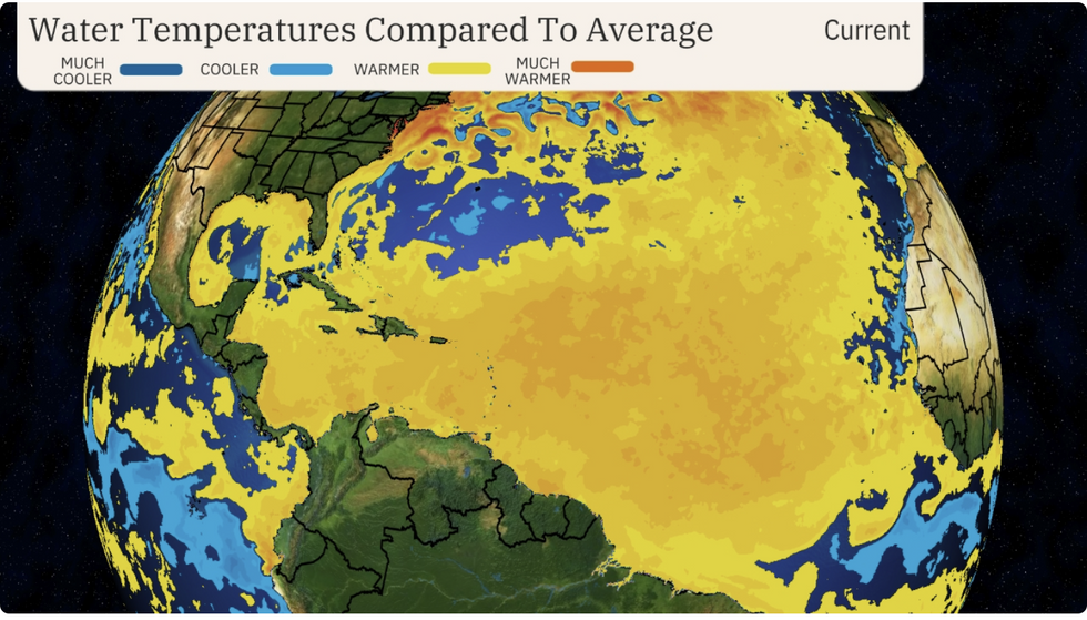
Sea temperatures still above average
Weather Channel
“The most immediate factor that will stall activity over the next few weeks is bursts of tropical-wave-eating dust from Africa which cause thunderstorms to dry out and fall apart.
“Mammoth bursts of dust can also act as a temporary shade over the Atlantic that can cool down water temperatures between the Lesser Antilles and Cabo Verde.”
Southern states in the firing line for hot air from the Gulf of Mexico will see the highest temperatures through the coming weeks.
Jim Dale, meteorologist for British Weather Services and US correspondent, said: “The heat is going to get worse, and we are already seeing temperatures that are close to if not past record levels.
“We are also in the season for tropical storms, and there is enough energy in the atmosphere to produce some very big storm systems.”
