


Churning tornado winds scouring hundreds of miles of tinder-box parched land threatens a near 10-state wildfire inferno.
Government forecasters have issued a raft of "critical" to "extreme" warnings ahead of 80mph winds and incendiary lighting strikes.
The next assault follows a killer weekend storm which smashed homes and businesses while leaving more than 30 people dead.
As temperatures rocket to flash point, the next aggressive storm system will plough through the south and Midwest.
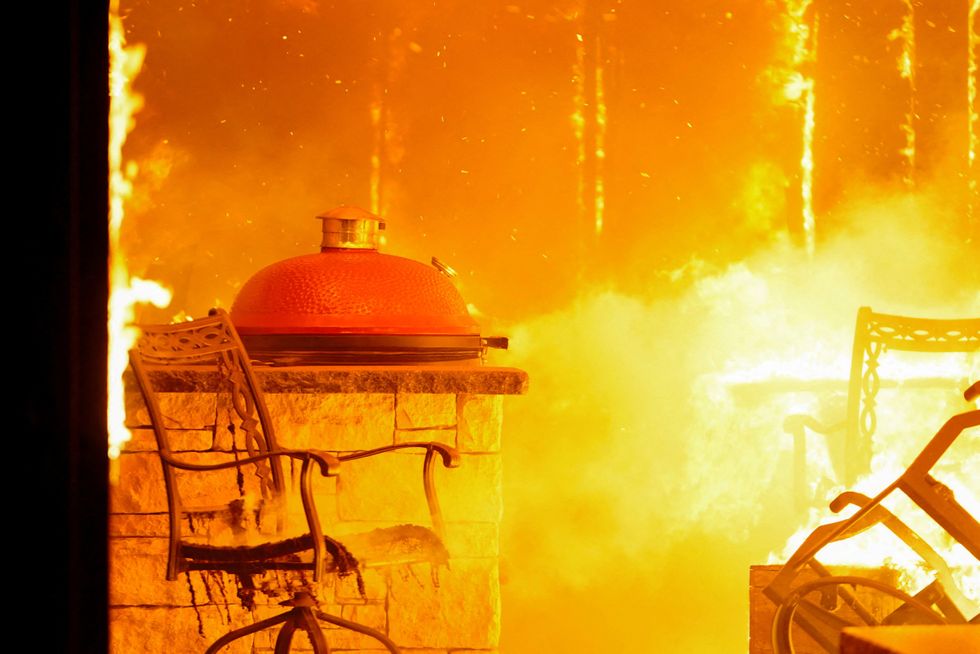
Oklahoma was ravaged by wildfires last week
REUTERS
AccuWeather meteorologist Dan DePodwin said: “Government leaders in some of the areas hit hard by the recent severe weather outbreak need to prepare for another round of dangerous and disruptive weather.
“Another powerful storm will bring damaging wind gusts and a risk of fires to many of the same areas that were impacted by extreme winds and fire activity on Friday.
“Extreme winds and a high risk of fires can create life-threatening conditions in a matter of minutes and travel can be extremely dangerous during these powerful winds.”
The US National Weather Service (NOAA) has warnings in force across Texas, Missouri, Kansas, Arizona, New Mexico, Colorado and surrounding states.
Further alerts for winds touching 80mph ahead of the weekend are in force more widely.
A NOAA spokesman said: “A round of high winds gusting to 80mph will impact portions of the Southern Plains into Wednesday with impacts from the winds possibly including sporadic power outages and very difficult travel due to reduced visibility from blowing dust.
LATEST DEVELOPMENTS:
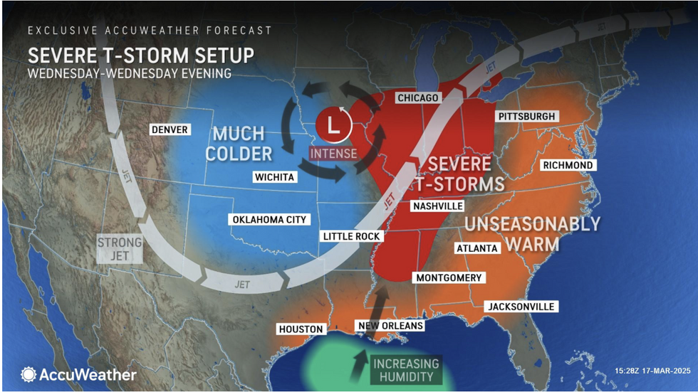
Behind the storm, a freezing gush from the Arctic will bring the risk of ice and snow
ACCUWEATHER
“There is an Extreme Risk of fire weather over the parts of the Southern High Plains.”
Behind the storm, a freezing gush from the Arctic will bring the risk of ice and snow, they added.
People have been warned to change travel plans with heavy wintry downpours in high winds threatening blizzards, they warned.
They said: “As the storm moves over the Upper Midwest Wednesday afternoon and night, heavy snow bands will become enhanced by Lake Superior.
“Very difficult and dangerous travel is expected due to the heavy and blowing snow, which could cause roads to become snow-covered and may dramatically reduce visibility. Avoid travel if possible.”
Volatile winds will bring the added risk of tornadoes supercharged with crackling thunderstorms.
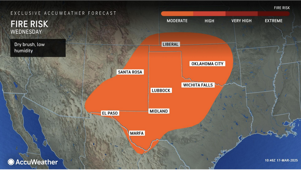
North Texas and Oklahoma could bear the brunt of the wildfires
ACCUWEATHEER
Winds will touch 65mph while heavy downpours will unleash cascades of giant hailstones.
DePodwin said: “The risk for severe thunderstorms will shift eastward and expand Wednesday through Wednesday evening across parts of Missouri, Iowa, Arkansas, Illinois, Indiana, Kentucky, Tennessee, Mississippi, Alabama, Ohio, and Michigan.
“Storms this week can still pack a punch but should be more localized than the recent severe weather outbreak. However, there still is a risk for a few tornadoes on Wednesday.
“This latest round of storms could disrupt cleanup and recovery efforts underway from the severe weather outbreak just a few days ago.”
Jim Dale, US meteorologist for British Weather Services and co-author of ‘Surviving Extreme Weather’, said: “There will be a growing risk of thunderstorms, tornadoes and lighting strikes through the middle of this week, and with that, the risk of wildfires.
“This will be driven by rising temperatures across southern parts of the US, and very dry winds over land which is already lacking rainfall.”
