


Searing ‘Diablo’ winds about to surge through western America will create a wildfire tinderbox putting the region on blaze alert.
California faces ‘critical danger’ from fires driven by an incendiary cocktail of heat, dry scrubland and 70mph Diablo, or ‘Santa Ana’ winds pouring off the mountains.
A dearth of rain through a summer of excruciating and unrelenting heat has left the region at ignition point, prompting a wildfire season ‘red flag’ warning.
Weather Channel meteorologist Kelly Cass said: “The fire danger is still elevated especially with that drying wind, so even though the moisture content is pretty good on the vegetation, with that drying wind coming off the slopes and that north-east fashion Santa Ana wind, that’s when we could get into trouble.
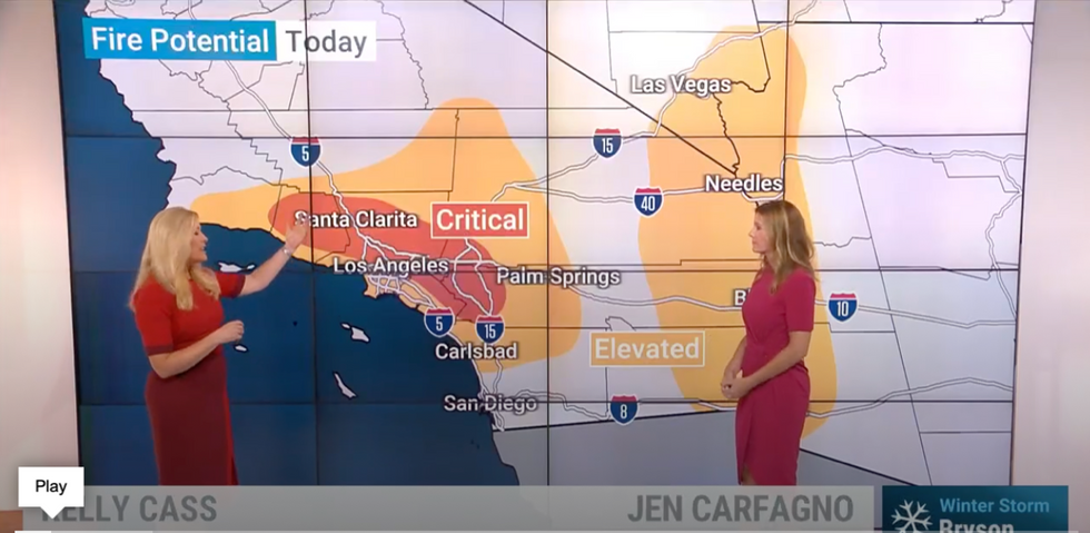
Weather Channel meteorologist Kelly Cass warns of a critical fire risk
The Weather Channel
A large high-pressure anticyclonic weather system will steer easterly winds over the Los Angeles mountains to fuel the risk.
So-called ‘Santa Ana’ winds compress as they fall over the mountaintops, warming and drying the landscape as they gush across the leeside landscape.
They usually cross the California city of Santa Ana, driving strong winds through gaps in built-up areas.
This helps to rocket temperatures and is a major driver of wildfires in California, especially during the summer months.
Ms Cass said: “The wind is down-sloping, compressing and heating up as it comes down the other side of the mountains, and that’s why they call it the Santa Ana wind with Santa Ana being located right in there.
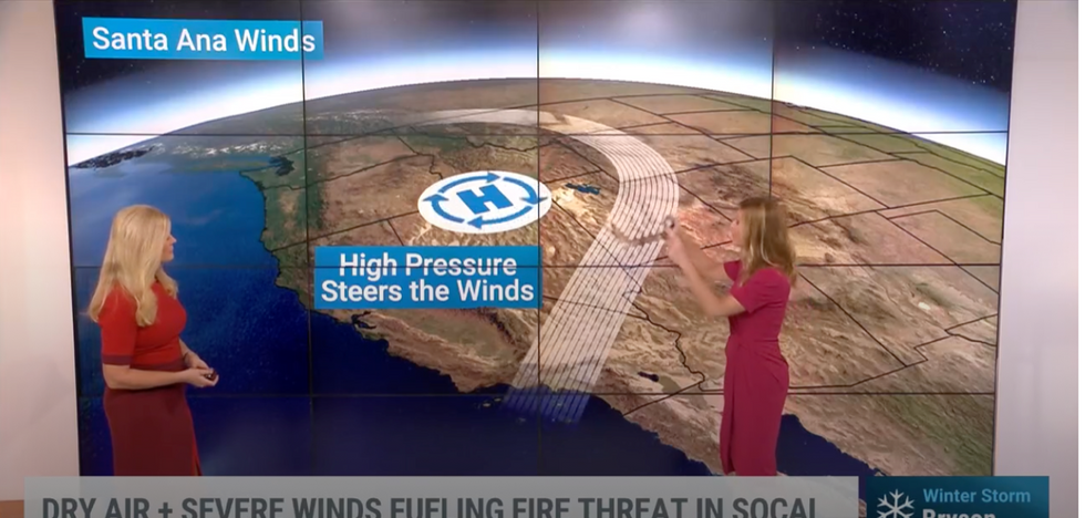
High pressure wil steer Santa Ana 'Diablo' winds
The Weather Channel
“That northeast wind is very strong, so if a fire does start it can quickly go out of control.”
It comes as temperatures to the south of the US start to rise, with Arizona, California, Nevada, and New Mexico looking warmer than average for mid-autumn.
Falling autumn leaves dried to a crisp in the dry heat will add to the fire risk later this week.
Jim Dale, US weather correspondent and senior meteorologist for British Weather Services, said: “We are looking at a combination of Santa Ana winds and very dry conditions, with the return of hot weather to the south of the US.
“Added to this, because of the time of year there will be a lot of leaf fall in the area, with the brushland already dry because of the baking heat and lack of rain through the summer.
“This is going to bring the risk of wildfires to California.”
The California National Weather Service has put out a ‘red flag’ warning across the western coast, with California, Nevada and New Mexico highlighted as danger areas.
The NWS has also warned that gusts of up to 70mph could be strong enough to topple trees and power lines.
A spokesman said: “Peak wind gusts of 40 to 60 mph will be common within the typical Santa Ana wind corridor, with isolated 70 mph gusts possible in the most wind prone foothill and mountain slopes.
“Downed trees and powerlines will be possible where winds are strongest.
“These winds combined with dry air, with minimum humidity of 10 to 25 percent, will
support elevated to brief critical fire weather conditions.”
