


Hurricane Helene will smash the US loaded with a swarm of ‘spin-off tornadoes’ as the US braces for the worst storm in year.
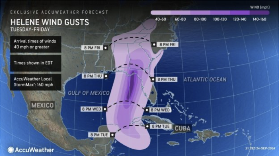
The 160mph mega tempest threatens ‘an extreme risk to life’ as yet another tropical storm – Isaac – erupts in her wake.
Americans have been urged to prepare for the worst as Florida is put under a state of emergency and evacuation order.
Helene is feared to be the strongest storm since Category-4 Idalia struck in August last year.
Florida has been put under a state of emergency and evacuation order
AccuWeather
AccuWeather lead hurricane expert Alex DaSilva said: “We’re urging people to get away from the immediate coastline and follow evacuation orders by local officials.
“We’re expecting deadly storm surge in parts of the Big Bend region, and if you get caught in this storm surge in the hardest-hit areas, rescue crews likely will not be able to respond during the height of the storm because it’s too dangerous.
“This hurricane is expected to be quite large, and impacts will be widespread.
“There is an extreme risk to lives and property along the Big Bend region of Florida.”
The storm, which formed in the Caribbean at the end of last week, has rapidly intensified over the past 24 hours.
In less than 72 hours, fed by simmering ocean temperatures, it has grown from a tropical disturbance to a monster hurricane.
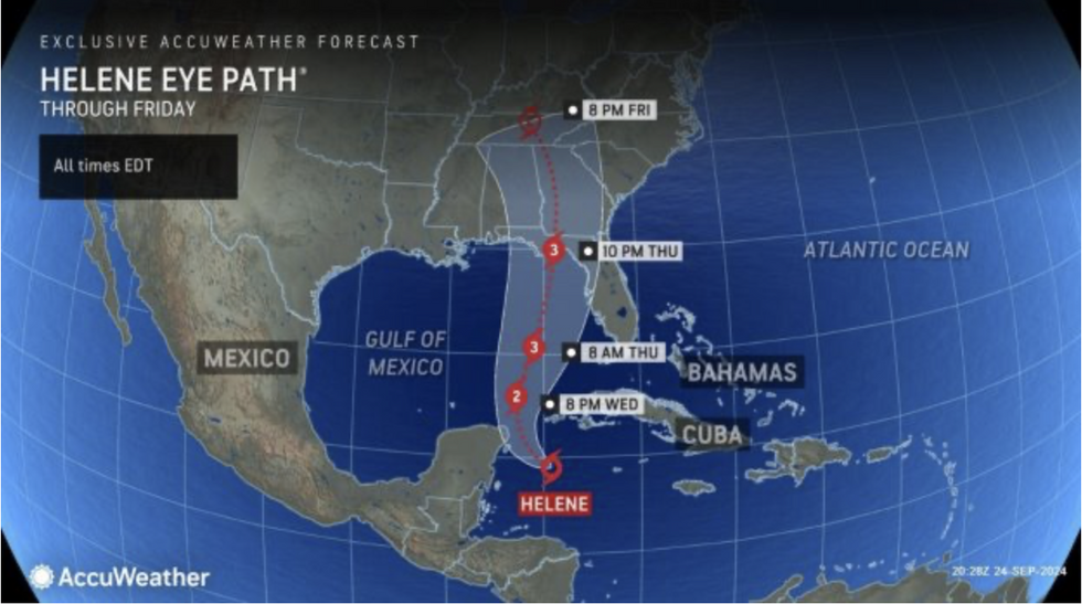
Helene is forecast to sweep into the Gulf of Mexico before ploughing north into Florida and eastern America.
AccuWeather meteorologist Jon Porter said: “Helene could cause a flooding disaster in some areas of the Southeast, especially in the higher terrain of northern Georgia, upstate South Carolina and western North Carolina.
LATEST DEVELOPMENTS:
Helene is feared to be the strongest storm since Category-4 Idalia struck in August last year
AccuWeather
“This is because of the combination of rain ahead of Helene on Wednesday and Wednesday night and then another thrust of torrential rain Thursday and Thursday night as Helene moves inland.”
AccuWeather forecasting operations spokesman Dan DePodwin added: “There could be a flooding disaster in several areas because of the extreme rainfall rates and what will likely be record rainfall for the Southeast in September.”
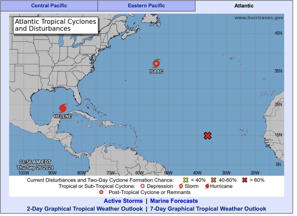
As Helene hurtles towards the east coast, the ninth storm of the season, Isaac, has erupted just a few hundred miles away.
The storm is forecast to take an easterly track through the coming days, avoiding the east coast of America.
Helen threatens coastal regions with a colossal 15-feet sea surge powerful enough to pull a wall of water into inland communities.
As she moves northwards ahead of the weekend, she will spew an army of ‘spin-off tornadoes’.
The churning twisters are more deadly at night, when they form quickly and with little warning.
Helen threatens coastal regions with a colossal 15-feet sea surge powerful enough to pull a wall of water into inland communities
National Oceanic and Atmospheric Administration
A spokesman for AccuWeather said: “People along the upper Gulf Coast region of Florida have less than 48 hours to prepare for life-threatening storm surge, destructive winds, flooding and spin-up tornadoes embedded in tropical rainbands.
“There will be a threat of tornadoes as Helene moves up the coastline and makes landfall on Thursday and continues northward Friday, mainly north and east of the track of the centre of the storm.
“Tornadoes from tropical systems can occur at night and form very quickly without warning.”
Helene is likely to be the strongest storm to hit the US since last Idalia last August, or 2020’s Hurricane Eta.
Pinellas County emergency management director Cathie Perkins said: “If you experienced flooding for Eta and Idalia and the Christmas storm we had, you’re most likely going to have flooding in your area again.”
Jim Dale, US weather correspondent for British Weather Services and co-author of ‘Surviving Extreme Weather’, added: “Helene is shaping up to be a significant threat, strengthened by unusually warm ocean temperatures.
“This could be yet another example of the consequences of a changing climate.”
