US weather: America to be hit with late winter snow as SSW smashes into northeast

Late snow is on the way
|The Weather Channel

While warmer temperatures sweep in from the south, New York, Pennsylvania, and parts of New England are heading for a late burst of winter
Don't Miss
Most Read
A disruption of the stratospheric vortex will drive two weeks of late winter snow across parts of the US.
An unusual triple-dip Sudden Stratospheric Warming (SSW) is suspected to be one of the ingredients behind cold weather hitting the northeast this week.
While warmer temperatures sweep in from the south, New York, Pennsylvania, and parts of New England are heading for a late burst of winter.
Low pressure from Canada will pull in Arctic air to plummet temperatures, although a rare stratospheric warming event may also be involved.

New York, Pennsylvania and parts of New England will be hit with the worst
|The Weather Channel
A third SSW–described as a ‘one in a 250-year event’ by the UK Met Office –has been confirmed by meteorologists.
SSW, caused by the slowing and reversal of winds high in the stratospheric atmosphere, can drive colder than normal weather in the US and across the northern hemisphere.
Jim Dale, US weather correspondent and meteorologist for British Weather Services, said: “The northeast of the US is now getting the winter they never had, with very cold weather coming into the region this week.
“This could be the first of two or three cold snaps over the next two weeks, with low pressure coming in from Canada bringing cold air and the risk of snow.
“There may also be a bit of Sudden Stratospheric Warming involved in this, which can be behind cold weather at this time of year.”
The Great Lakes and surrounding regions will be in the firing line for any significant snow showers, he added.
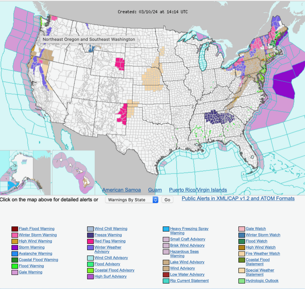
Winter storm warnings have been issued by the National Weather Service (NOAA) in Maine, New England, New York, Connecticut, Vermont, New Hampshire, Massachusetts and the northern tip of Ohio.
LATEST DEVELOPMENTS:

Winter storm warnings issued by the NOAA
|National Oceanic and Atmospheric Administration (NOAA)
People living in the area are warned to prepare this week for gusty winds, heavy coastal rain, hazardous sees and heavy snow downwind of the Great Lakes.
A NOAA spokesperson said: “An intensifying low-pressure system that brought another round of moderate to heavy rain across the northern Mid-Atlantic to New England Saturday night into Sunday morning will continue to track northeast through coastal New England.
“Colder air wrapping around the expanding storm will support heavy wet snow across northern New England, especially over the higher elevations of upstate New York, Vermont, New Hampshire and Maine where winter storm warnings are in effect.
“As much as six to 12 inches of heavy wet snow can be expected in these areas along with increasingly strong and gusty winds. “
The triple SSW event is first seen since the start of 20th-century meteorological records, 250 years ago.
Usually, one occurs every two winters, and can bring severe bouts of cold weather to the northern hemisphere.
Warming of the stratosphere is caused by air falling rapidly, this in turn can push polar air downwards into Europe and America.
The event this year may have been made more likely by a strong El Nino warming of the East Pacific.
UK Met Office long-range forecaster Professor Adam Scaife said: “Although this is very rare, we also found that the chance of multiple SSW events is increased during El Niño and so the chance of multiple events this winter is raised.”
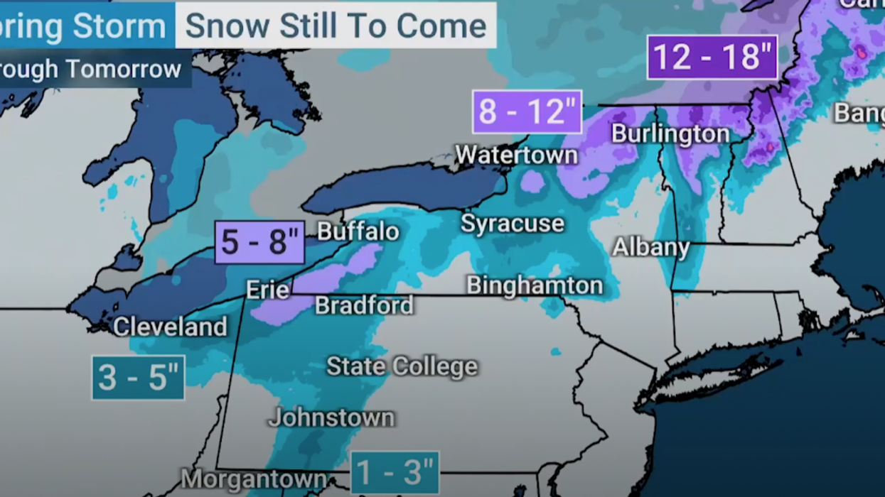
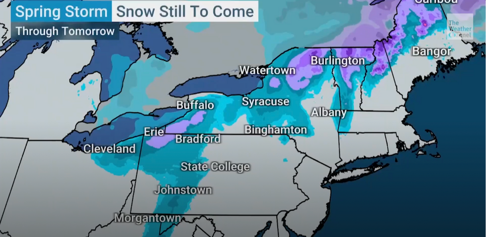
More than a foot of snow could fall over high ground over the coming days, according to The Weather Channel.
A spokesman said: “Going forward, we see a dose of wintry weather moving into Buffalo, and Syracuse will be next, and it is going to be falling pretty decently in Syracuse.
“It will be really breezy at times, and you go inland a bit and there could be five to eight inches, and to high elevations, there could be over a foot.”


