


A "hazardous" tangle of storm fronts entering an Arctic-tropical battle zone threatens thunder, gales, tornadoes and two inches of hail.
Winter’s exit is about to take another chaotic turn as volatile air masses collide ahead of a "big weekend storm".
Severe weather will arrive as meteorologists sound alarm bells for the start of the tornado season, signalling months of "large, destructive" storms.
Four Pacific weather fronts will drive days of severe weather, sweeping into temperatures ranging from sub-zero in the north to 100F in the south.
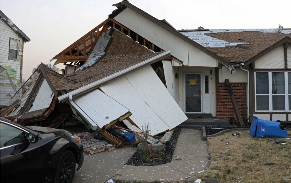
Tornadoes ripped through parts of the US earlier this month
REUTERS
A spokesman for the US National Weather Service (NOAA) said: “The Storm Prediction Centre has issued a Slight Risk of severe thunderstorms over the Pacific Northwest through Thursday morning.
“A fourth front over the Eastern Pacific moves onshore over the West Coast, continuing eastward to the Northern Rockies to Southern California by Thursday evening.
“The hazards associated with these thunderstorms are frequent lightning, severe thunderstorm wind gusts, hail, and a few tornadoes, and there is an added threat of hail, two inches or greater over the region.”
In days, the US will mark the most dangerous time of year for violent thunderstorms and tornadoes.
Deep southern states are most at risk of twisters which start their three-month rampage around the start of April.
Most tornadoes strike in May, with around 260 in the month building to a seasonal average of more than 500.
Weather Company meteorologist Chris Dolce said: “April, May and June are the most active months, especially when it comes to very large, destructive tornadoes.
LATEST DEVELOPMENTS:
In days, the US will mark the most dangerous time of year for violent thunderstorms and tornadoes
ACCUWEATHER
“Outbreaks of tornadoes occur when a storm system propelled by a strong, southward dip in the jet stream punches into the Plains, Midwest or South.
“Now is a good time to review your plan for severe weather this spring and any other times of the year tornadoes might threaten your area.”
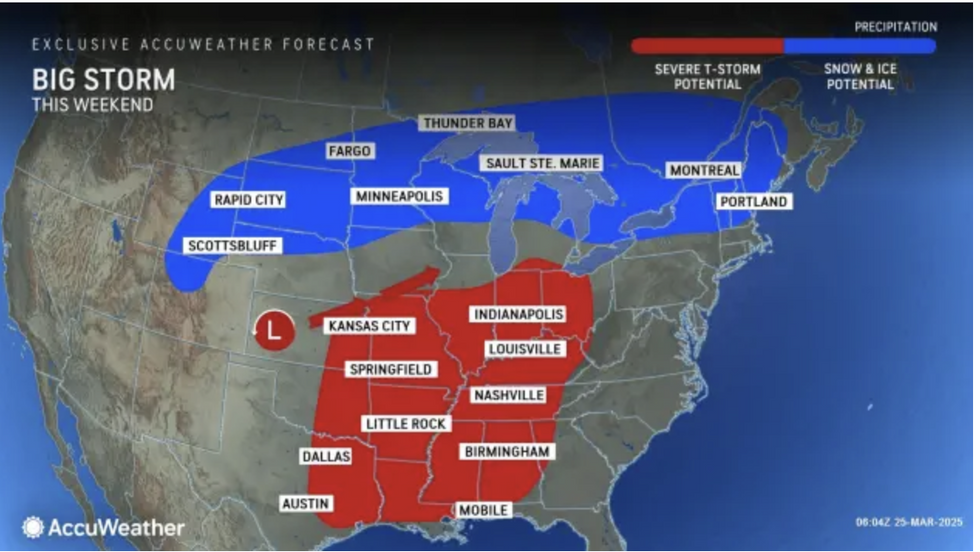
More than a dozen states are on alert for storms this weekend with a powerful area of volatility threatening heavy snow, floods and hail.
NOAA predicts two inches of hail in the worst-hit regions while the deluge pushes rivers to bursting point.
In parts of the country where temperatures are soaring to 100F, dry winds will bring the risk of wildfires.
AccuWeather meteorologist Alex Sosnowski said: “That storm is destined to bring severe weather, snow and wildfire-spreading winds.
Stormy weather will continue to rage as hot and cold air battle astride a centrally swooping jet stream
ACCUWEATHER
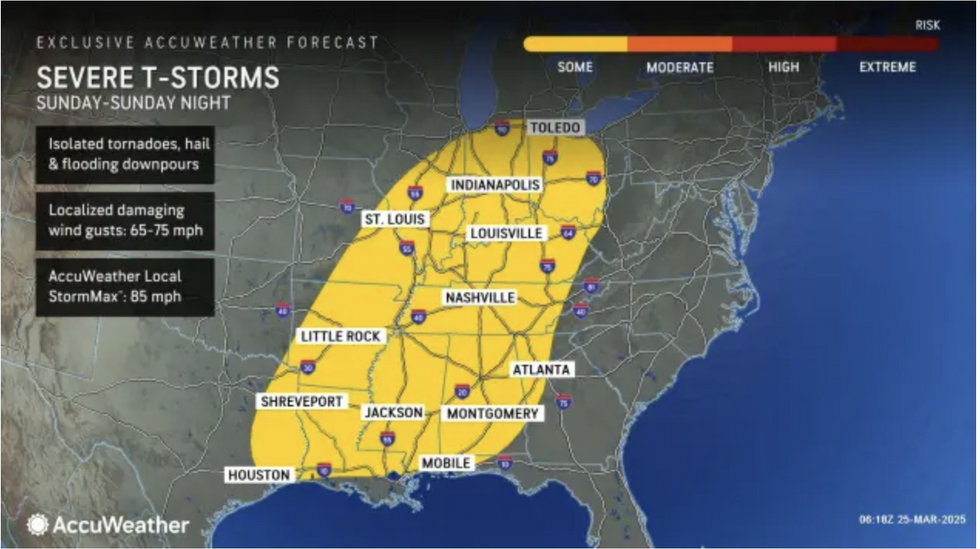
“More than a dozen states may be at risk of severe weather Sunday, ranging from damaging wind gusts to large hail and even tornadoes.
“The severe weather threat is likely to continue farther to the east on Sunday with heavy, gusty and locally severe thunderstorms likely to stretch from Maryland and Delaware to northern Florida.”
Stormy weather will continue to rage as hot and cold air battle astride a centrally swooping jet stream.
Jim Dale, US meteorologist for British Weather Services and co-author of ‘Surviving Extreme Weather’, said: “The jet stream is further south than we would usually expect at this time of year and that is going to drive some of the instability that we are expecting over the coming days.
“Warm air to the south will come up against very cold air coming down from Canada, and this is going to go bang.
“There will be a risk of thunderstorms and further south, tornadoes.”
