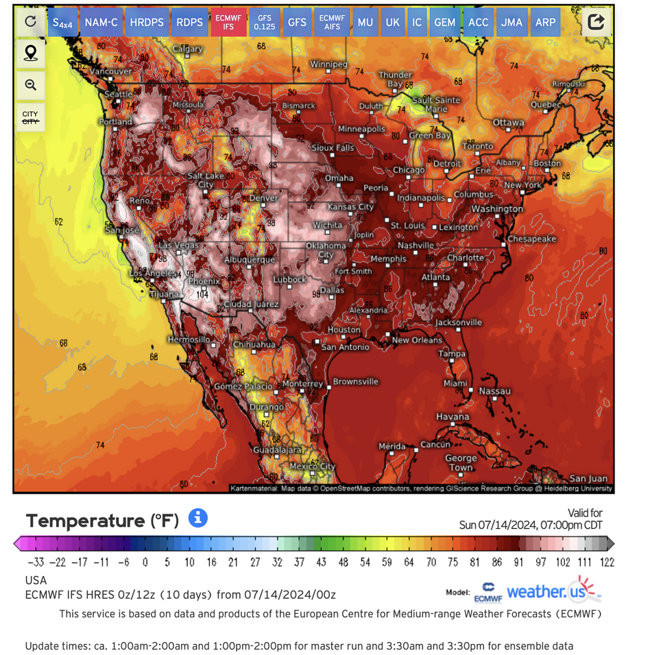
Thermometers will rocket around 5 to 15F above the historical average across more than 20 states
WEATHER.US
So far this month, more than 50 record temperatures have been recorded in California and Nevada
Don't Miss
Most Read
Trending on GB News
A 30-state scorcher will leave ‘nowhere to hide’ as more than 30 million Americans fry in a 115F heat bubble.
The deadly heat dome has sparked a raft of extreme weather alerts across the US as it continues its advance eastwards.
Further records are expected to tumble as high pressure boosts a tropical plume from Mexico, pushing temperatures to simmer point.
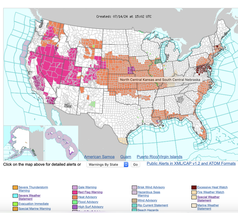
The US National Weather Service (NOAA) has heat advisories across 30 states, although almost nowhere will escape the heat.
Jim Dale, US meteorologist for British Weather Services, said: “The land mass is really heating up now with the plume of heat that came into the wet now spreading further into the east.
“After moving into eastern areas through the coming days, extreme heat is going to affect pretty much everywhere leaving nowhere to hide from it with few places escaping.
 Thermometers will rocket around 5 to 15F above the historical average across more than 20 statesWEATHER.US
“Temperature records could fall in some places with highs of 115F already recorded in some southern states.”
So far this month, more than 50 record temperatures have been recorded in California and Nevada, according to AccuWeather.
This week will turn the heat up under the Southeast, mid-Atlantic and Northeast putting a huge strain on power grids.
Thermometers will rocket around 5 to 15F above the historical average across more than 20 states.
AccuWeather long-range expert Paul Pastelok said: “A dominant area of high pressure is to blame for the relentless heat in the western US and Pacific Northwest and this heat will expand into central states.
“Scorching summer temperatures will be on the rise from the Southeast to much of the mid-Atlantic and even parts of the Northeast early in the week, and we expect more records to be shattered.

The US National Weather Service (NOAA) has heat advisories across 30 states
NOAA
“An estimated 30 million people will see temperatures hit the 100 degree mark or higher in parts of the West and the Plains."
A cold front moving in from the north will give some relief from the heat and humidity, he added.
He said: “Relief from the heat will arrive in the upper Midwest, Great Lakes, and Northeast mid to late week next week with lower humidity and more comfortable nights.”
As temperatures rocket over dry land, experts have warned to be on the alert for raging wildfires.
NOAA has ‘Red Flag’ warnings in force across Washington, Idaho, Oregan, Utah, Nevada, California, Colorado, Wyoming and Nebraska.
Elsewhere, the warnings map is orange with heat advisories and ‘excessive heat watch’ alerts.
A NOAA spokesman said: “The heat wave that has plagued the West for over a week will remain in place as a stubborn upper-level high sits overhead.
“Temperatures are forecast to reach the mid-90Fs for the Mid-Atlantic and Midwest, and into the upper 90Fs to low 100Fs for the Southeast, with portions of the central Plains reaching the low to mid-100Fs.
“The heat will get more intense on Wednesday as the Mid-Atlantic soars into the
upper 90Fs to low 100Fs and the heat spreads northward into New England with low to mid-90Fs expected.”
As the American continent heats up, experts say predict a reduced risk from tropical storms.
After monster Hurricane Beryl devastated parts of the Caribbean and southern United States, the Atlantic will now calm.
Weather Channel meteorologist Jonathan Belles said: “Saharan dust has taken over much of the tropical Atlantic, Caribbean Sea and even the Gulf of Mexico.
“This tends to put a lid on thunderstorm development and, therefore, squashes any tropical activity.”


