US snow: Winter Storm Cait to bring snow deluge amid extreme -10C Arctic blast
WX charts
Wisconsin, the Great Lakes, New York and surrounding areas are on alert for a winter deluge
Don't Miss
Most Read
Trending on GB News
Winter Storm Cait will make her parting shot this week dumping a potential snow deluge across Atlantic states.
The storm will hit northeastern states through the start of the week before stalling over Canada.
WATCH HERE: UK weather outlook 27/11/2023
Wisconsin, the Great Lakes, New York and surrounding areas are on alert for a winter deluge having so far dodged the assault.
Jim Dale, US weather correspondent and meteorologist for British Weather Services, said: “This is an Arctic blast that will carry on through Sunday and Monday and into the start of the new week.
“It started in the northwest, but is moving north-eastwards towards New England, Virginia, New York City, Boston and Maine.
“All of these states are going in the same direction as those that have seen snow across western regions of the United States, and there is bound to be snow over the Great Lakes through the end of the month.”
US LATEST:
Jim Dale said: 'This is an Arctic blast that will carry on through Sunday and Monday and into the start of the new week'
Weather.us
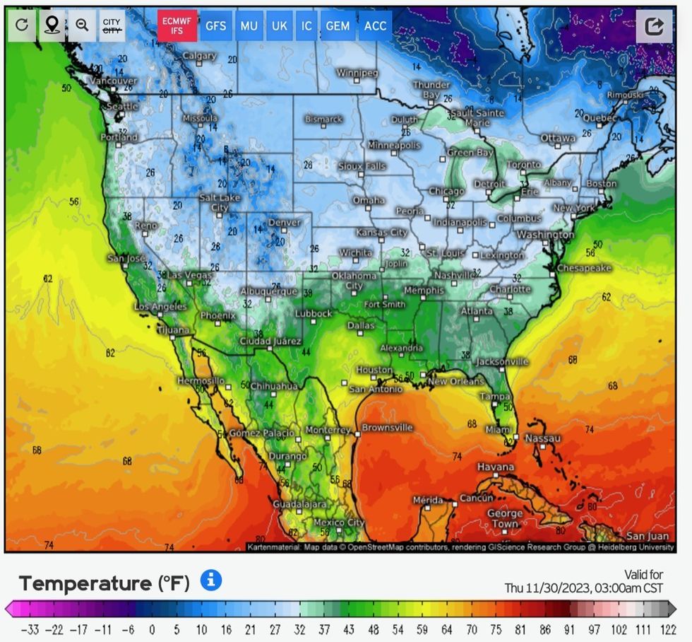
The storm will pull away after the weekend to leave the US in a pool of freezing air pushing temperatures in parts to -10C.
Weather models reveal the risk of moderate to heavy snow, particularly in the northeast, while alerting the west to rolling fog banks.
Where thermometers plummet over Colorado, Utah, Arizona and California, heavy rain threatens to freeze into lethal ice lakes.
Mr Dale added: “These regions are going to be left in the very cold air after the storm departs.”

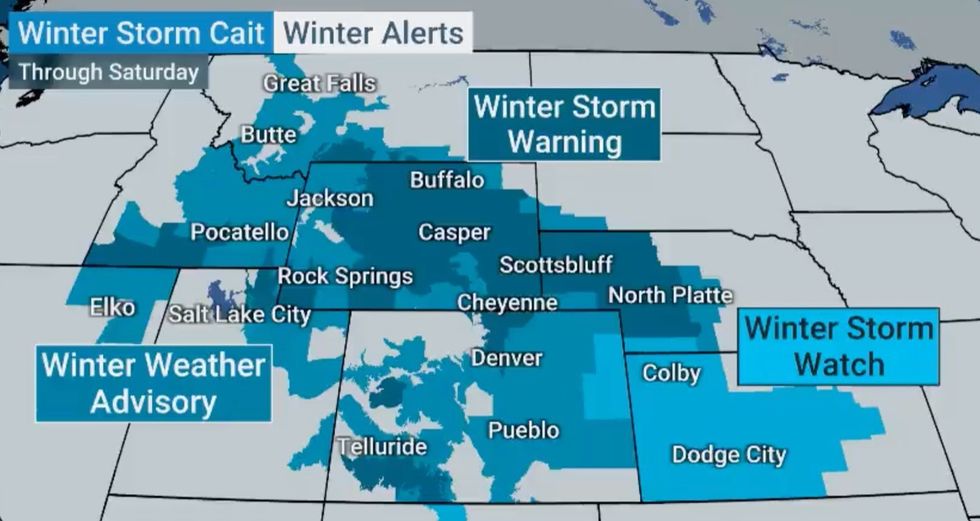
Regions hit worst by Winter Storm Cait at the weekend
The Weather Channel
Storm Cait struck at the weekend after sweeping in from the northwest at the weekend, dumping inches of snow and triggering travel chaos.
Millions of Americans returning after Thanksgiving faced hours of delays on roads, highways and transport networks.
Snow could continue to sweep the Great Lakes through the rest of this week, according to the National Weather Service (NOAA).
A spokesman said: “Favourable westerly cold flow over the still relatively warm Great Lakes will continue to promote a multi-day period of accumulating lake effect snow especially downwind of Lakes Erie and Ontario, with the best chance for possibly heavy totals on Tuesday.
“Models show agreement on a favourable lake effect event Monday into Tuesday (and possibly beyond).
“But given the small scale of the heavy snowbands, minor shifts in location of the bands would provide considerably different conditions and accumulations over slightly different areas.”
Cait continued to plough through the United States yesterday putting millions of Americans under winter storm warnings.
It unleashed the first “measurable snow” of the season, according to The Weather Channel, dumping more than a foot across the Central Plains.
Officials closed major highways in Wyoming as blizzards brought dangerous driving conditions to the area.
Lander, Wyoming, had its snowiest day since 1999 with almost 19 inches falling on Thanksgiving.


