


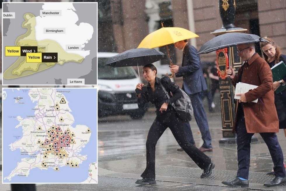
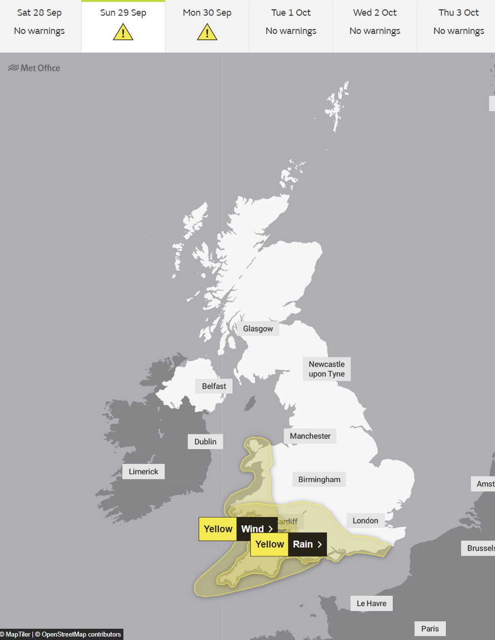
Two new yellow weather warnings have been issued as downpours look set to batter Britain yet again.
The Met Office issued the double warning for Sunday, with one warning lasting into Monday.
A wind warning covering much of the South West of England and Wales is in place from 9pm on Sunday to just before midnight.
Meteorologists warn winds of up to 60 miles per hour could cause disruption, with longer travel times expected and potential short-term loss of power a possibility.
 Weather warnings forecast a return of downpoursPA/MET OFFICE
In its update, the UK's national weather service said: "Winds will strengthen from west to east during Sunday, with gusts of 50-55 mph likely in places, especially near coasts and over/to the west of high ground, perhaps exceeding 60 mph in the most exposed areas.
"This will be accompanied by outbreaks of rain, heavy at times, which could lead to some surface water and spray.
"Winds will gradually ease across Wales and inland parts of southwest England through Sunday evening and night, but it may remain fairly windy along some coasts of southern and southwestern England during Sunday night."
Britons have been advised to check road conditions and gather torches ahead of Sunday.
The Met Office has issued two weather warnings for tomorrow
MET OFFICE
Windy weather will hit the UK just hours before torrential downpours batter the South East, South West, Wales and Herefordshire.
Rain could yet again bring chaos, with the Met Office suggesting travel delays and stressing that flooding remains likely on Sunday evening.
In its full update, the UK's national weather service said: "Rain is expected to develop across southwest England and south Wales during Sunday morning, moving slowly east before rain gradually eases from the west during the second half of Sunday night.
"Much of the warning area is likely to see 20-30 mm fall over 9-12 hours, though some places may see 50-80 mm.
"These higher accumulations are most likely across higher ground in south Wales, Dartmoor and the Dorset Downs."
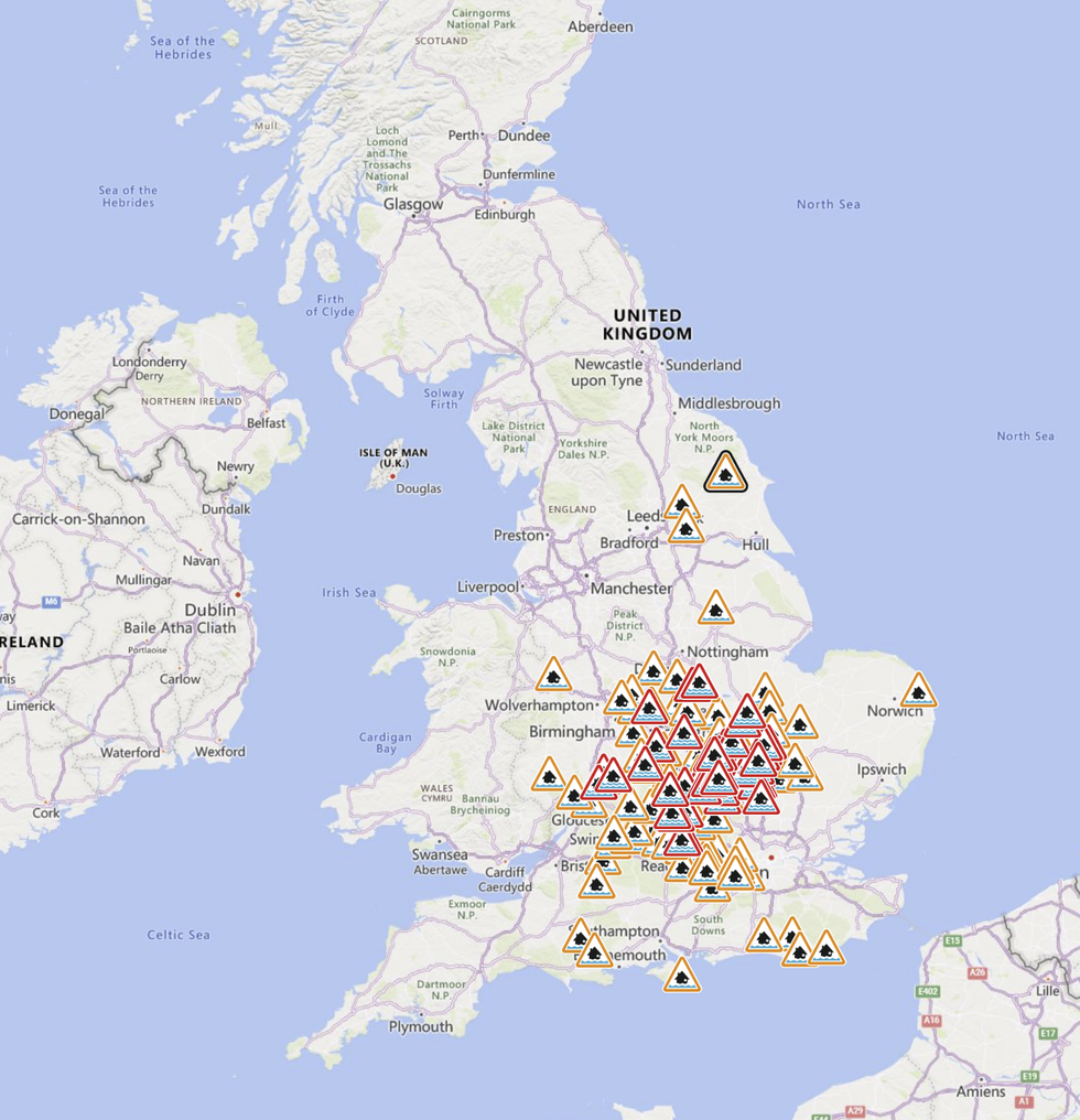
England's Environment Agency has issued 48 flood warnings and 89 flood alerts, stretching from Norfolk to the Isle of Wight and Hampshire to Yorkshire
ENVIRONMENT AGENCY
The warning comes after mass downpours earlier in the week.
England's Environment Agency has separately issued 48 flood warnings and 89 flood alerts, stretching from Norfolk to the Isle of Wight and Hampshire to Yorkshire.
Commuters faced significant disruptions earlier this week, with heavy rain and flooding causing problems to roads and rail services.
Rail services between Shrewsbury in Shropshire and Wolverhampton in the West Midlands were cancelled after severe flooding at Wellington station and a tree on the line.
