


A storm brewing over France is about to nudge Britain’s weather as clear skies give way to cloud, rain and thunder.
After weeks of dry weather, up to an inch of rain is forecast in parts this weekend as the nation braces for a turn in fortunes.
Hot on the heels of Storm Oliver’s rampage across the Canary Islands, a second system threatens to clip the UK.
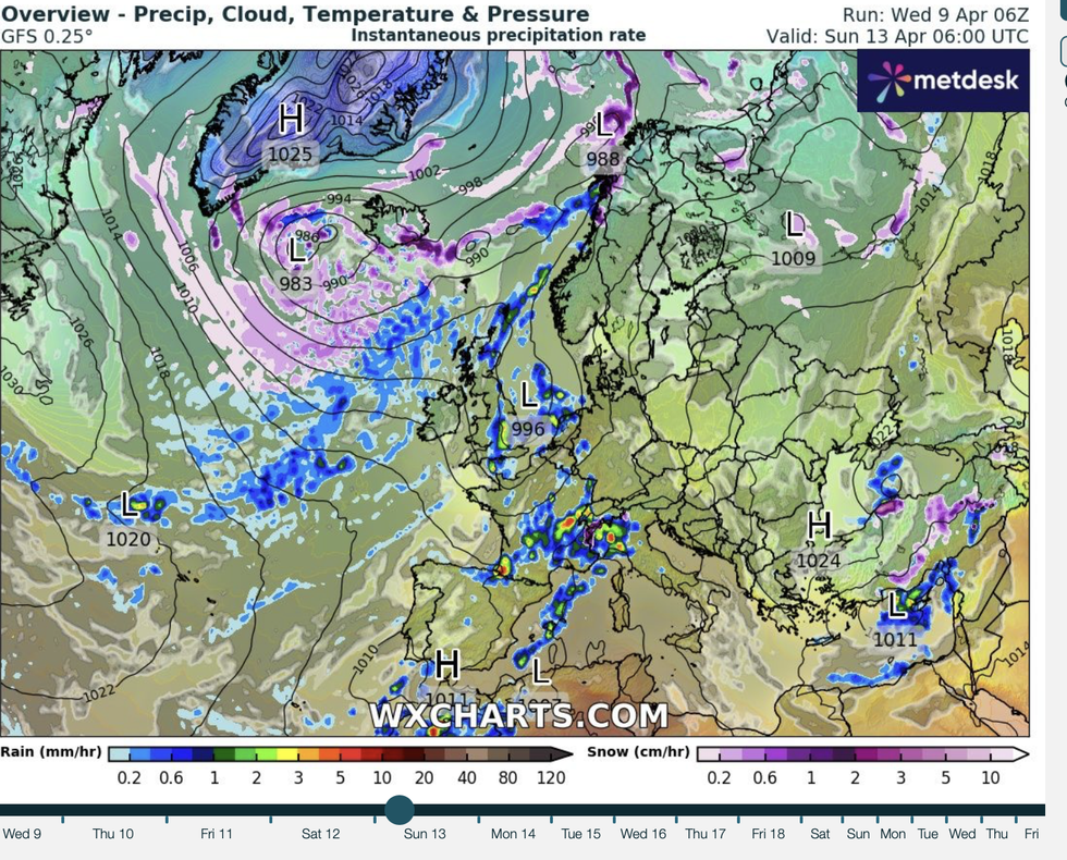
Jason Nicholls, lead international forecaster for AccuWeather, said: “Storm Oliver itself is not expected to come far enough north, but a new low-pressure system should develop over the Bay of Biscay on Friday that could bring some rain and cooler weather to the UK on Saturday night and Sunday.
After weeks of dry weather, up to an inch of rain is forecast in parts this weekend
Weather forecast
“The sunshine and warm weather should continue across much of the UK into Saturday, but later in the day and into the night there will be areas of low cloud and fog in eastern areas.
“In northern Scotland on Friday and going into the weekend, showers are possible, and by Sunday going into Monday, it will feel cooler.”
Britain’s weather will ‘break’ on Sunday with sunseekers urged to make the most of the early weekend rays.
High pressure, the driver of the recent find though chilly weather, will hold out through the start of the weekend before shifting.
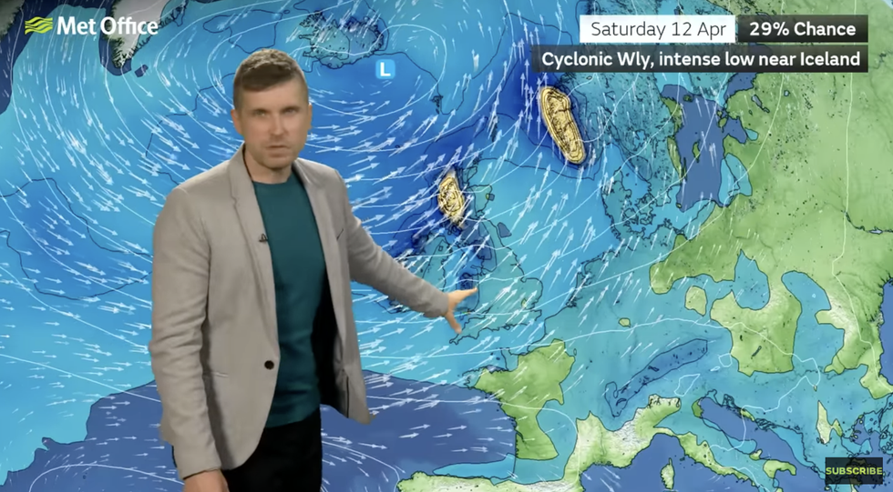
Met Office meteorologist Alex Burkill said: “This weekend, the weather is set to take a bit of a turn with more rain on the cards.
“There is some showery rain over France, and there is a chance that could clip us, but Saturday looks like it will be a generally dry day.
LATEST DEVELOPMENTS:
Up to 25mm of rain could drench parts of the country
MET OFFICE
“Through Sunday there are some showers coming through from the west and some of those could be on the heavy side.”
Up to 25mm of rain could drench parts of the country, although this will bring relief to farmers and gardeners after weeks of dry weather, he said.
He added: “Low pressure is just to the north of the UK, and with that we will have some blustery winds and some heavy rain and that maybe could cause some localised impacts, with 20 to 25mm in some western areas.
“It will be wettest towards the northwest because of the position of the low.
“But because it has been so dry recently that could be relatively welcome rain for some people”
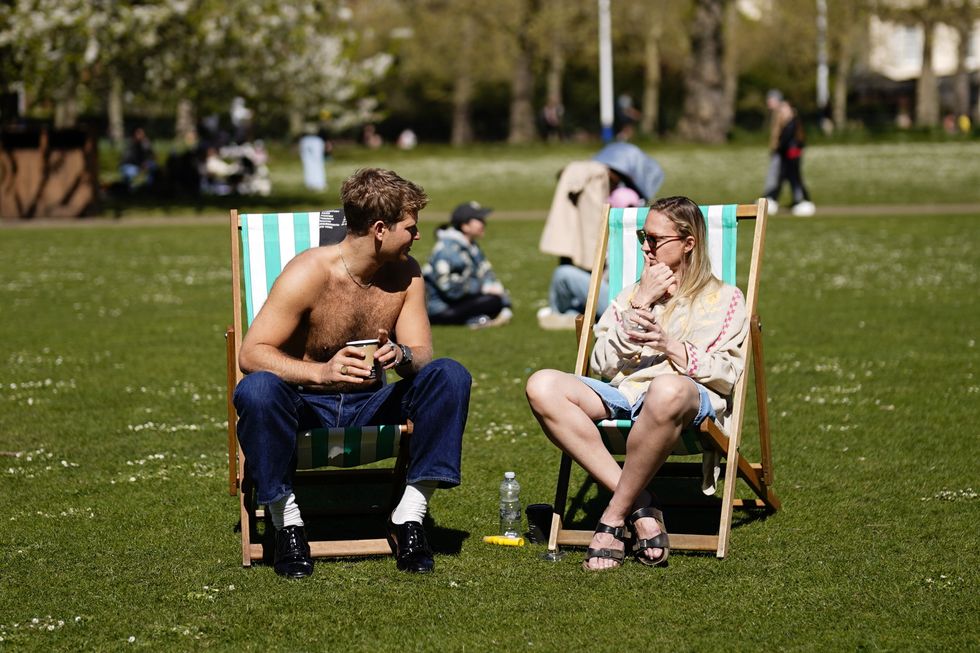
Britons have been urged to enjoy the last rays of sunshine in the early part of the weekend
PA
As high pressure slides away, low pressure will stir up the risk of strong winds and thunder, the Met Office added.
Meteorologist Honor Criswick said: “High pressure is going to sink southwards, and we are going to see something a bit more unsettled move its way into the north and then sink its way south-eastwards.
“There is a chance we could see some rain and some showers and possibly some thunder, as well.
“It’s later Saturday into Sunday that we start to see more and more of this unsettled weather, so Sunday is going to be more of an unsettled day for many compared to what we have seen recently.”
Jim Dale, meteorologist for British Weather Services and social commentator, said: “The breakdown in the fine weather is likely at the weekend, and from Sunday we will see something more unsettled and wet.”
