


A tropical storm heading towards the UK is set to bring more wet weather as experts suggest it will likely be an "ex-hurricane" by the time it reaches Britain.
A 500-mile tropical storm is currently in the Atlantic, with the tail end set to batter the UK towards the end of the week.
Weather experts predict the storm could mutate into a hurricane, however the Met Office say there still a "lot of uncertainty" as to what kind of conditions it will bring.
"The jet stream will keep powering in from the Atlantic, ensuring a supply of rain-bearing weather systems," John Hammond of weathertrending told the Daily Star.
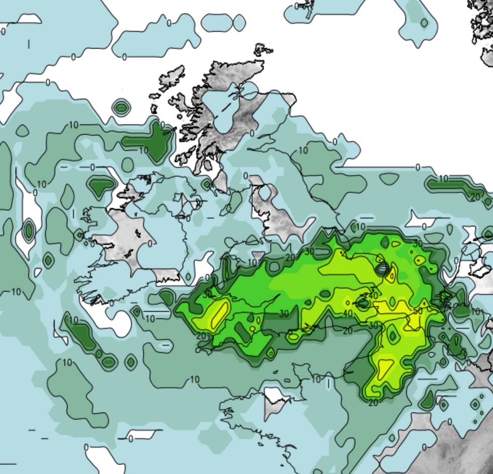
Weather experts predict the storm could mutate into a hurricane, however the Met Office say there still a 'lot of uncertainty' as to what kind of conditions it will bring
Net Weather
"More rain could arrive through the weekend. This may have remnants of an ex-hurricane entrained within it."
The Met Office's Kathryn Chalk told The Express: "I imagine [Hammond] is referring to a system that is currently out in the Atlantic which could develop into a tropical storm and could come into the mid-latitudes by Friday.
"Given how far it is away, there is a lot of uncertainty, though this could bring a further area of low pressure for next weekend.
"It won’t be a hurricane if/when it reaches the UK as they are tropical features which require sea temperatures much higher than those around the UK and instead can be classified as ‘ex-hurricanes’ or ‘extra-tropical cyclones’ if we are affected by them.
"Ex-hurricanes and tropical storms merging into the North Atlantic low pressures systems is not that unusual."
Forecasters warn that August will see overcast conditions and heavy rain, similar to July.
And more rain is on the way, with Monday marking the start of another 10 days of rain, according to reports.
"There will be another seven to 10 days of this unsettled weather as the jet stream comes in from the west giving us periods of rain and showers and moderate temperatures of 20°C in the south and 17 to 18°C in the north," Meteorologist Phil Morrish told The Express.

One weather expert explained that 'the jet stream will keep powering in from the Atlantic, ensuring a supply of rain-bearing weather systems'
Net Weather
A Met Office spokesperson said: "Unsettled conditions will persist through the start of August, with days of sunny spells and showers perhaps interspersed with periods of more persistent rain as low pressure systems move across the UK.
"When these low pressure systems occur, they are more likely to run across southern parts of the UK while the north remains drier.
"Otherwise, on showery days, showers will often be concentrated in the north and east, where they may be heavy and thundery at times and could occasionally merge into longer spells of rain.
"Western areas are more likely to remain drier, although the chance of showers remains."
You may like
