


Easter will climax in a thundery deluge as post-holiday downpours threaten parts of the country with floods.
Energetic weather fronts ploughing in from the Atlantic, loaded with heavy rain spell a washout end to the Bank Holiday.
Western and southern regions are in the firing line, while Scotland and the northeast stand the best chance of dodging the deluge.
Rain will hold out through the start of the week as a band of electrical storms sweeps the country.
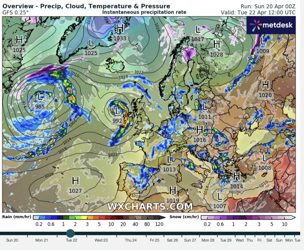
Rain rattles in through the start of the week
WX charts
Jim Dale, meteorologist for British Weather Services, said: “While we are looking at typical April showers for many, there is going to be a risk of thunderstorms through the rest of the Bank Holiday.
“Low pressure from the west, and the strong angle of the sun putting energy into the atmosphere, will bring the risk of thunder and lightning.
“A potential band of thunderstorms will move across the country, with western and central regions most likely to see one.”
Persistent and frequently heavy rain in regions drenched over the past week also threatens a risk of flooding.
The Environment Agency has alerts in force across the southeast, the Home Counties, and the West Country.
LATEST DEVELOPMENTS:A spokesman said: “Groundwater levels are unusually high for this time of year and have now reached a level where communities are at risk of being affected by flooding.
“Due to the nature of groundwater behaviour, this situation could continue for several weeks or longer.”
Rain will move in through today, driven by Atlantic weather fronts sweeping Northern Ireland, Wales and southwest England.
Grey, cloudy skies will dampen holiday spirits for many today, with only southeastern regions expecting spring warmth.
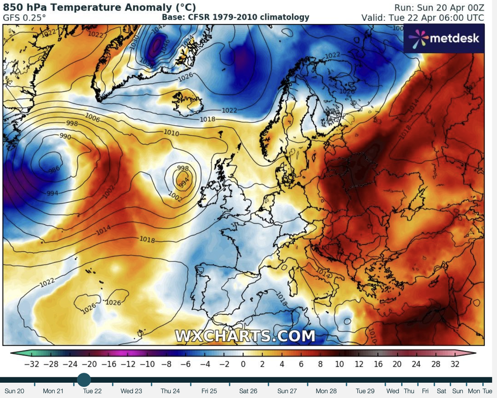
Temperatures set to dip
WX charts
Met Office meteorologist Craig Snell said: “A weather front moves in from the Atlantic to give further rain across Northern Ireland, bumping into western parts of Wales and the southwest.
“For most, it is a grey, damp start to the day, and then a weather front slowly pushes north-eastwards as we move through the day.
“The driest weather is most likely across northeast Scotland, where we could see some sunny spells until the rain arrives later in the day.
“Temperatures are a little lower under the cloud, but still in any brighter breaks, we could see 16C, 17C or possibly 18C across parts of central and southern England.”
Government forecasters warn showers through the end of the weekend could turn thundery.
Further bouts of rain are waiting in the wings to drench the nation through the start of the week, the Met Office warned.
A spokesman said: “Monday will be rather cloudy with rain continuing eastwards, sometimes heavy and thundery, over England in the afternoon, and temperatures mostly around the seasonal norm.
“Monday's rain will eventually clear the northeast on Tuesday before further wet weather crosses western and southern regions overnight into Wednesday.”
Britons face a stark difference from the start of the season when high pressure brought weeks of dry weather.
Temperatures in the run-up to mid-month smashed the mid-20Cs in parts, with a different story predicted this week.
The mercury is forecast to sink below normal for the time of year, pushing highs of just 18C or 19C.
Jason Nicholls, lead international forecaster for AccuWeather, said: “Rounds of showery rain are expected early in the week, and temperatures will be near or below the seasonal average.
“The greatest risk of rain will be across southern Britain.”
Most read


More


