


Britain is on flood alert as intense thunderstorms laden with heavy downpours roll in from Portugal.
Weeks of rainless blue skies are about to give way to persistent electrical downpours.
High pressure, the driver of fine weather, will give way to low pressure and a storm system churning near Portugal.
Parts of the country left parched after an unusually dry start to the spring could be at particular risk of floods, experts warn.
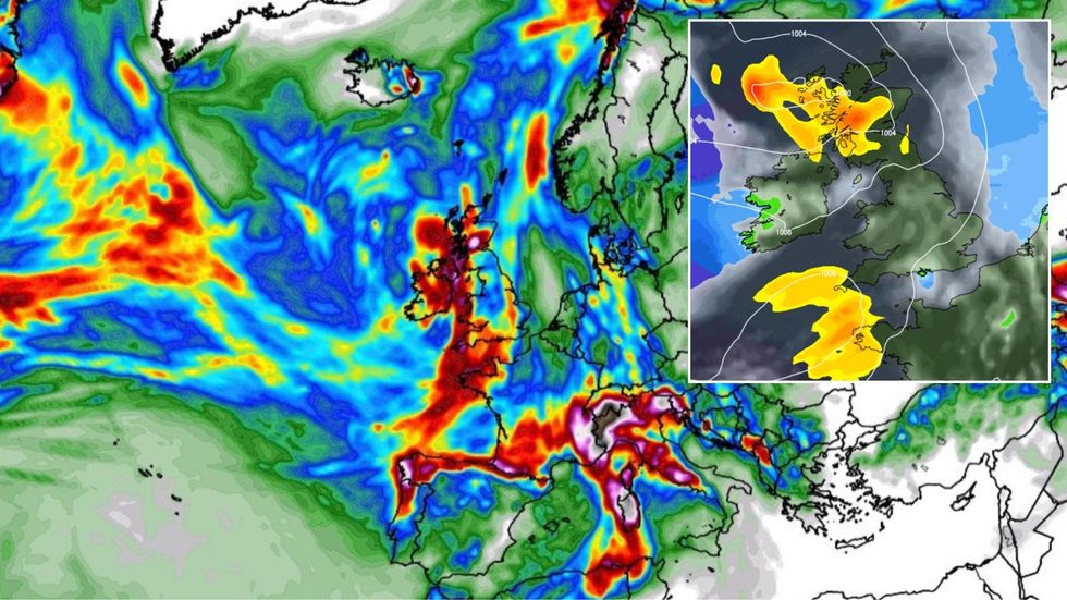
Britain is on flood alert as intense thunderstorms laden with heavy downpours roll in from Portugal
WXCHARTS/ Netweather
Jim Dale, meteorologist for British Weather Services, said: “There will be the potential for very heavy rain through the rest of the week as low pressure becomes more dominant.
“The problem will be that the ground is dry as a bone after weeks of little to no rain, and heavy rain will run off quickly and that is going to bring the risk of flooding.
“People will have to prepare themselves for this across England and Wales where the ground is baked.”
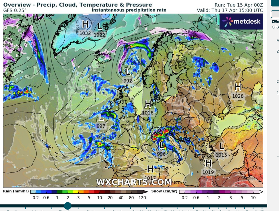
Rain will turn heavier through the middle of the week thanks to a storm spinning off the coast of Europe.
While the system will not directly hit the UK, it will throw in this direction bouts of heavy, thundery rain.
The Met Office has warnings in force for up to three inches of rain heavy enough to disrupt travel and spark local floods.
LATEST DEVELOPMENTS:
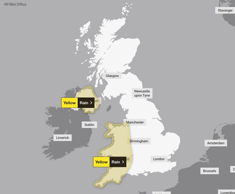
Western parts of England and Northern Ireland are in the firing line for the worst of the weather as low pressure storms in from the Atlantic
Met Office
Western parts of England and Northern Ireland are in the firing line for the worst of the weather as low pressure storms in from the Atlantic.
Met Office chief meteorologist Matthew Lehnert explained: “After a long spell of high pressure bringing dry weather and sunshine, gloomier and unsettled conditions are on the horizon.
“Low pressure has become established to the west of the UK bringing cloud, rain showers, and lower temperatures for many.
“A low-pressure system near Portugal is of particular interest as it moves towards the UK, bringing with it potentially heavy rain and thunderstorms.”
Another blast of rain will hit at the end of the week as government forecasters ‘keep the situation under close watch’, he added.
The switch from sunshine to showers has prompted bookmakers to tear up Easter scorcher predictions and reset the odds for a washout.
High pressure, the driver of fine weather, will give way to low pressure and a storm system churning near Portugal
WXCHARTS
Ladbrokes spokesman Alex Apati said: "It was fun while it lasted, but it looks like things will go back to normal for Brits on the weather front.
“This Bank Holiday weekend could well be a washout."
Spring so far has been dominated by high pressure, the harbinger of fine weather during the summer months.
Rain has been held at bay by a stubborn ‘blocking high’, although bone-dry winds have driven damaging wildfires.
The change in weather in the run up to Easter will bring lower temperatures and the threat of persistent rain.
Jason Nicholls, lead international forecaster for AccuWeather, said: “Temperatures this week are expected to be lower than recently, and with that there will be a change to wetter weather.
“While there is no big storm expected in the UK, there will be some locally heavy rainfall.”
