


A soggy Easter washout could set the scene for the next fortnight with grey skies and rain feared to dominate the rest of April.
The dry and sunny start to spring is about to take a damp U-turn with a return to typical, gloomy British weather looming.
Torrential downpours over Easter threaten to turn thundery, experts warn, with rain expected through the holidays.
A pendulum swing from the fine start to spring is blamed as the weather unleashes a “balancing” deluge.
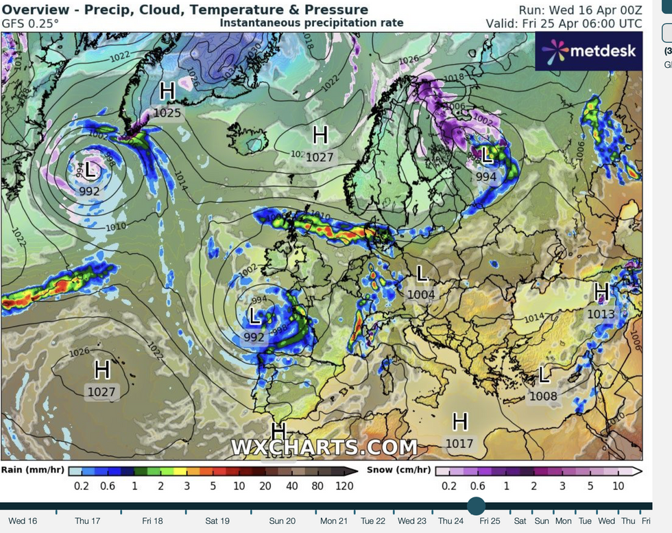
Unsettled systems swirl around the UK towards the end of the month
WX charts
Jim Dale, meteorologist for British Weather Services, said: “The start to spring was unusually mild and sunny with temperatures in the mid-20Cs, and I am a believer that the weather will always seek to balance these periods.
“This is what we are going to see through the rest of the week and potentially into the start of May, with something more typical for the time of year.
“The outlook is more unsettled going through the next week and beyond with low pressure likely to be in charge.”
It comes amid warnings the sunshine is about to give way to a thundery Easter deluge.
Fine weather, which has held out through the past week,s will evaporate for torrential rain, winds and electrical eruptions.
LATEST DEVELOPMENTS:Temperatures in the mid-20Cs will sink to just above double figures with Scotland and the north facing the risk of sub-zero frosts.
Dale said: “There will be some warmer days over the next week, but temperatures are going to drop significantly from what we have seen so far this month.
“Further north, there will be the risk of frosts where temperatures dip to below freezing overnight.
“There is a chance we could see some very cold nights over the next few days.”
Eastern regions are expected to enjoy the best of any warmth, with the west in the firing line for rain.
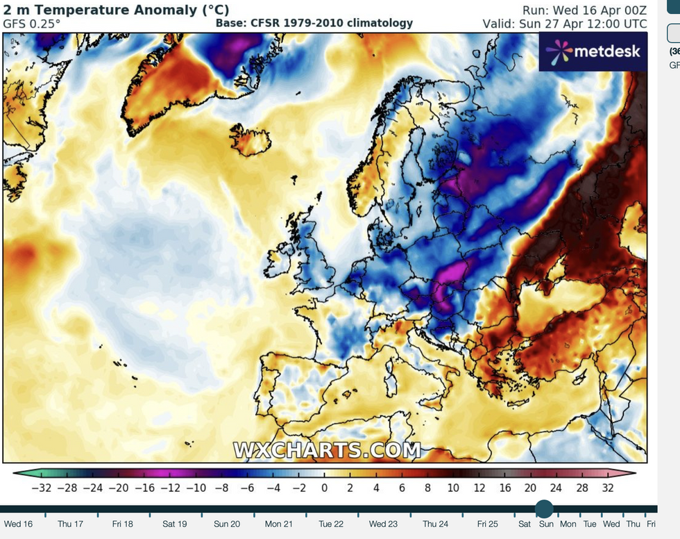
WX Charts map shows temperatures set to dip later in the month
WX Charts
Met Office meteorologist Honor Criswick said: “On Thursday, there is still going to be some rain at times, particularly across Wales and with some showers moving into northwestern Scotland, and it is going to be fairly blustery across southern coasts later in the day where into the afternoon we could see some showers start to pop up, particularly across parts of the west.
“Friday is a slightly brighter day, but there are some frontal systems clipping their way into the west, it is likely that we will see the bulk of the cloud in western areas and eastern areas is where we will see the best of the brightness through much of the day.
“It’s not going to be completely settled, and it is likely that we will see the bulk of the rain across western areas.”
Long-range outlooks for the rest of spring paint a mixed picture, with some predicting an unsettled run-in to summer.
The Met Office’s three-month outlook is more reserved, landing on a 20 per cent chance the weather will be drier than usual and a 20 per cent chance it will be wetter.
Overall, an ‘average’ season is the most likely, it states, although it may turn cooler towards June.
It states: “There is an increased likelihood of northerly and easterly winds in April which increases the chance of some colder spells.”
As temperatures dip through the holiday weekend, rain will turn heavier as low pressure barrels in from the Atlantic.
Jason Nicholls, lead international forecaster for AccuWeather, said: “Steadier and locally heavy rain is possible late this week.”
