


Balmy spring sunshine will be blown away by chilly northerly winds as hopes for a return to hot weather fade until after mid-spring.
Britian’s skies will once again be put through the spin cycle as the warmest day of the year vanishes in a puff of wind, rain, thunder and plunging temperatures.
Unusual changes in the atmosphere above the North Pole could even delay summer warmth for another month or longer.
A weak jet stream spells a two-week forecasting nightmare, meteorologists say, although a cooler and wetter picture is expected.
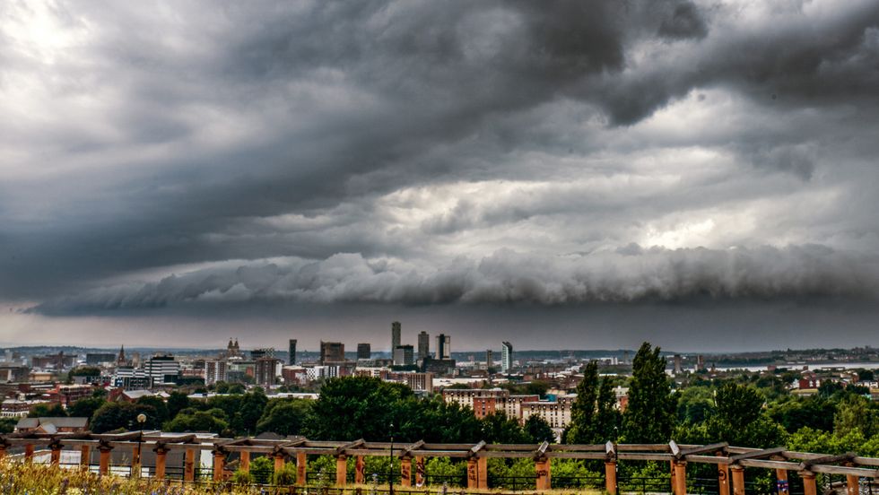
Thunder and lightning is on the horizon
PA
Met Office meteorologist Aidan McGivern said: “There are some patterns emerging in the trend for next week.
“By day, because we have a cooler wind direction, daytime temperatures will be a bit lower.
“For the last few days of March and into April, after we see these weak north-westerlies showery conditions and average temperatures through next week, the trend is for higher pressure to the north.
“This signals more of a northeasterly wind but with drier weather coming into the north and perhaps some more unsettled weather to the south and the southeast.”
Britain’s weather will take a U-turn this weekend with 50mph winds and the risk of thunder washing away any spring joy.
High pressure building after the weekend will steer winds in from the north as temperatures dip by around 10C.
McGivern said: “It is turning much more unsettled on Saturday, and we continue in the same vein on Sunday.
LATEST DEVELOPMENTS:
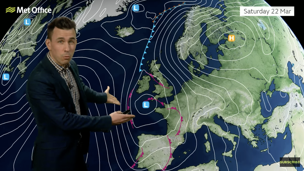
High pressure building after the weekend will steer winds in from the north as temperatures dip by around 10C
MET OFFICE
“Towards the south, winds could come together to provide a line of showers across and perhaps even the odd thunderstorms with some heavy downpours, but these will be hit and miss.
“The jet stream is weaker and tends to twist on its journey across the northern hemisphere and that makes it tricky to forecast weather patterns beyond five or six days.”
Meteorologists are still keeping a close eye on the North-Pole atmosphere for the emergence of a Sudden Stratospheric Warming (SSW).
The phenomena triggered by a change in wind direction causes the Polar Vortex – the mass of cold air over the Arctic – sink south over northern Europe.
This, as was the case during the 2018 Beast from the East, can drive extreme cold weather late in the season.
Current signals are still shaky, although a weak SSW could delay warm weather into the end of spring.
Jim Dale, meteorologist for British Weather Services and social commentator, said: “It is going to be something that might be hit and miss, but we could see a reversion to colder temperatures later in spring.
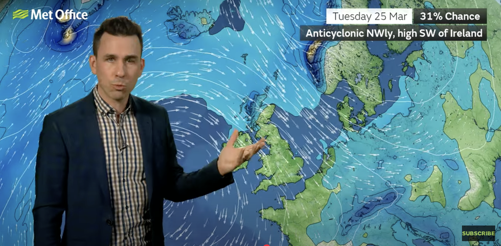
A weak jet stream spells a two-week forecasting nightmare
MET OFFICE
“But, as we go through April, we could also see some very warm weather with pulses of colder temperatures.”
In the short-term, Britons are warned to get coats and brollies at the ready for a potentially stormy weekend.
Northern regions will turn unsettled through Saturday with southern counties in for the best chance of sunshine.
McGivern said: “It won’t be a complete washout, and there will be some warmth and some bright weather to the east of the UK, but more cloud in the skies than there has been over the past few days.
“On Friday, the wind will continue to strengthen, and wind gusts over the higher parts of Scotland will be 50mph or so.
“We are likely to see gales developing in the far northeast of Scotland as this low moves in, and it is this low that is with us through the weekend.”
Thursday marked the warmest day of the year so far with 21.3C recorded in Northolt, according to the Met Office.
