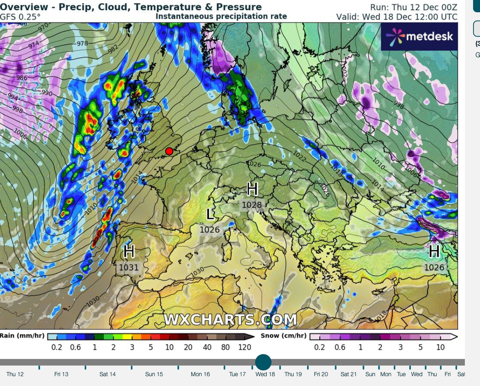
A freezing blast gripping Canada and a warm plume from the Canary Islands will throw Britain back into a 60mph spin cycle
WXCHARTS
The calm after the Storm-Darragh deluge is about to give way to another burst of wet and windy weather
Don't Miss
Most Read
Trending on GB News
A freezing blast gripping Canada and a warm plume from the Canary Islands will throw Britain back into a 60mph spin cycle.
The calm after the Storm-Darragh deluge is about to give way to another burst of wet and windy weather.
High pressure, the current driver of grey but settled skies will be shoved into the Atlantic this weekend by low pressure from the west.
A kink, or ‘trough’, in this low-pressure system will wrangle with a similar ‘ridge’ in the high sitting over Britain, triggering the change.
 A freezing blast gripping Canada and a warm plume from the Canary Islands will throw Britain back into a 60mph spin cycleWXCHARTS
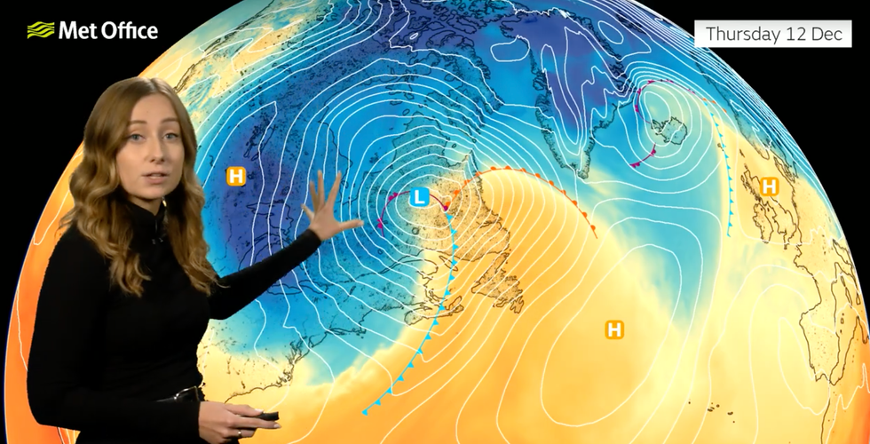
Met Office meteorologist Honor Criswick said: “We have a large upper trough and that is driving a ridge out into the Atlantic, and this is being driven by some quite cold air over eastern parts of Canada.
“This is driving high pressure to the east, and will allow Atlantic mobility to take place, and we will see more and more fronts clip their way into the northwest.
“This is also being driven by quite a strong jet to the north of the country.”
Wind and rain will set in through the weekend, although milder southerly gusts will push temperatures in parts to double figures.
Scotland and northern Britain are in the firing line for the worst of the weather, although winds will pick up countrywide.
Criswick said: “In the far north of Scotland, we are likely to see the strongest gusts, and we could see some gales or severe gales at times as we head into later Saturday and into Sunday.
LATEST DEVELOPMENTS:
“We could see gusts of around 60mph as we head into the weekend, but even elsewhere it is going to be a very breezy day as we head into the weekend but especially northern parts of Scotland.
“Not only is it going to be a windy weekend, but it will also be fairly wet in places, particularly in the northwest of Scotland.”
Unsettled weather will persist into the middle of next week, although warm air from the tropics will thaw the cold, she added.
By the middle of next week, winds will be steered in from the Canary Islands, bringing more wind and rain, she warned.
She said: “As we head into the middle part of next week, it is all eyes on a developing area of low pressure out in the Atlantic.
“This starts off at quite a southerly altitude quite close to the Canary Islands, and it moves its way northwards and gets dragged up by the jet stream.
“It may merge with other areas of low pressure, and this will eventually move its way north-eastwards towards the UK, so by the time we reach the middle part of the week we are likely to see more spells of wet and windy weather.”
With less than a fortnight until Christmas, forecasters have started making tentative hints on festive snow.

High pressure, the current driver of grey but settled skies will be shoved into the Atlantic this weekend by low pressure from the west
Met Office
Forecasts for the next two weeks show a continuing flip-flopping between cold and stormy, although snow is looking more possible for the north.
For a White Christmas, one flake of snow must fall anywhere in the UK during the 24 hours of December 25.
While scenes of a Dickensian snow globe are unlikely, parts of the country could see a flurry.
Jim Dale, meteorologist for British Weather Services and social commentator, said: “It is not looking great for a traditional White Christmas with the very cold weather heading to Eastern Europe rather than the UK.
“But there is a chance that Scotland and Northern England could see at least some snow from Christmas Eve.”
Bookmaker Coral has slashed the odds to 1-2 from 4-5 on a flake or two falling somewhere on the big day.
Spokesman John Hill said: “With snow forecast to fall in some areas of the UK over the next couple of weeks, the prospects or a White Christmas are increasing.
"We make it odds-on for snow to fall on Christmas Day on any major UK city this year.”


