


Winter threatens to roar back with a vengeance as a rip in the Polar Vortex sparks warnings for an imminent major cold blast.
As storm-battered Britons enjoy a spell of calm, experts warn around the corner lurks a snow-laden Arctic U-turn.
Slowing winds high in the atmosphere herald a dreaded Sudden Stratospheric Warming (SSW) event–the driver of 2018’s notorious Beast from the East.
While forecasts for cold weather are guarded, an SSW could drive a significant cold snap from the middle of February.
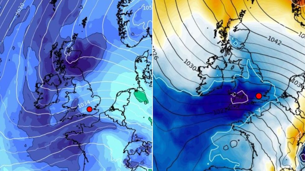
Winter threatens to roar back with a vengeance as a rip in the Polar Vortex sparks warnings for an imminent major cold blast
WXCHARTS
Jim Dale, meteorologist for British Weather Services, said: “There are signs for the middle of the month for another of very cold snap on the way.
“There could be a sooner taste of this with colder weather on the way this weekend, but the killer could come at around the second week when a shift of the Polar Vortex could see it coming down over the UK.
“This would mean very widespread low temperatures and the risk of snow, which actually is more common at this time of year than earlier in the winter.
“This is something we are keeping a close watch on as winter is definitely not over yet.”
Alarm bells sounded this week amid reports of wind speeds in the stratosphere –the layer of atmosphere at around 10 miles above ground level – slowing.
When this happens, changes in airflow can cause air to fall and warm in a so-called ‘stratospheric warming’.
LATEST DEVELOPMENTS:
This forces the Polar jet stream, which drives our Weather, further south than normal, causing Arctic air to spill over the UK.
This happened in February 2018 when a historic ‘Beast from the East’ brought swathes of the country to a standstill.
While nothing on that scale is anticipated, experts warn the ingredients could come together for a late-winter cold spell.
Andrej Flis, meteorologist for Severe Weather Europe, said: “A strong Stratospheric Warming event is starting to appear in the forecast for February.
“Sudden Stratospheric Warming (SSW) means a strong temperature and pressure rise in the Stratosphere.
“That causes a major disturbance in the circulation and, as a result, starts a collapse of the Polar Vortex.”
A surge of cold air as the ‘Polar Vortex splits’ would primarily be of concern to North America which faces a more direct hit, he added.
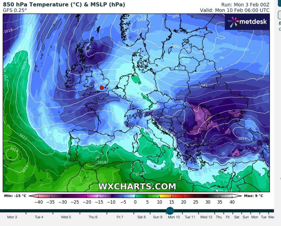
Colder air is set to sweep across the UK in the coming weeks as wintry conditions return
WXCHARTS
Government long-range forecasts are more optimistic hinting towards wetter, windier but milder late-winter weather.
The Met Office’s three-month outlook describes a higher than average chance of milder temperatures into spring.
The Met Office’s deputy chief meteorologist Chris Bulmer said: “The main signal is that we are going to see stronger-than-average westerly winds in the stratosphere as we go through late winter.
“So, there is a very low chance of a Sudden Stratospheric Warming at this stage.
“There’s an increased likelihood of spells of wetter and windier weather and generally milder-than-average conditions.”
Met Office chief meteorologist Frank Saunders added: “It’s worth being aware that despite a largely pleasant week ahead, there’s a good chance the UK will experience a dip in temperatures at the weekend and into next week.
“High-pressure is set to move in, bringing along easterly winds, low temperatures and an increasing risk of wintry hazards like snow and ice.”
