


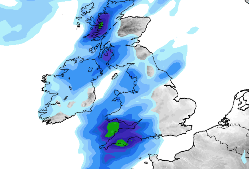
A band of rain is set to shift from west to east across the UK as thunderstorms and "very windy weather" strike following disruption from ex-tropical hurricanes.
Britain could be battered with "sharp showers" and "thundery outbreaks" next week as frontal systems collide with warm air towards south east England.
Next week is set to see westerly and south-westerly winds dominating with a band of rain pushing across the UK.
Weather maps suggest that August 19 will see relatively infrequent rain in the south and east of England but in western Scotland and north-west England there will be heavier rain with some brighter, showery weather.
 A band of rain is set to shift from west to east across the UK as thunderstorms and "very windy weather" strike following disruption from ex-tropical hurricanesVentusky/ Net Weather
Later in the week, there is potential for "occasional sharp showers and thunderstorms" towards the south-east.
According to NetWeather, "one or two ex-tropical hurricanes" could disrupt weather patterns towards the end of the week.
Forecasters suggest that some "very windy weather" could strike north-western Britain.
The latest weather map show the unseasonal winds are set to strike on Thursday, August 22.
LATEST DEVELOPMENTS:
Britain could be battered with "sharp showers" and "thundery outbreaks" next week as frontal systems collide with warm air towards south east England
Net Weather
A weather expert at NetWeather said there could be "a possible brief hot southerly plume on its eastern flank with potential for thundery outbreaks especially for central and eastern England."
They added: "Most regions will be wetter than average during this week but there is potential for it to be drier than average in some parts of the east, particularly eastern England and also north-east Scotland.
"Sunshine will generally be below normal in the west.
"But Northern Ireland and western Scotland may see close to average sunshine if these regions see frequent bright and showery polar maritime air masses during the daytime.
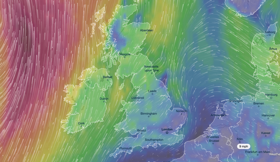
The latest weather map show the unseasonal winds are set to strike on Thursday, August 22
Ventusky
"Eastern regions are more likely to have near to slightly above average sunshine."
The Met Office said that a "mobile westerly pattern is expected" during the middle of August.
A spokesperson said: "A series of low pressure systems are likely to track eastwards, mainly over or to the north of Scotland but perhaps also further south at times.
"The associated fronts will bring spells of cloud and rain at times, perhaps occasionally accompanied by rather breezy or unseasonably windy conditions in places, but interspersed with brighter, more showery periods."
