


Britain is bracing for a cold snap as temperatures are set to plummet below zero, with the Met Office warning of snow and sleet.
A frosty easterly wind originating from the Nordic region is expected to bring wintry conditions to the UK, as high pressure moves in across the region.
Met Office meteorologist Aidan McGivern noted that "easterly winds at this time of the year are always going to be cold", though he emphasised this would not match the severity of 2018's "Beast from the East".
Temperatures are expected to drop to -2C in the Midlands and Wales following a frosty start to Thursday.
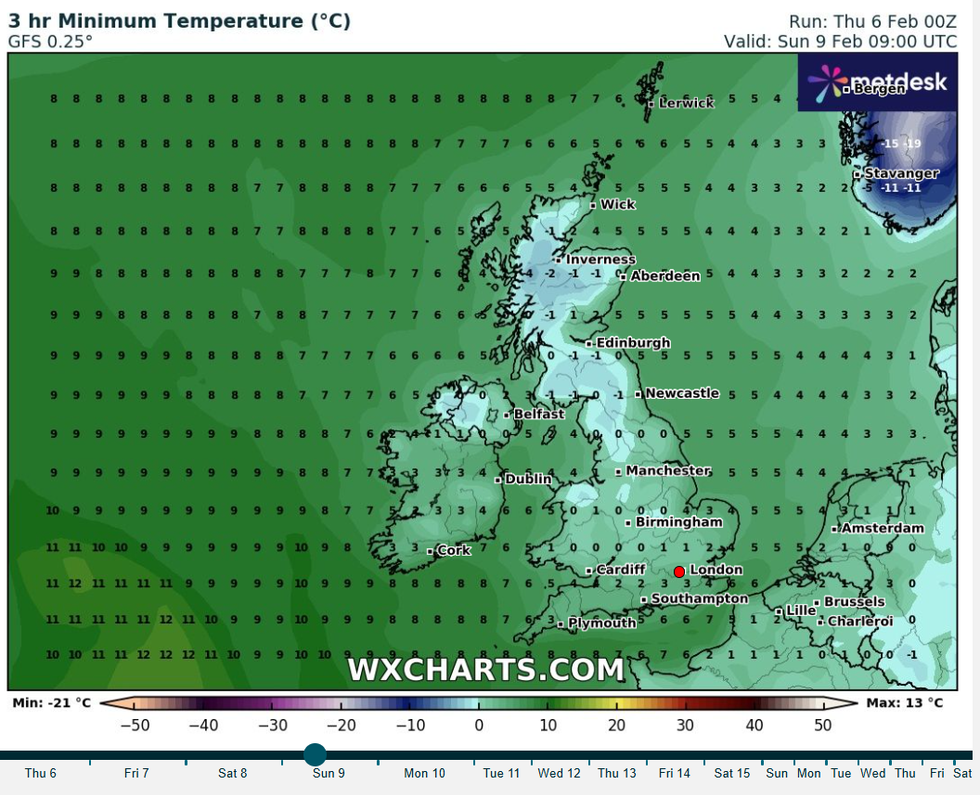
Temperatures will drop below freezing as the week draws to a close
WXCharts
The cold conditions come after what the Met Office recorded as one of the sunniest Januarys on record, despite being colder than average.
The south of England will experience the brunt of wintry conditions, with rain, sleet and snow forecast over the weekend.
Meanwhile, the northwest is expected to remain brighter, with drier conditions predicted for northern and western regions.
Met Office meteorologist Alex Deakin said: "Bit more in the way of wet weather coming into eastern counties by the time we get to Saturday.
"Despite the cold conditions, most of this will still be rain, but there's a little bit of white mixed in there so a little bit of snow is possible, certainly some sleety conditions are likely."
WEATHER LATEST:
A frosty easterly wind originating from the Nordic region is expected to bring wintry conditions to the UK
PA
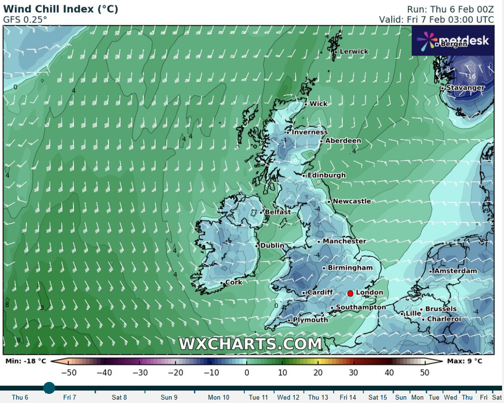
A windchill index map from WXCharts for the end of early Friday morning
WXCharts
Chief meteorologist Frank Saunders warned: "High-pressure is set to move in, bringing along with it easterly winds, low temperatures and an increasing risk of wintry hazards like snow and ice."
The weekend forecast shows a distinct north-south divide in weather conditions across the UK.
Eastern counties will see increased wet weather by Saturday, with a mix of rain and wintry precipitation expected.
Skies will turn cloudier during evenings, with strengthening winds across the south of the country and isolated showers towards dawn.
The north and west of the country will remain largely dry, with Met Office forecasts indicating brighter conditions for these regions throughout the weekend.
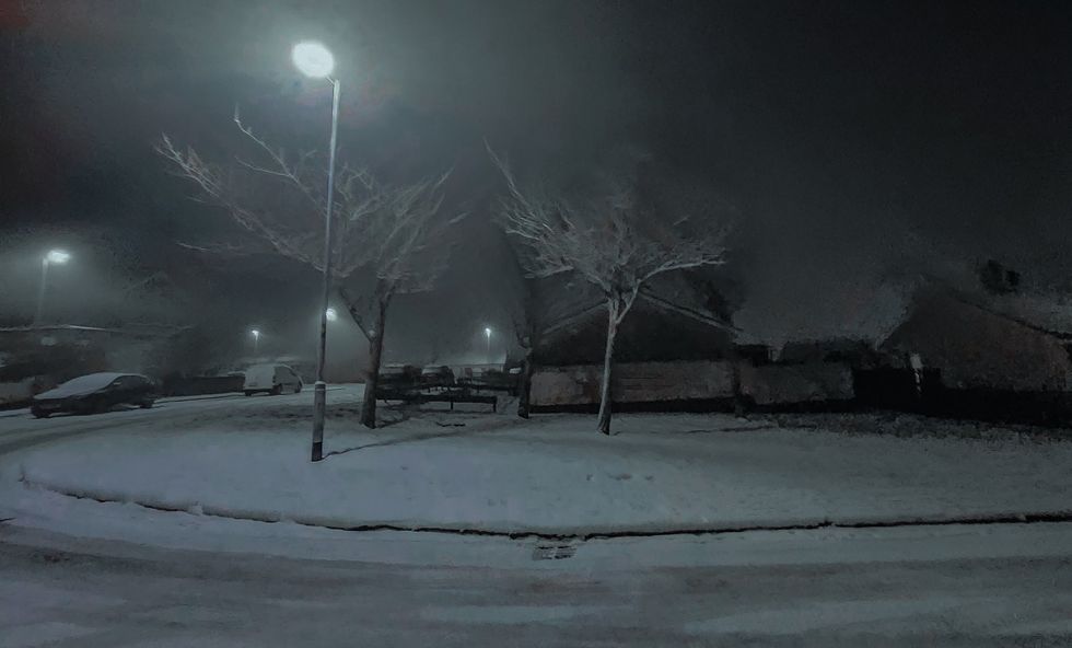
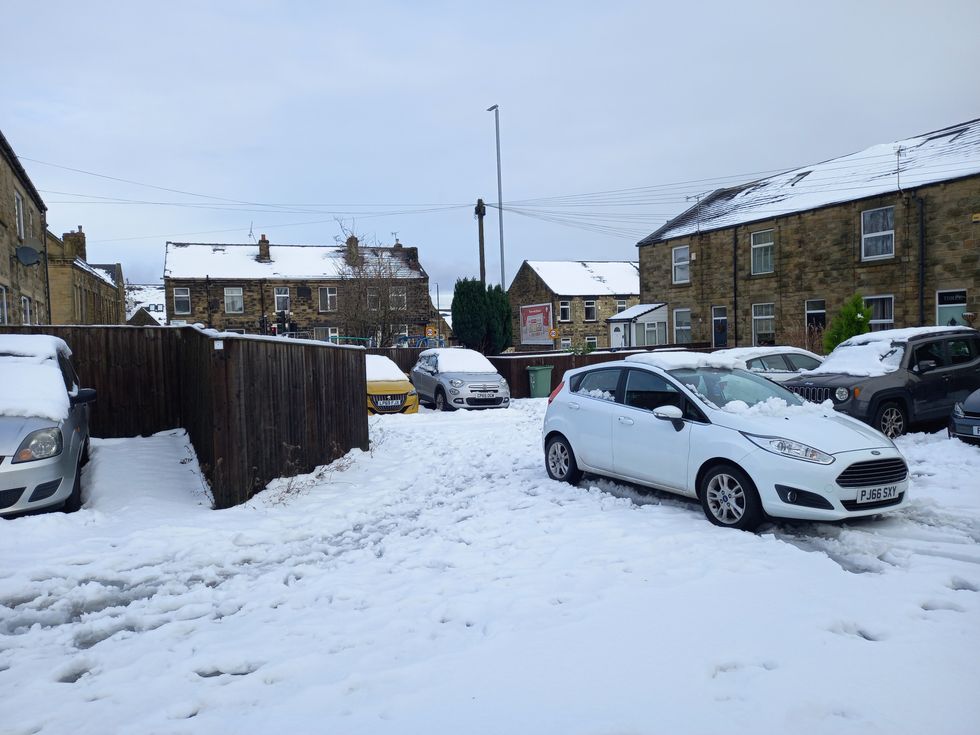 Large swathes of the country have been blanketed by snow in JanuaryPA
The Met Office outlook for Friday shows bright or sunny spells across the north, while England and Wales will be cloudy with wintry showers over hills.
Looking ahead to the weekend and Monday, an easterly wind will maintain cold conditions across the country.
The south can expect cloudy conditions with showers of rain, sleet and snow at times.
The northwest will continue to see brighter weather through this period, maintaining the split in conditions across the UK.
