Three MONTHS of hot sunshine: Britain told to brace for summer heatwave as Met Office issues updated forecast
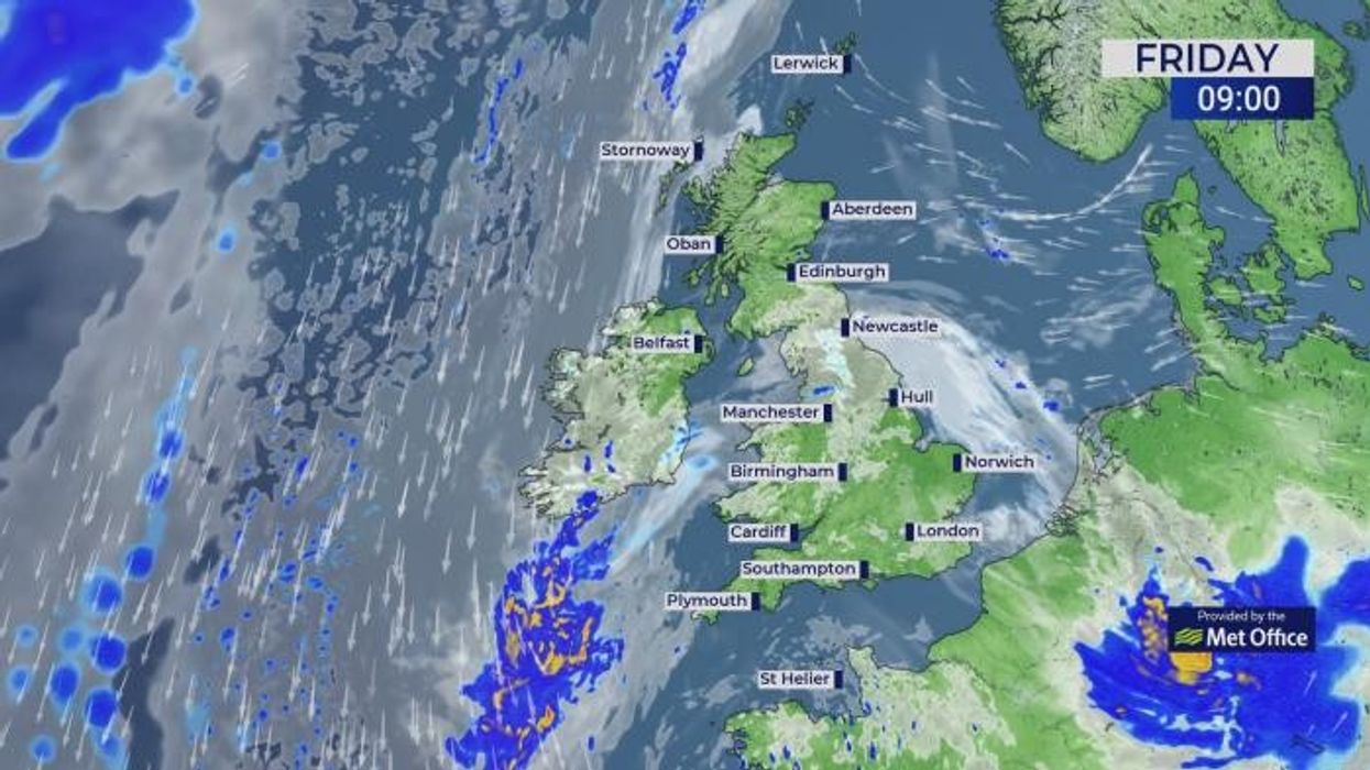
WATCH HERE: Met Office's UK regional forecast 17/05/2024
|MET OFFICE

The Met Office’s three-month outlook predicts a near double the average chance of ‘hot’ weather
Don't Miss
Most Read
Latest
A ‘meandering and branching’ jet stream will keep Britons dodging showers before the start of what could be another freakishly hot summer.
Sunshine and showers are in store for most of this weekend with no immediate sign of a repeat of the recent hot weather.
However, long-range experts are hinting that after the next 10 days, a dramatic U-turn in the weather awaits.
The Met Office’s three-month outlook predicts a near double the average chance of ‘hot’ weather until July.
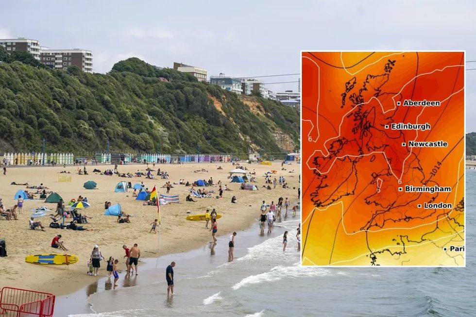
Britain told to brace for summer heatwave as Met Office issues updated forecast
|WX Charts/Getty Images
Global climatic drivers could also help drive a long-awaited scorchio, including a transition from El Nino to La Nina and changes in stratospheric wind patterns.
Exacta Weather forecaster James Madden said: “June is likely to start on a decent note for many of us, with warm or potentially hot temperatures spilling over from the end of May.
“Some projections have identified a potentially hot period of weather around mid-July, and this could last for an extended period, and during this time, there is no reason we couldn’t see temperatures in the mid-to high-30Cs.
“Temperatures are likely to be above-average for the month as a whole.”
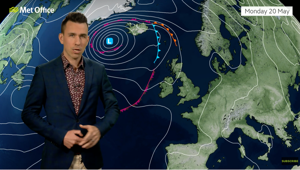
Low pressure to the north brings some unsettled weather, according to Met Office’s Aidan McGivern
|Met Office
Britain’s summer will come under the influence of several influences which may push temperatures into the hot zone.
A waning El Nino–a warming of the eastern Pacific which set in last summer–is expected to pendulum swing into a counterpart La-Nino cooling.
Delayed development of stratospheric winds high above the atmosphere will also favour drier, settled conditions, experts say.
This summer has a 35-per cent, 1.8 times the norm, chance of being hot, and a mere five per cent chance of being cool, according to the Met Office.
It means the trend towards hotter summers seen over the past few years this year could be set to repeat.
LATEST DEVELOPMENTS: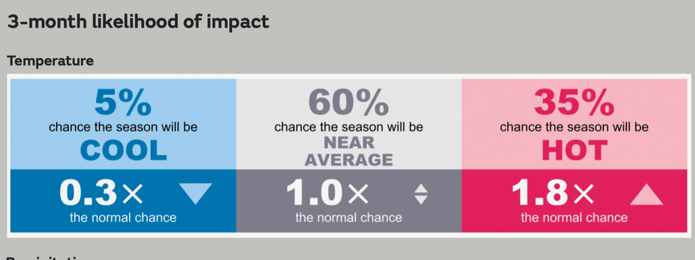
This summer has a 35-per cent, 1.8 times the norm, chance of being hot
|Met Office
A Met Office spokesman said: “Drivers relevant to the current outlook include warming of the UK climate consistent with wider global warming trends.
“The El-Nino Southern Oscillation is expected to transition towards neutral or a La Nina in the outlook period with continued cooling of tropical East Pacific waters.
“And looking at stratospheric winds, the normal spring transition from a westerly to an easterly direction is delayed this year, slightly favouring more settled conditions in the upcoming three months.”
In the meantime, Britons will have to grit their teeth through more unsettled weather although the immediate outlook is not entirely bleak.
The jet stream, which largely steers the weather, has fragmented meaning a tussle between low and high pressure and a mixed picture.
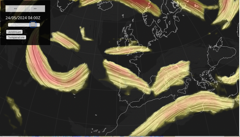
A ‘meandering and branching’ jet stream will keep Britons dodging showers before the start of what could be another freakishly hot summer
|Netweather
Met Office meteorologist Aidan McGivern said: “We end up with a weak and meandering jet stream which is the case over the next few days.
“The jet stream splits into various branches and those come together again, and it is all over the place as we get to the start of next week.
“That tends to suggest that the weather will become more settled into the start of next week, but not entirely dry and sunny, there will be some showers around.”
Temperatures could reach the low-20Cs in parts, he said, although at times it will be cloudy and dull.
He added: “By the start of next week, it is going to be quite calm, but with no significant high or low in charge it will be sunny spells, strong sunshine and some sharp showers around.”


