


A tropical plume from the Continent could be about to trigger a major U-turn with temperatures after the weekend tipped to nudge 26C.
Drastically changing weather patterns hint at booting out the lingering chill for a balmy blast of summer.
Independent forecasters agree next week is likely to bring a temperature surge, particularly across southern Britain.
Jim Dale, meteorologist for British Weather Services and social commentator, said: “There is a good chance we will see temperatures in the 20Cs, and in the sunshine, it is going to feel very warm and pleasant.
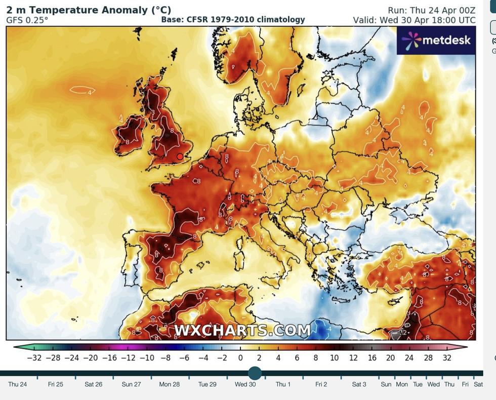
Temperatures are on the rise
WXCHARTS
“It depends on where the high pressure ends up, and where it gets established over the UK, but we could be looking at some warmth through the end of April and into May.”
However, freakishly undecisive forecasting models give this as just one possible set-up, with others painting a very different picture.
A slight change in ‘synoptic’ pressure patterns would instead trigger thundery outbreaks and heavy downpours.
Met Office meteorologists are tirelessly poring over forecasting ‘members’ – model predictions – for the most likely scenario.
Meteorologist Honor Criswick said: “One member has a 20-per cent chance that high pressure sits to the east, and that means we drag in a southerly flow.
“This would mean it will be largely settled with lots of dry weather and sunny spells, and it would bring in some very warm temperatures particularly across the far south and southeast, and we could potentially get into the high 20Cs if this solution occurred.
LATEST DEVELOPMENTS:
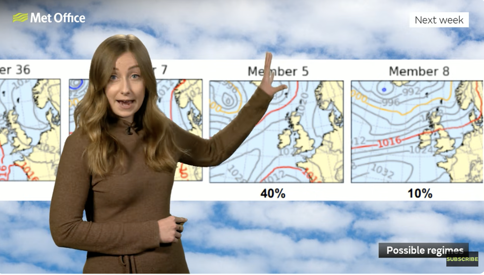
Honor Criswick explains the changing ‘members’ predicting the weather next week
MET OFFICE
“Another member with a 30-per cent chance has the high pressure further east, and that would bring slightly more unsettled conditions, so this is something more changeable, not quite as warm with average temperatures across much of the country.
“So, between the two, there are quite different set ups.”
Further tussling weather models predict a "warm plume with heavy thundery showers", she added.
The chaotic forecasts are driving meteorologists to pull their hair out through uncertainty over where high pressure next week lands.
In spring and summer, anticyclonic highs lead to dry, warm and sunny conditions while lows bring the rain.
A wavy jet stream can add huge uncertainty over where the high pressure ends up, causing forecasts to change by the day.
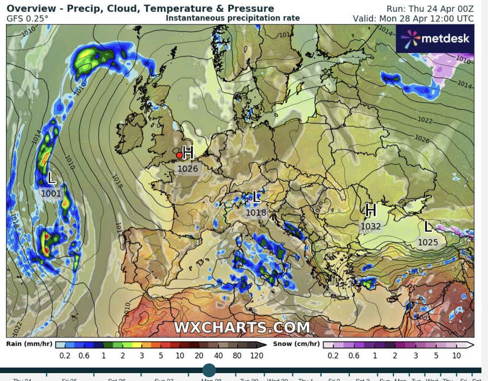
High pressure builds over the UK
WXCHARTS
“It really depends on where that high pressure is going to sit and how quickly it is going to last,” Criswick said.
She added: “From Monday, the certainty levels really plummet, so it is really a big question mark as to the kind of weather we see next week depending on whereabouts that high pressure will sit.”
Despite the uncertainty next week, this weekend looks more likely to be dry and warm particularly in London and the southeast.
Runners are urged to prepare for higher temperatures for the 26-mile marathon slog round the capital on Sunday.
Criswick said: “It is fairly good conditions for running, there could be some fog clearing through the morning but otherwise it should stay dry with sunny spells, but it is going to be feeling rather warm across the southeast, London in particular.”
