


A peculiar weather phenomenon threatens to drive Britain’s mini heatwave to an explosive climax.
An unusual arrangement of high and low pressure – known in meteorology as a ‘col’ – could see the heat erupt in a flash of thunderstorms.
Cols, which describe four areas of pressure, two high and two lows, arranged in a grid, can drive humidity and atmospheric instability.
Such an arrangement, stretching across the UK from eastern Europe, the Atlantic, North Africa and Scandinavia, could be about to light the blue touch paper.
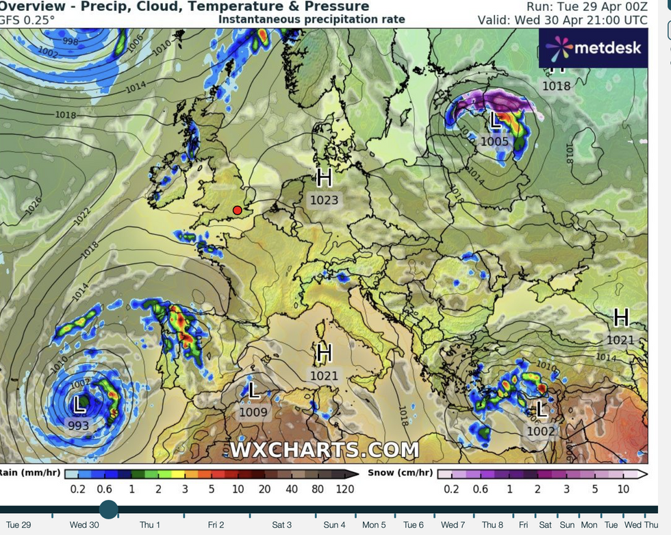
A 'col' is formed by an unusual arrangement of high and low pressure
WX Charts
Jim Dale, meteorologist for British Weather Services, said: “It looks as though a col set up will become established by Thursday, and this means we could be in the middle of no man’s land between these regions of pressure.
“But cols can create some instability, and this means there will be the chance of an isolated thunderstorm.
“It is very difficult to pinpoint where exactly a thunderstorm will happen, and although it is not a massive risk for all parts of the country, it is a risk nonetheless.”
Cols can drive higher levels of humidity, which with high temperatures, provide the ingredients for storms, he warned.
He said: “This type of situation brings instability in the atmosphere, and with the humidity and the high temperatures, that could result in thunderstorms.
“With these, there could be some sharp showers before the end of the week.”
LATEST DEVELOPMENTS: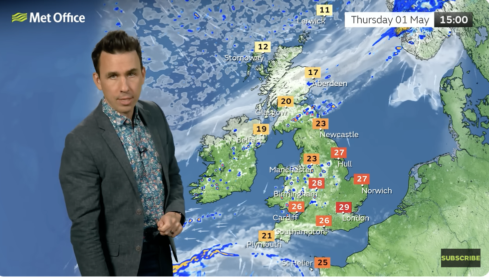
Met Office’s Aidan McGivern says temps could hit 29C
Met Office
Temperatures before the end of the week could nudge records with highs of 29C or higher possible.
The mercury will creep upwards through the next 72 hours before peaking ahead of the weekend.
Although the highest temperatures will be in the south, the whole of the country will bask in the ‘hottest week of the year so far’, according to the Met Office.
Meteorologist Aidan McGivern said: “It is easily going to be the hottest week of the year so far.
“The jet stream is pushing well to the north of the country allowing high pressure to build in, delivering sunny skies and day by day, rising temperatures.
“Thursday, the first day of May, is going to be a very warm one.”
Temperatures could hit 29C on Thursday, more than 10C above average for the time of year, he said.
He added: “It will be widely into the mid- to high-20Cs across England and Wales, with a maximum temperature most likely somewhere between Bristol and London of 29C, and further north, still warm but a little less so.
“There will be one or two showers about because of a weather front.”
Bookmaker Ladbrokes has slashed the odds on this week toppling the record for the hottest April day ever.
Spokesman Carl Gildart said: “This week’s forecast calls for factor 50. So while the mercury rises, our odds have plummeted on a record temperature for April arriving before the month is over.”
Jason Nicholls, international lead forecaster for AccuWeather, said: “High pressure will hold out through the middle of the week, and then there is the possibility of some showers.”
