


The Met Office has forecast that there will likely be some “very warm” days towards the end of August, as the UK prepares to enter the first of the autumnal months.
For most Britons, this summer has felt rather disappointing bringing just a few days of sultry heat.
However, the Met Office has suggested those warm days could be returning at the end of the month.
The Met Office long range weather forecast suggests the final days of August are set to see some “very warm” days.
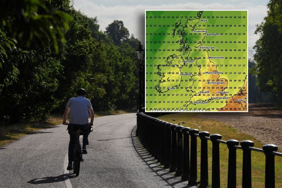
UK weather: Met Office forecasts some ‘very warm’ days before end of August
PA/WX CHARTS
Giving a prediction for August 22 to August 31, the national weather service said: “Toward the end of August, conditions are expected to become gradually more settled.
“Any wetter weather will probably become confined to northern and western areas, with longer drier periods in the south and east.
“Temperatures overall will probably be close to average, but with a chance of some short-lived very warm conditions in the south and east at times.”
However, it also suggested that for many areas, the start of the period would be marked by more “unsettled” conditions.
LATEST DEVELOPMENTS:“Unsettled for many areas at the start of this period with outbreaks of rain or showers spreading in from the west,” the Met Office said.
“The wettest weather will likely be across northwestern parts of the UK, with the southeast tending to be drier.
“Strong winds are also likely, these mostly affecting parts of the west and north.
“It is expected to be cooler in the northwest and warmer in the southeast.”
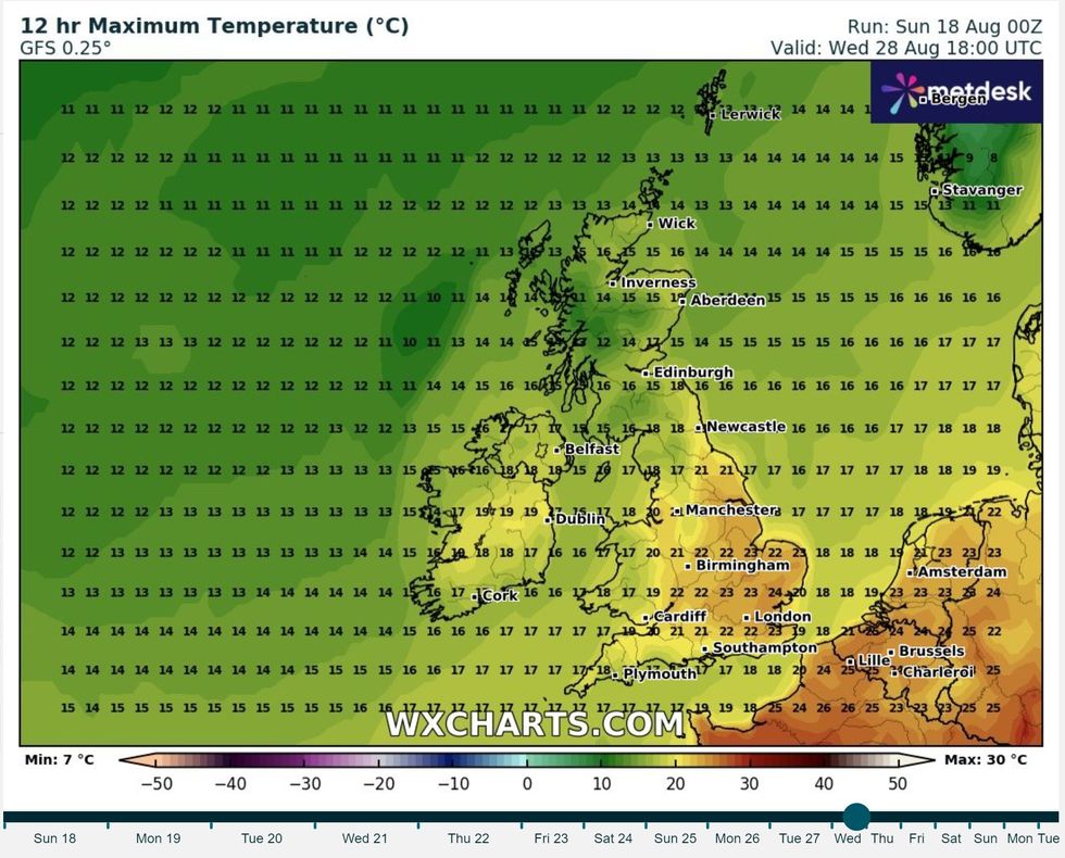
Weather map shows warm air creeping up from the south
WX CHARTS
Netweather appeared to echo the Met Office forecast as they also said the forecast for the coming days will likely be mixed.
The forecast said: “Sunshine amounts will be variable, because frontal systems will be frequently moving from west to east across the country, and although these will not produce much, if any, rain in eastern, central and southern England, they will often bring plenty of cloud with them.
“In between these systems, most of England can expect plenty of sunshine, while in western Scotland and Northern Ireland, there will be some brighter weather mixed with showers.”
However, the Netweather prediction adds that the conditions experienced will be fuelled by the remnants of Hurricane Ernesto which will soon be dissipating over the north Atlantic.
It continued: “Through next Thursday and Friday, and possibly into next weekend, there is potential for some very windy weather associated with the remnants of Hurricane Ernesto, particularly in northern Britain, with a significant possibility of gales especially in the north and west of Scotland.
“South-eastern Britain may largely miss the wind and rain associated with this. This will probably clear away by the Bank Holiday Monday, promising quieter weather especially for the south.
“Looking further ahead, although Ernesto could temporarily disrupt the pattern, there is no clear end to the northwest-southeast split pattern on the horizon, and it could well persist through to the end of August.”
