UK weather: Britons set for ‘Green Christmas’ as snow hopes melt away
WATCH: Weather expert Tamsin Green says it's extremely unlikely that the UK will wake up to White Christmas
The mercury is likely to hit double figures
Don't Miss
Most Read
Trending on GB News
Britons are more likely to gather around barbecues than roaring fires tomorrow as all chances of Festive snow melt into a balmy ‘Green Christmas’.
Tropical weather more typical of mid-summer will sweep in Grinch-like, stealing hopes of snow-covered villages, sparkling tree-tops and frosted Church spires.
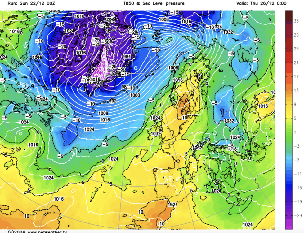
Weather charts have literally turned green as temperatures through Christmas week soar into double figures.
While it is unlikely to be the hottest Christmas on record, the whole country will be mild with almost no chance of snow.
Jim Dale, meteorologist for British Weather Services, said: “If there is any snow hanging around from the unsettled period in the run-up to Christmas, that is going to be it.
“There is little to no chance of snow on Christmas Day, with temperatures widely above average in double figures.
 UK weather maps Green Christmas snow britain temperature 2024Netweather
“We are not looking at a record-breaker, but other than over the very highest tips of the Scottish mountains, we are neither looking at a White Christmas.”
Winter so far has been the battleground for low and high pressure driving a chaotic tussle between cold snaps and storms.
With low pressure to the north of the UK, the Azores High – a region of high pressure behind summer heatwaves – will nudge in from the south.
Warm air from the south will sweep in behind it, pushing the mercury across Britain into double figures.
Southern regions will see the mercury nudge 11C or higher, with the north hovering around 10C.
LATEST DEVELOPMENTS:Although weather charts have turned a spring-like shade of green, temperatures are unlikely to hit the 1920 Devon record of 15.6C.
Met Office meteorologist Honor Criswick said: “The Christmas period looks largely settled with just a chance of wet and windy weather in the far northwest.
“Generally, with this wind direction, it is a milder direction, with winds from the south and southwest is more of a milder direction compared to if the high was situated further west, and then we would start to see northerly winds.”
Even the bookies have called time on a festive flurry, with Ladbrokes offering 4-6 from 1-3 for snow on Wednesday.
Spokesman Alex Apati said: “It's bad news for White Christmas wishers.
“The odds of snow falling on Christmas Day are beginning to head in the wrong direction."

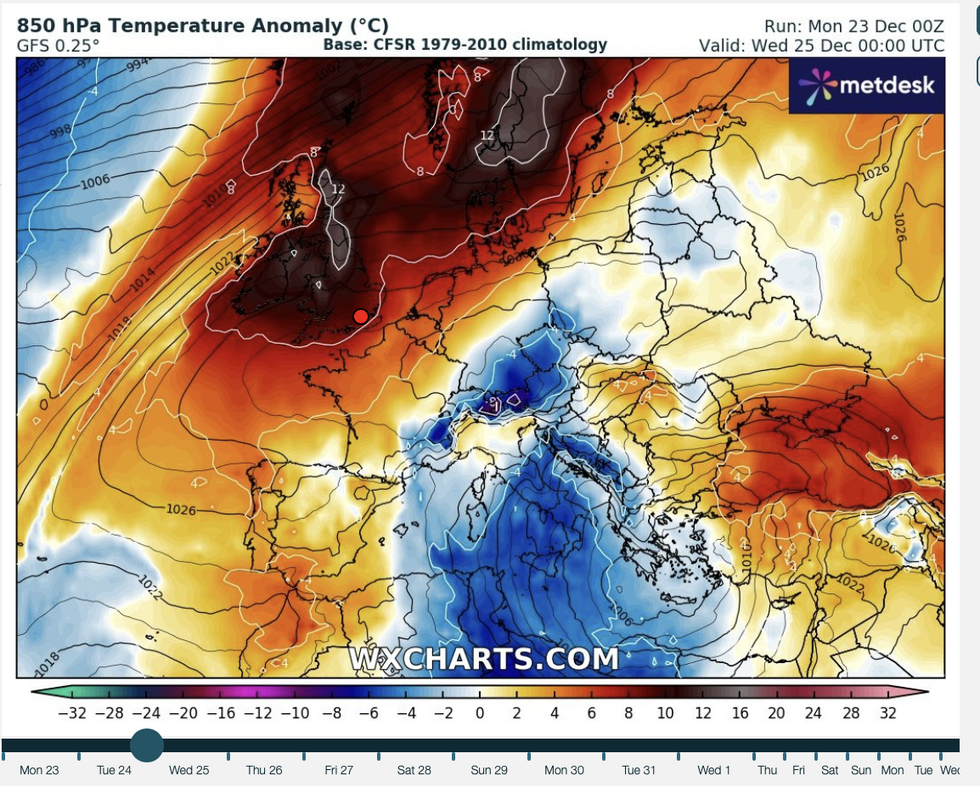
Temperatures soar on Christmas Day
WX charts
Temperatures in parts of the country could touch 12C or 13C tomorrow, keeping meteorologists’ eyes peeled for the warmest spots.
Milder conditions are likely to hang around through the rest of the week before there are hints of the cold returning.
Mr Dale, co-author of ‘Surviving Extreme Weather’, said: “We are looking at a Green Christmas instead of a White Christmas, with no real change through the rest of the week.
“As we get to the New Year, there is more of a chance of something colder coming in, and perhaps more unsettled.”
In the meantime, last-minute Christmas shoppers face a grey and cloudy Christmas Eve shopping dash.
A Met Office spokesman said: “It is a mostly cloudy Christmas Eve, but there will be some brightness developing to the east of high ground.
“It will be damp for many initially, but rain will become mainly confined to the northwest later.
“It will turn much milder.”


