


Britain faces wind and rain as summer heat is booted out by weather systems barrelling in ‘one after the other’.
Temperatures will nosedive 10C as the jet stream dives southwards, throwing open the gates to the Atlantic.
A major meteorological shift will abruptly swap the hot spell for a regime of ‘chopping and changing’.
Unsettled weather is forecast into the start of July as Britons are urged to make the most of lingering sun where they see it.
 UK weather: Jet Stream to send temperatures into nosedive as heat gives way to rain | Met Office
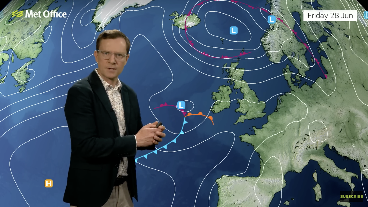
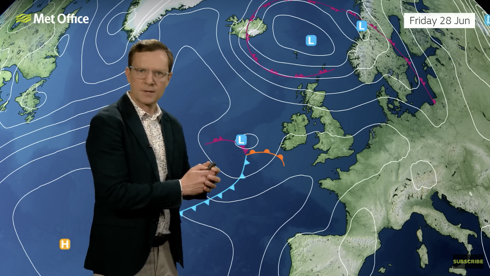
Met Office meteorologist Alex Deakin said: “We are in for a shift.
“By Friday we are all in the cooler air and some areas are going to be 9C or 10C lower compared to Wednesday.
“With winds coming in from the Atlantic next week, that means we will see weather systems moving in one after another and it means our weather will be chopping and changing quite a bit.”
Britain’s weather will also come under the influence of swinging pressure patterns spanning the Atlantic.
Falling atmospheric pressure over Iceland and rising pressure further south over the Azores will nudge the North Atlantic Oscillation (NAO).
The NAO is forecast to swing into a positive phase, triggering a stronger Atlantic influence on the weather.
UK LATEST:It means prolonged warm and dry weather going into July is less likely than cooler, wetter conditions.
Mr Deakin said: “This is called the North Atlantic Oscillation, and it is a way of looking at the pressure patterns across the Atlantic and how they affect the UK.
“When it is positive, it means the pressure across Iceland is lower than usual and pressure across the Azores is higher than usual, and when that is the case, you get westerly winds coming in from the Atlantic.
“That is our most likely weather flavour next week.”
Southern regions are most at risk of rain later in the weekend with the north cooler and drier.
Heat energy and humidity left in the atmosphere from the recent hot spell will drive unsettled weather.
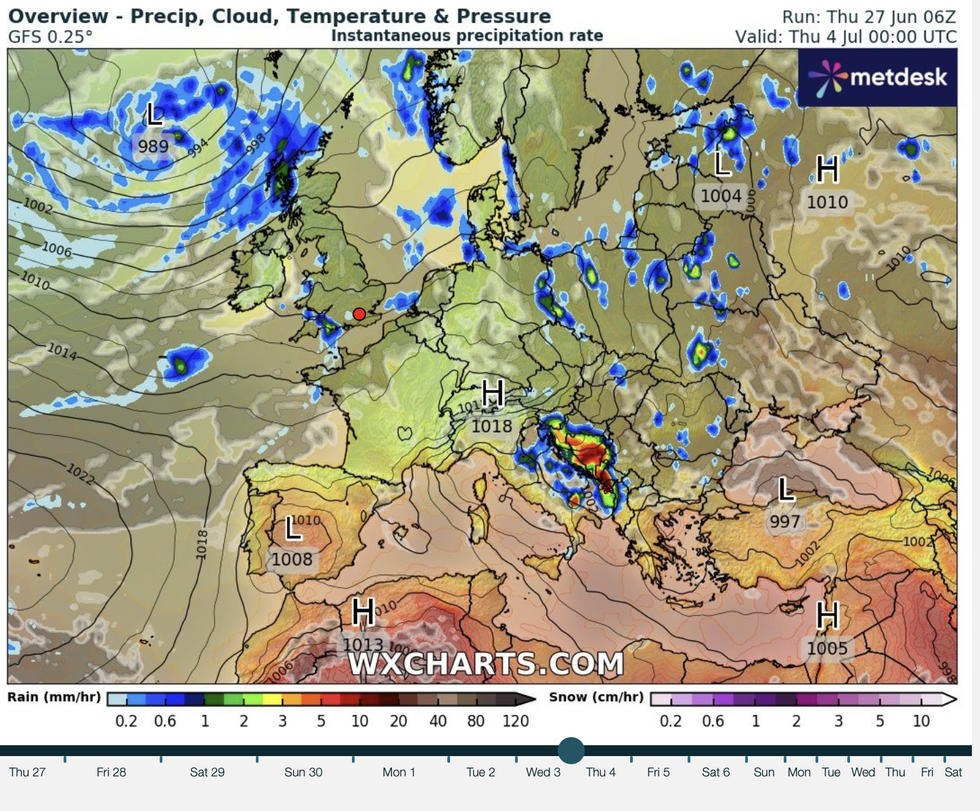
Low pressure from the Atlantic returns
|WX charts
Jim Dale, meteorologist for British Weather Services and social commentator, said: “The humidity has come in from the south and this is going to bring more unsettled weather as fronts come in from the west towards the weekend.
“On Saturday, there is a conveyor belt of fronts coming in bringing the risk of heavy downpours which could be thundery.
“Sunday will bring more in the way of showers, and this weekend marks the changeover from the hot weather to more average and changeable conditions.”
Some long-range forecasters are more optimistic for early July to signal the return of hotter weather.
It would depend on the position of the jet stream and the development of high pressure across the UK.
Exacta Weather forecaster James Madden said: “It looks favourable for high pressure to make a return and bring warm to hot conditions during early July.
“There are two favourable options with the first being for this high pressure to intensify during the start of the month.
“The other option is that we see more of a north-south divide for several days or more after any initial high-pressure rise.”