


An ‘angry’ jet stream will fracture into two before joining forces with ex-Hurricane Ernesto to shake up Britain’s weather.
‘Complex’ weather systems will compete to bring wind and rain before another blast of sultry warmth.
Perplexed meteorologists are once again scratching their heads over yo-yo-ing forecasts heavily influenced by the tropics.
Hurricane Ernesto had last night strengthened off the US east coast where it will hitch a ride to the UK on a powerful jet stream.
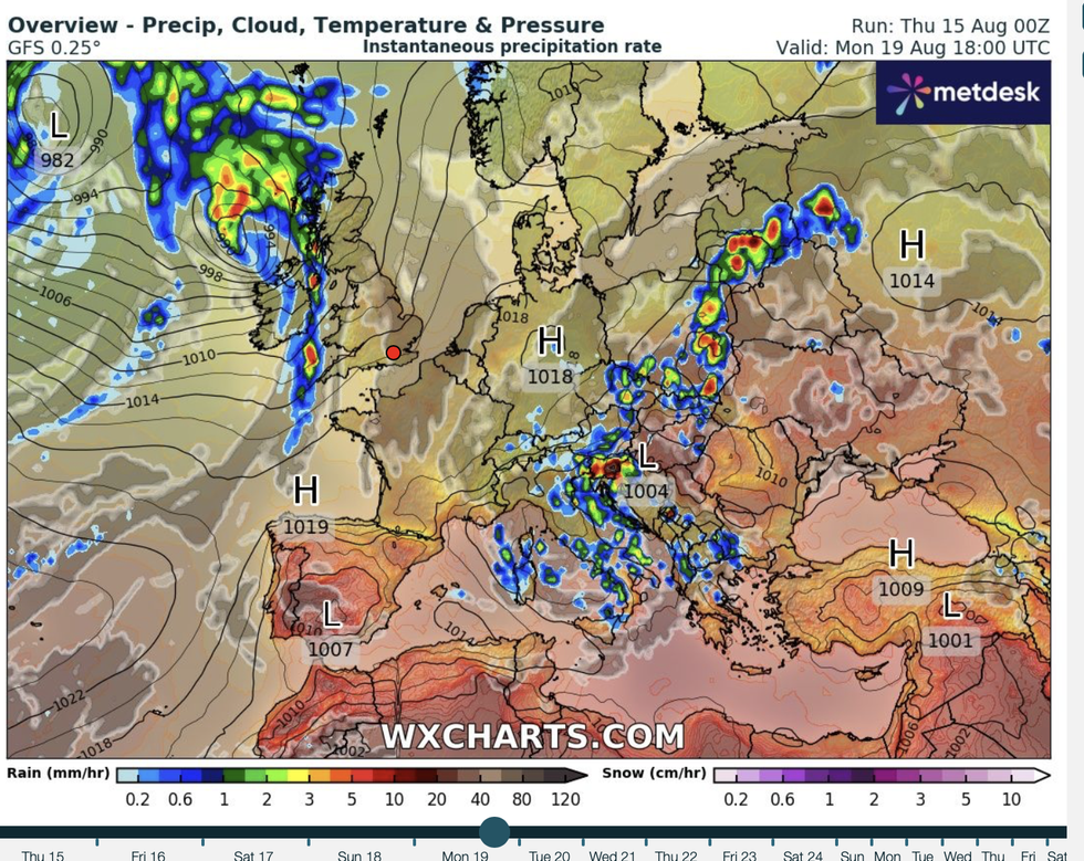
Weather map shows band of rain sweeping in on Monday
WX Charts
 UK weather: Angry jet stream set to bring heavy rain before Britain hit by sultry blastWX Charts
After a settled weekend, Monday will see gusty showers sweep in from the west before temperatures rise in the death throes of the storm.
Met Office meteorologist Alex Deakin said: “It’s the time of year when the tropics can influence our weather and certainly add some difficulties to the longer-range forecast.
“It is quite a complex situation, but there is agreement that we will see clouds and rain spilling into the west on Monday after what will be for most of us a fine weekend.
“As Ernesto tracks further northwards, it may well start to interact with the jet stream as we head into next week.
“It could contain some warm air as it heads northwards so it could bring some warmth into the UK.”
LATEST DEVELOPMENTS: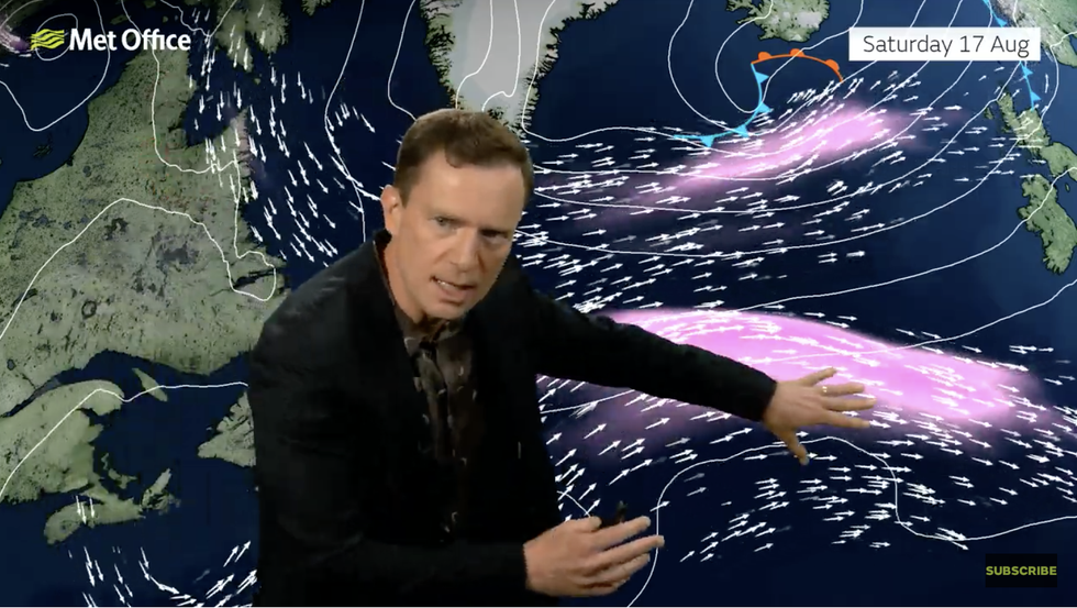
Met Office’s Alex Deakin describes a split in the jet stream
Met Office
Bizarrely, the jet stream split into two branches later this week pulling unsettled weather systems into Britain.
It will pull a ‘tangle’ of weather systems in from the Atlantic after the weekend to give western regions a drenching.
Deakin said: “There is a standard but fairly angry-looking jet stream ploughing across the Atlantic and is pretty lively for the time of year.
“Then it splits, interestingly, and we have kind of two jet streams as we go into the weekend.
“We start to see a low pressure spinning up as we go through the weekend out in the Atlantic, and it is that one combined with a tangle of weather front associated with the northern jet stream that combines to bring us cloud and rain as we head into Monday.”
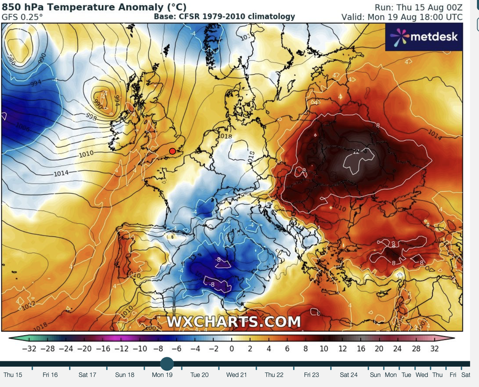
The path of Ernesto will determine how warm it turns next week, and how much rain hits the UK.
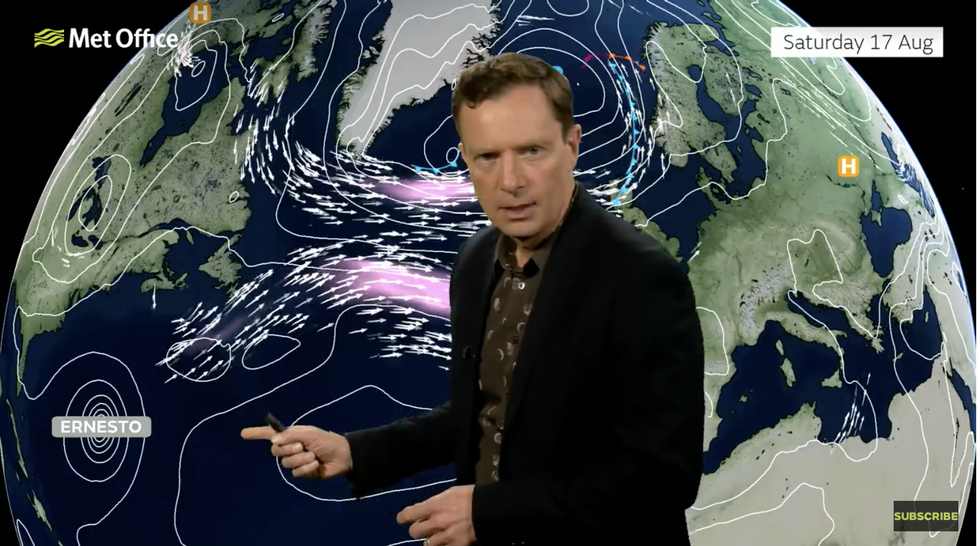
The remains of Ernesto are on the way
Met Office
If the former Hurricane heads further north towards Iceland, it will bull a plume of tropical air more widely across the country.
A more southerly path will put Scotland and northern England at greater risk of cloud and rain.
However, the Met Office thinks it will take a path somewhere between the two, bringing warmth to the south while clipping northern regions with showers.
As Britain’s weather dishes up another box of tricks, experts say another very hot spell is possible.
After a pretty lacklustre summer ends in just two weeks, the start of autumn could yet deliver.
Jim Dale, meteorologist for British Weather Services and co-author of ‘Surviving Extreme Weather’, said: “September is the new summer month, and so there is every chance we could see warmer weather after August.
“This is an effect of climate change, and we are seeing higher temperatures later in the year.
“It is not out of the question that we could see some warm to very warm and pleasant weather through the start of autumn.”
