Pressure-pattern changes during the start of May will restore the ‘balance’
Don't Miss
Most Read
Trending on GB News
Britain’s dire weather will give way to spring warmth and sunshine after a -4C weekend of winter frosts and a dusting of snow.
Pressure-pattern changes during the start of May will restore the ‘balance’, pushing temperatures back where they should be late spring.
However, it will follow a late bite of cold with Polar winds this weekend to plunge Scotland and northern England back into winter.
Southerly winds from the Atlantic will bring milder weather elsewhere, although bands of rain will dampen spring spirits.

Temperatures are set to rise significantly next week
Met Office/WX Charts
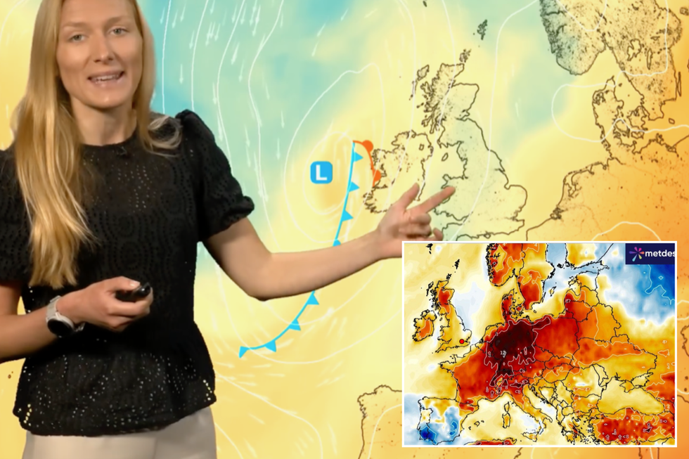
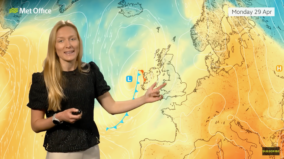
Met Office meteorologist Annie Shuttleworth said: “Low pressure will start to arrive into the south on Friday afternoon, and it will bring the threat of cloudier skies and perhaps some outbreaks of rain to end the day.
“Temperatures will start to rise in the milder air to the south, but the rain risk will increase through the afternoon.
“Saturday will see a cold start, and we could see temperatures down as low as -4C in Northern Ireland and Scotland which is fairly cold for the time of year, so there is potential for a frost for northern and western areas.”
Rain will push north through Sunday when southern Britain may get a clattering of thunderstorms, she said.
A low-pressure system will ‘anchor’ to the southwest of the UK steering southerly and milder winds into the UK.
“Temperatures will likely continue to rise to average if not a little above average for the start of next week,” Ms Shuttleworth said.
LATEST DEVELOPMENT:
- UK weather: Hot temperatures 'tantalisingly close' as maps turn yellow
- UK weather warning: Britain set for Arctic blast with -2C plunge as 'gales and thunderstorms' to hit within days
- UK weather warning: 'Venomous' cyclonic pressure system barrelling across the Atlantic could unleash Storm Lilian on Britain

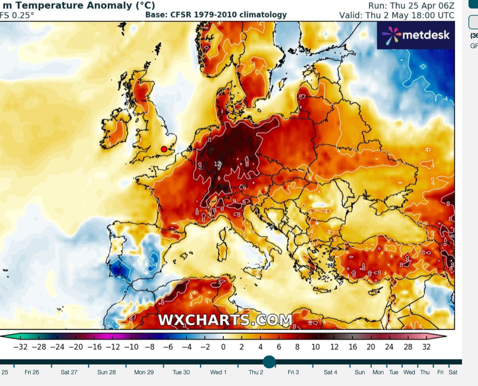
Signs of things turning warmer from the start of next month
WX Charts
She added: “But it could throw up a risk of heavy showers from the near Continent as well.”
Thermometers will plunge around 6C below the seasonal average with the risk of a flurry of snow over high ground, the Met Office said.
But after a miserable wet and cold April, things could be about to change for the last month of spring.
Colder weather over the past week has been driven by northerly winds pulling cold Arctic air across the country.
Long-range outlooks predict temperatures rising more widely through the end of April and into next month.
Bursts of hotter weather across Europe pushing thermometers in parts of the Continent to record highs have raised hopes that Britain will be next in line.

Met Office’s Annie Shuttleworth predicts warmer weather from next week
Met Office
Jim Dale, meteorologist for British Weather Services and social commentator, said: “There is likely to be a balance in the weather, and we can look to Europe where temperatures have ebbed and flowed, at times rising higher than normal for the time of year.
“This may end up affecting us as we go into a transition zone, and we should emerge into hotter weather during May, and the odds are pointing to a swing around before the end of spring.
“This will depend on the synoptics, and it is not going to happen immediately, instead we are looking at a slow climb, but there is no reason May shouldn’t deliver.”
Independent forecasters agree that while the weather may take a few days to dry up, things are looking warmer.
Exacta Weather’s James Madden said: “Winds this weekend will turn to a more southerly direction, and so warmer, and this will drive a gradual rise in temperatures from the current cool pattern to above-average for many.”


