


Simmering Britain will nudge a raft of weather records this week as temperatures bubble over the 28C mark.
Parts of the country are facing the hottest spring blast for more than 30 years under a plume of tropical sunshine.
Southern and southeastern England could hit 28C by the end of the week, smashing the May 1 record of 27.4C, set in 1990.
But while daily records are under threat, this week’s hot spell is unlikely to topple the monthly hotspot of 33C.
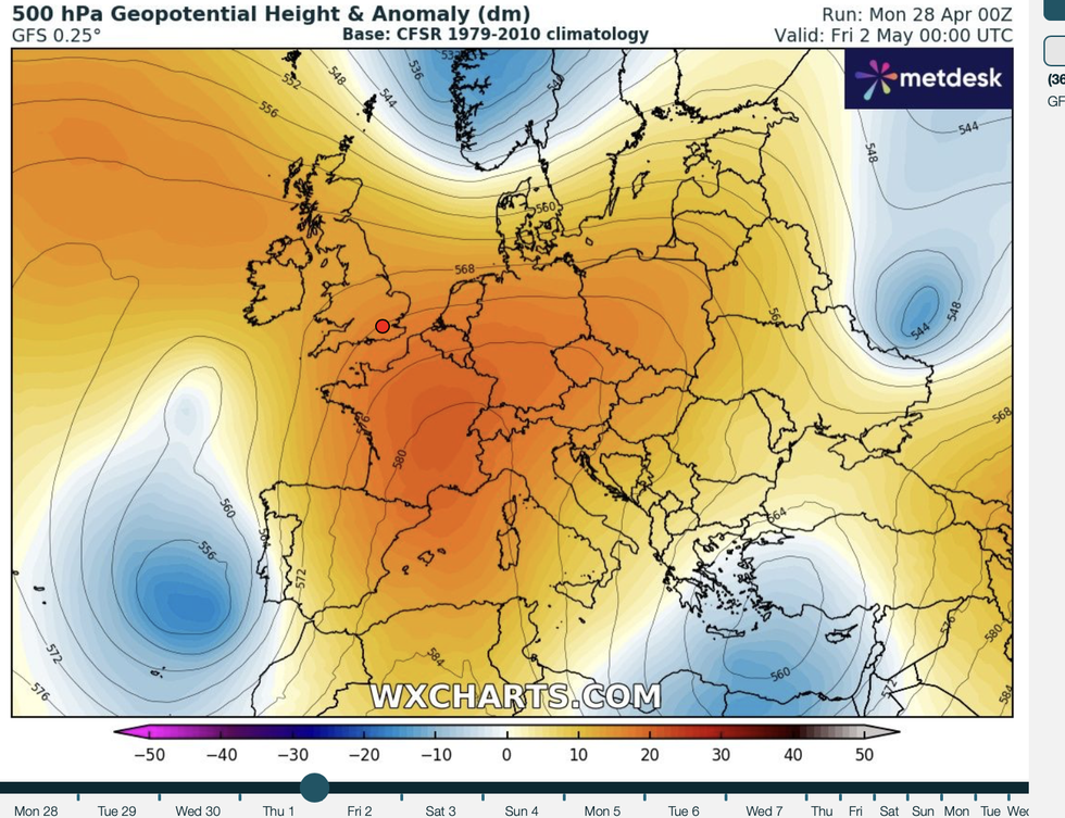
Southern and southeastern England could hit 28C by the end of the week, smashing the May 1 record of 27.4C, set in 1990
WXCHARTS
Jim Dale, meteorologist for British Weather Services, said: “There is a chance we could hit 28C on Thursday, and this would put daily records under threat.
“We are not going to see the monthly record for May, but we are at the top end of the temperature scale this week, and it is going to be very warm for the time of year.
“The highest temperatures will be in the southeast and across the capital, with temperatures rising day on day from the start of the week.”
Hot weather will be driven by a high pressure ‘anticyclone’ serving as a heat dome under strong sunshine.
The high-pressure feature is similar to those which frequently drive extreme heat during the summer months.
Air sweeping in from Scandinavia will warm as it reaches the high, pushing temperatures in the UK skywards.
Dale said: “The high is the Azores high coming in from the south, and under this high, air is falling, or subsiding, warming and pushing up the temperatures.
LATEST DEVELOPMENTS:

Hot weather will be driven by a high pressure ‘anticyclone’ serving as a heat dome under strong sunshine
PA
“Temperatures are going to rise, and it is going to be a dry week with no rainfall.”
Temperature will rise around more than 10C above the 15C average for the time of year bringing the warmest day of the year so far.
Thursday is shaping up for the hottest day in London since autumn, with the heat to hold out through the week.
Jason Nicholls, AccuWeather lead international forecaster, said: “London could reach 27C on Thursday, and this will be 13C above average for this time of year.
“It would also be the first day since September that we have seen 80F or more in the capital.
“The warn, dry pattern is the result of high pressure, and it is going to last until at least mid-week.”
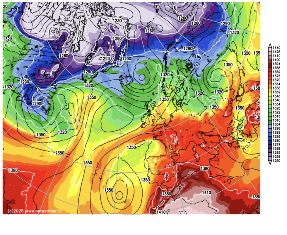
Temperature will rise around more than 10C above the 15C average for the time of year bringing the warmest day of the year so far
NETWEATHER
Met Office meteorologist Honor Criswick said: “It is likely that we could start to hit 25C, 26C or 27C as we head through Wednesday.
“In Scotland on Tuesday and Wednesday, we are looking at the high teens or the mid-20CS, so it is likely that by Wednesday and Thursday, many areas will be quite warm, particularly across the far southeast.”
Despite rocketing temperatures, Britain is unlikely to reach conditions for an official heatwave.
A heatwave requires temperatures to breach a regional threshold – 28C in London – for three days in a row.
Criswick said: “Actually, for a heatwave to take place you need to reach a certain temperature depending on your geographical location in the UK, and you need to see that temperature or above for three consecutive days.
“There is a good chance that there will be some certain days that we reach these temperatures, but it is unlikely that it will be for three consecutive days.”
Most read


More


