


Britons hoping for more summer weather before the season is out can rejoice as highs of 27C will be reached thanks to a Scandinavian plume.
The warm weather will come as a welcome relief after Britain has been battered by Storm Lilian, which has caused chaos with its 73mph winds.
However, before balmy sunshine makes a return, showers will strike over the bank holiday weekend, the Met Office has said. A yellow rain warning was in place for much of the South East from 6.00am until 1.00pm today.
The week will begin wet and gusty, as the aftermath of Storm Lilian is felt - though thankfully it will feel slightly warmer than the previous week, the weather office said.
 UK weather: Scandinavian plume to bring 27C heat 'before summer is out'Getty/Met Office
And sunny days will make a reappearance, thanks to a high pressure system moving in from Europe from Tuesday onwards, with temperatures expected to soar to 27C in London on Wednesday.
Met Office Meteorologist Annie Shuttleworth said: “Next week is looking much drier and more settled than this week.
“From Tuesday, low pressure is centred up to the north and west of the UK.
“But high pressure from Scandinavia will pick up warmer air for the week - bringing more settled weather to eastern and southern areas of the UK - lasting into the first week of September most likely.”
WEATHER LATEST:
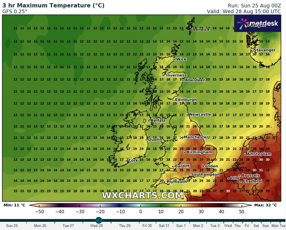
Highs of 27C are expected in London on Wednesday
WXCharts
Whilst London will see the highest recorded Mercury, Northampton and Milton Keynes should reach 25C, with the West Midlands coming behind at just 1C lower.
She explained that any weather fronts heading for the North West will be stopped in their tracks by this high pressure.
“So that leads us into the very end of summer which means we could start to see some warmer air moving up from the south and east.
“That does mean it looks quite a lot warmer this week so there's improvements to come before summer is out.”
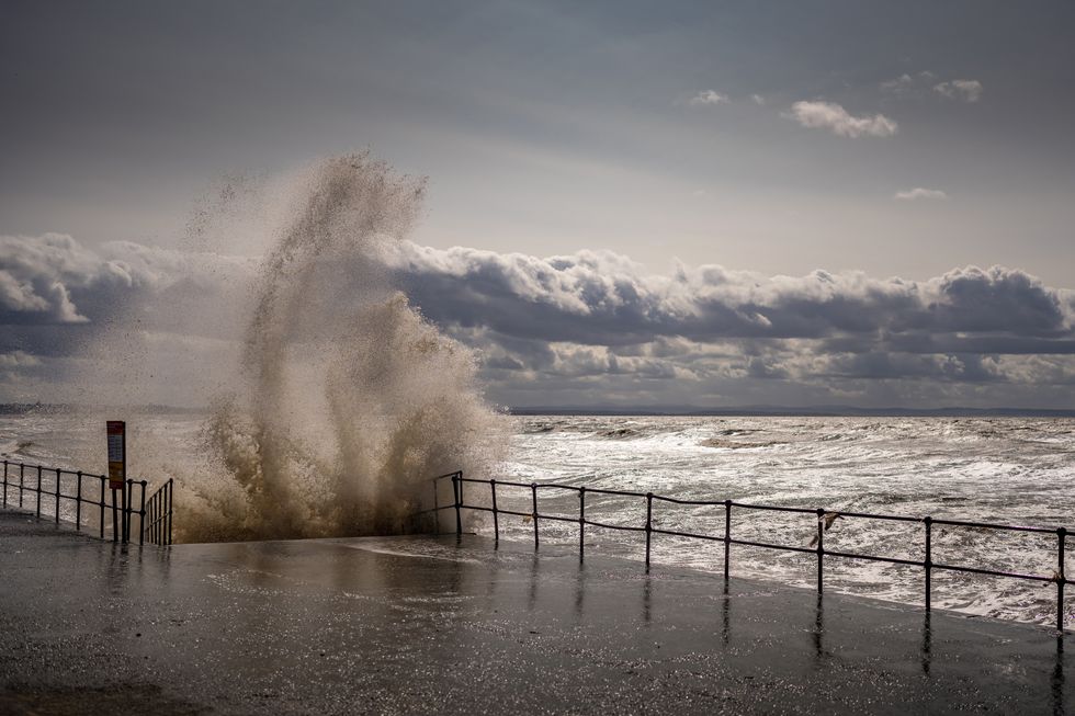
Waves whipped up by the wind hit Crosby Beach promenade as Storm Lilian brings rain and high winds to the UK
Getty
Nick Finnis, of Netweather, said the incoming week will bring with it rising temperatures, leading into a September which will be both drier and more settled.
He said: “Tuesday sees a frontal system push in from the west and grind to a halt over northern and western areas - bringing a cloudy and wet day, sunnier and warm in the southeast, perhaps reaching 25C here.
“The front eventually clears east on Wednesday, but not before eastern England sees a very warm and sunny day, likely warmest day of the week, with temperatures reaching 28C.
“So the week ahead promises rising temperatures until Thursday, before cooler and fresher conditions return. Some rain too, but mostly in the north and west, best of the sunshine in the south and east of England.”
