


A summer-heat phenomenon is about to blast Britain driving some of the warmest weather since spring.
The mercury could hit 25C by the weekend as forecasters sound the klaxon to "get out sun-loungers and T-shirts".
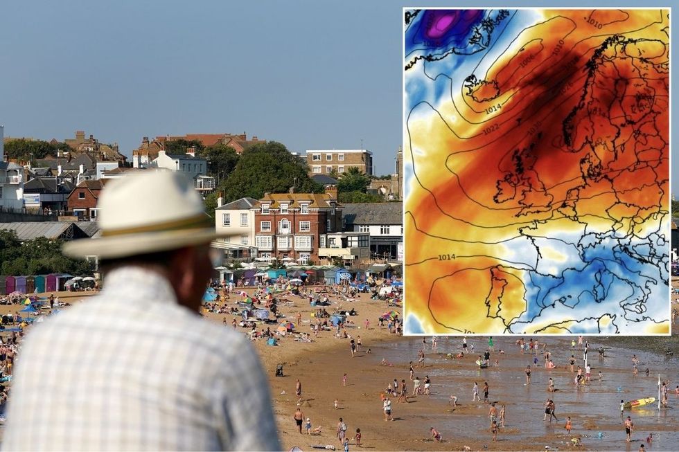
The driver will be the Azores High, a huge region of high pressure in the southerly Atlantic, heading towards the UK.
Also called the ‘Bermuda High’, it usually frequents the hotter summer months as it sweeps the nation with tropical winds.
 UK weather: Britain blasted by 25C 'Bermuda High' as high pressure sends mercury soaringPA/WXCHARTS
Jim Dale, meteorologist for British Weather Services and social commentator, said: “We haven’t seen much of this type of high pressure through most of summer, and this is going to initially come up from the Azores bringing high temperatures by the end of the week.
“This is a late visitor to the UK, as it usually affects the weather during the summer, but it is going to try its best to bring a return to some warm weather.
“We are looking at temperatures widely across southern and central Britain in the low- to mid-20Cs, and I would not be surprised to see a 25C.”
Even further north, winds tumbling over the mountains of Scotland – the Foehn Effect –will push a surge in temperatures.
LATEST DEVELOPMENTS: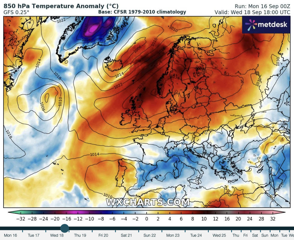
WXCHARTS has showed temperatures surging
WXCHARTS
While northern Britain will be closer to cooler gusts, temperatures nationwide are expected to rise.
Dale said: “Across the Highlands, the Foehn effect will bring higher temperatures to parts, although it is going to be further south, towards Cumbria, where the heat starts to build.
“It is safe to say that it is time to get out the sun-loungers and T-shirts and put away the winter coats.”
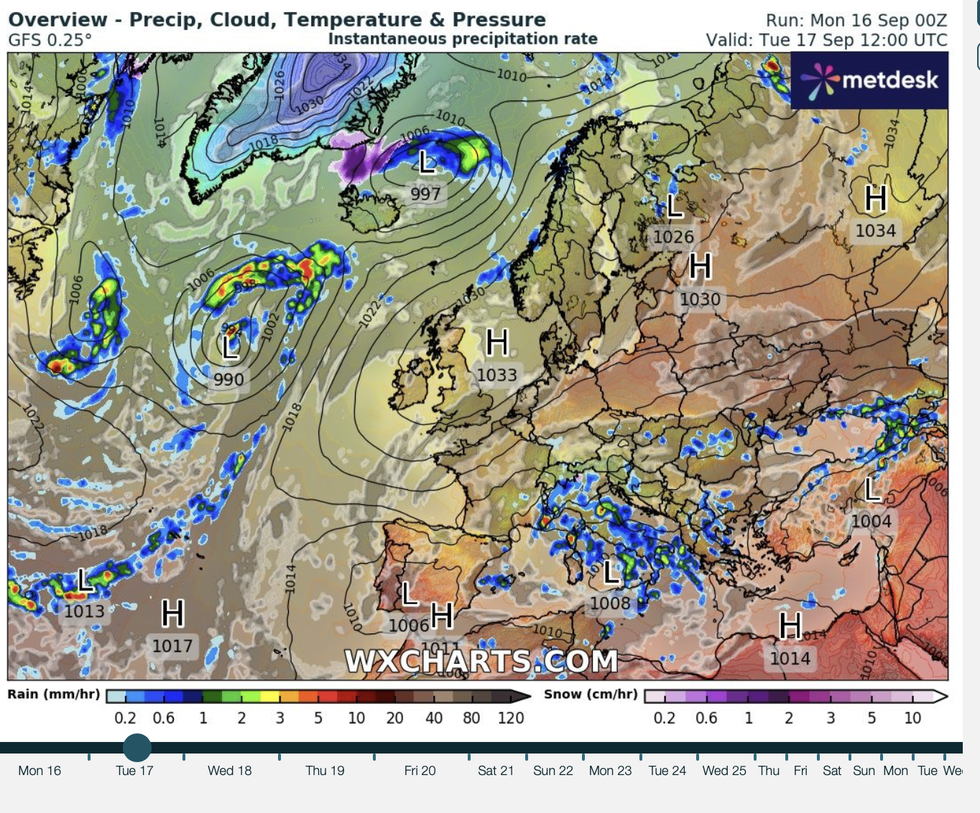
Warmth will at first be driven by the Azores High before a separate high-pressure zone closer to Scandinavia takes the helm.
Calm, summery weather is forecast to hold through the week before an unsettled spell hits the far north.
Met Office Meteorologist Annie Shuttleworth said: “It looks like high pressure is here to stay.
Temperatures will soar following high pressure
WXCHARTS
“We see the next area of low pressure move in for the weekend, and that will probably bring some further windy weather to northern Scotland and a spell of wetter weather that sinks southwards into central areas but Sunday, but high pressure will probably hold on through southern areas.”
The weather this week could be some of the best seen for three months, after the Met Office confirmed the coldest summer since 2015.
Despite the odd burst here and there ad a slightly warmer August, temperatures came in below the seasonal average.
The hottest day was 34.8C recoded in Cambridgeshire on August 12, although the seasonal mean was 14.37C, 0.22C below average.
ExactaWeather forecaster James Madden said: “A significant area of high pressure will start to influence our weather, and some prolonged periods of settled sunshine will kick in across some large parts of the UK.
“Around Thursday or Friday, we will see this high pressure intensify to produce some extreme heat for the UK and bring a pinnacle of this particular heat surge.”
