


Britain is set to bask in a "mini-heatwave" in just a few days' time as temperatures rocket into the 20s.
As the first full week of April comes to a close, parts of England and Wales are predicted to see thermometers climb as high as 23C - with Friday afternoon pencilled in as the hottest period to come.
Across the country, the warm spell is expected to blanket an area stretching from London to as far north as Darlington - while Herefordshire and the Welsh marches could see the highest temperatures.
"Temperatures are indeed forecast to rise above 20C in some areas, possibly peaking at 22C or 23C on Thursday and Friday," the Met Office said.
"For the next few days, those further west will see the higher temperatures, before a change in the wind direction stops the onshore flow, meaning those further east will see the higher figures from Thursday."
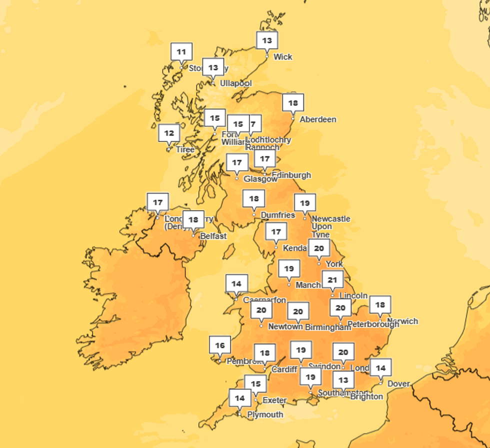
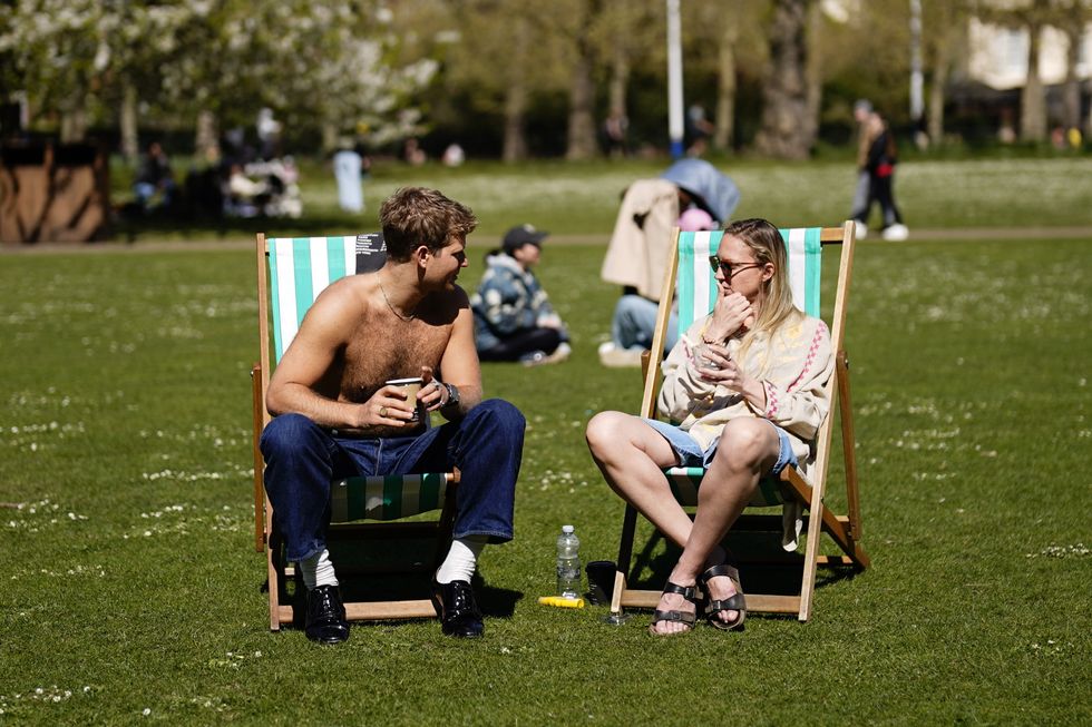
By 4pm on Friday, swathes of England and Wales are set to bask in temperatures in the 20s
|MET OFFICE
Overall, forecasters expect "largely dry and fine conditions" to continue through much of this week, but warn that some showers are possible in parts of Scotland from Friday and into Saturday.
"There are also signals for some more unsettled weather on Sunday and into next week, but it's too early to give specific details," according to the Met Office.
The pleasant predictions come as bookies have slashed odds on this April being the warmest ever.
Cal Gildart of Ladbrokes said: "With the UK swapping showers for sunshine to kick off April, not to mention the forecast showing bright days for the foreseeable, we've had to cut the odds on this month being the hottest on record."
LATEST WEATHER UPDATES FROM GB NEWS:
'Temperatures are indeed forecast to rise above 20C in some areas, possibly peaking at 22C or 23C on Thursday and Friday,' the Met Office said
|PA
But forecasters have counselled calm over the prospect of a full heatwave.
"Temperatures will be above average through much of this week for many, with plenty of warm sunshine," according to the Met Office.
"'Mini heatwave' isn't a defined meteorological term and this week's warmth won't reach the levels to be classified as an official heatwave," meteorologists said.
And the Met Office's five-day forecast still warns of cool climes after dark - conditions will be "feeling warm, but still some chilly nights", it said.
HEATWAVE ON THE WAY? READ MORE:
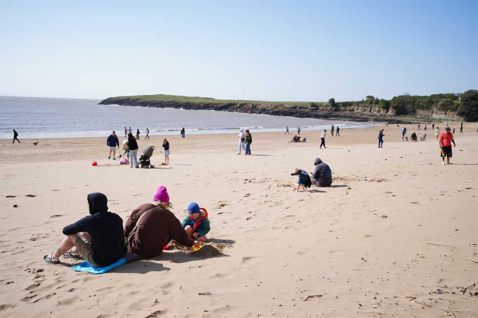
Beachgoers in Barry Island in Wales's Vale of Glamorgan on April 5
|PA
And looking further forward, conditions may take a turn for the worse - the Met Office's long-range forecast from Sunday to Tuesday says: "A transition from the fine and settled conditions most will have seen is expected through this period.
"This will most likely come in the form of a cold front progressing southeast bringing some rain and showers and fresher conditions.
"There is a low risk of heavier, possibly thundery showers coming into the country from the south for a time early in the period, but confidence in this aspect of the forecast is low and these may well pass to the east.
"This heralds a wetter period through the middle of April with showers or longer spells of rain at times, which could be heavy and thundery in places.
"Strong winds could develop in some areas, particularly the south and west. Temperatures are likely to return closer to normal."