


A 10-day heat surge, almost void of any rain, threatens to set the scene for a summer drought.
Summer is about to arrive early as thermometers this week skyrocket into the 20Cs – well above average for mid-spring.
But typical April showers will be held off by a ‘blocking’ high-pressure dome, leaving much of the nation to dry to a crisp.
Early spring is usually the time for persistent rainfall to top up reservoirs and water tables ahead of the dry summer months.
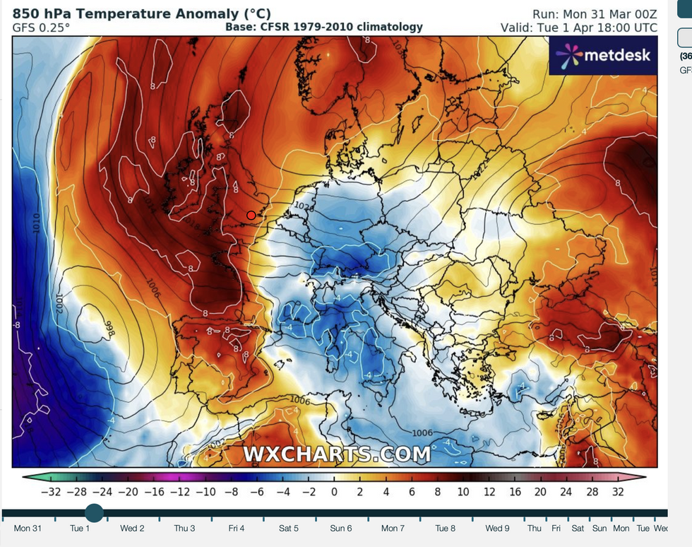
WXCharts map shows Britain to see more heat than usual
WXCharts
But the forecast through possibly the next fortnight is for unusually high temperatures and clear, cloudless skies.
Jim Dale, meteorologist for British Weather Services, said: “The outlook for the next 10 days, as well as pleasantly warm, is very dry with no signs at all of the usual April showers.
“There may be some rain in the northwest and Scotland, but other than that, high pressure is dominating through the start of April and that means warmer, drier conditions.
“There is a risk that we could be heading in the direction of a summer drought.”
LATEST DEVELOPMENTS: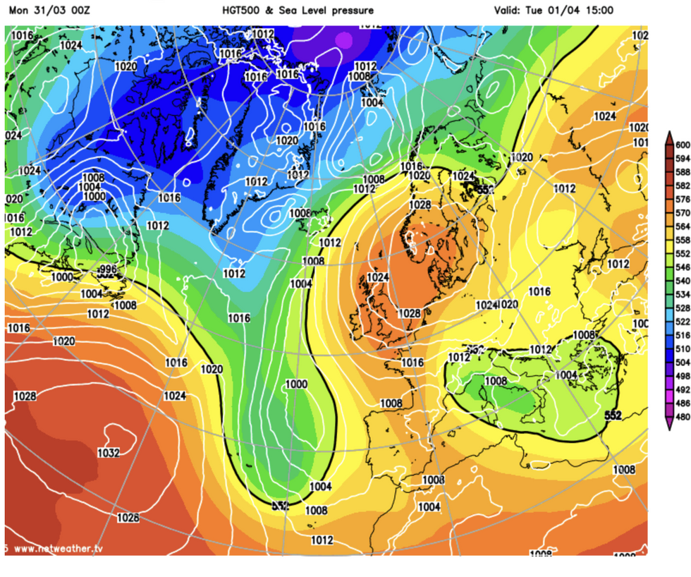
Temperatures build under high pressure
Netweather
Parts of the country are likely to hit a balmy 23C ahead of the weekend, he said, as warm gusts waft in from the south.
The UK will almost certainly bake in the warmest spell of the year so far, which is good news for sun-starved Britons but bad news for thirsty gardens.
Dale said: “We expect to see some decent rainfall at this time of year, but there is nothing significant in the forecast.
“We are stuck in a ridge of high pressure, and while that is good news for people’s morale, it is not such good news for gardeners and farmers.
“However, it is going to be a very pleasant week with lots of sunshine and dry, warm weather.”
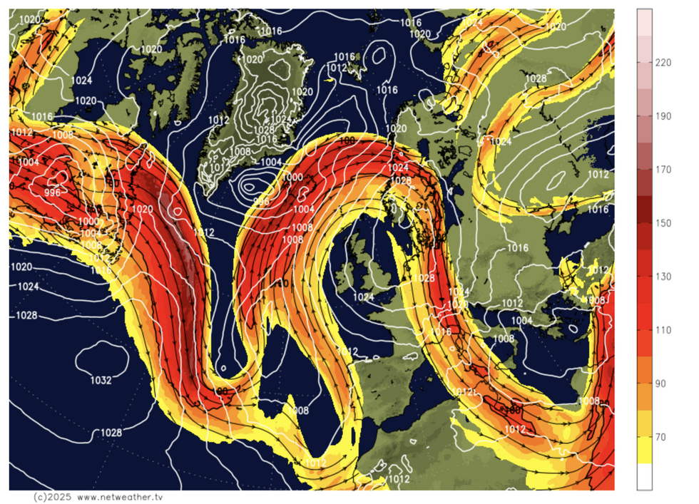
Jet stream builds an Omega block
Netweather
Glorious weather this week will be driven by high pressure building across the country, keeping at bay Atlantic wind and rain.
Such stubborn ‘blocking patterns’ can dig in for weeks, bringing periods of hot, dry summer weather.
In 2018, a blocking high plunged the UK into months of drought, and in 2022 high pressure drove the hottest day in history.
Hot weather this week will be driven by an Omega Block, high pressure that builds in a loop of the jet stream shaped like the Greek letter.
BBC meteorologist Chris Fawkes said: “We are going to see a ridge of high pressure build across the UK, and this is part of a blocked weather pattern known as an Omega block, and these can hang around for a week or more.
“It is this that is going to build an area of high pressure that is essentially over or close to the UK all of next week and perhaps the weekend beyond as well, so expect a lot of dry and sunny weather.
“As this high pressure builds in, most areas will be dry with some sunshine and it will get warmer, and that warming trend is set to continue.
“We will see temperatures getting into the low 20Cs with a lot of dry and sunny weather just around the corner.”
