


A weather front sweeping Britain will drive wind and heavy downpours across the north while elsewhere is shrouded in a creepy ‘radiation fog’.
Scotland and northern England will stay in the firing line for a stormy deluge with up to two inches of rain sparking warnings for floods, travel chaos and treacherous roads.
However, a shift in weather pattern to the south through the coming days will see a massive high-pressure anticyclone descend across the region.
Ground saturated from the recent rain brought by Storms Elin and Fergus will drive thick fog to form under clear overnight skies.
WATCH: Latest Met Office forecast
Jim Dale, social commentator and senior meteorologist for British Weather Services, said: “There is another front coming in later in the week and this will bring more unsettled conditions to Scotland and northern England.
“It travels across the country, and then high pressure builds to the south bringing much calmer conditions compared to the past week or so.
“But with this there will be the risk of fog, particularly in the valleys and the glens.
“The UK has had rain after rain after rain, and this has left a lot of moisture in the ground which will help to drive this.”
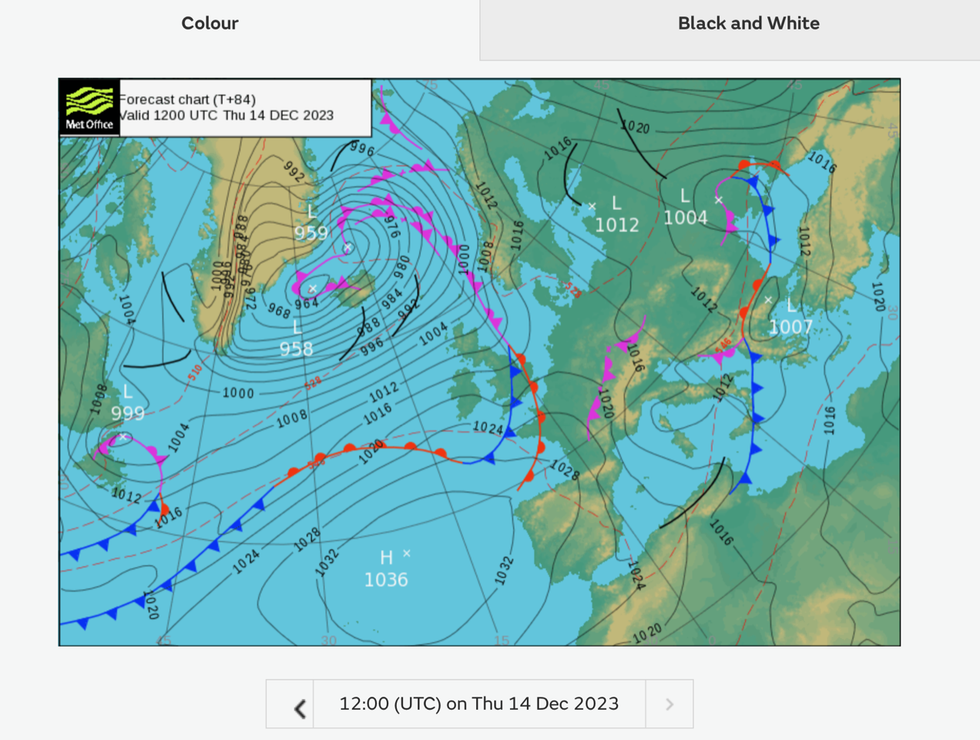
A cold front sweeps the country
|MET OFFICE
Wet ground will lift humidity by day, which will condense into mist and fog overnight as heat radiates temperature drop.
The so-called radiation fog threatens an eerie Dickensian run up to the festive season, as a White Christmas continues to hang in the balance.
Mr Dale said: “This fog will be driven by radiation of heat from the ground, and as such, it is radiation fog.
“So, a bit of a creepy feel to parts of the country over the coming days.”
Warnings remain in force across north-eastern England until mid-week for heavy rain with the risk of flooding and bus and train disruption.
Up to two inches could fall in the worst affected regions including Scotland, East Lothian and the Scottish borders, Tayside and Fife, and Northumberland.
But high pressure will build towards the end of the week bringing a much-needed respite from the rain, according to the Met Office.
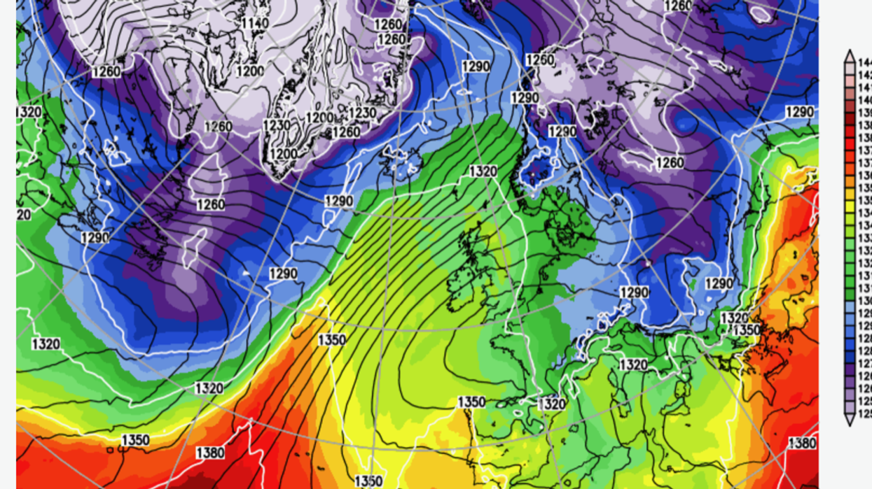
The jet stream will shift over the next few days, moving from its current southerly position over the UK closer to Greenland.
Meteorologist Annie Shuttleworth said: “By the end of the week, it is looking like we could see a slightly more prolonged settled spell across the UK.
“That’s because of the position of the jet stream will change through the course of this week.
“This will allow high pressure to build from the southwest and that means that low pressure systems from Friday will skirt to the northwest of the UK with higher pressure bringing drier weather to more central areas.”
Fronts will sweep eastwards bringing some ‘pretty heavy rain’ through the start of the week, she added.
Temperatures will lift higher than average for the time of year, hitting the low teens in parts of the south.