


Britain will be hit by ‘three seasons in one week’ as storms and floods give way to a bitter autumn chill.
Torrential downpours will drench swaths of the country through the coming days before temperatures plunge.
The jet stream will nosedive to the south ahead of the weekend pulling brisk northerly winds, with a dusting of snow possible in parts.
But through the rest of this week, the main threat will be from rain-bearing low-pressure systems crashing in from the Atlantic.
Jim Dale, meteorologist for British Weather Services and social commentator, said: “We are looking at three seasons in one week, with the start of the week bringing heavy rain and the risk of flooding before colder air comes down from the north later.
“There is a big change on the way for the end of the week when it will feel colder, particularly in the north.
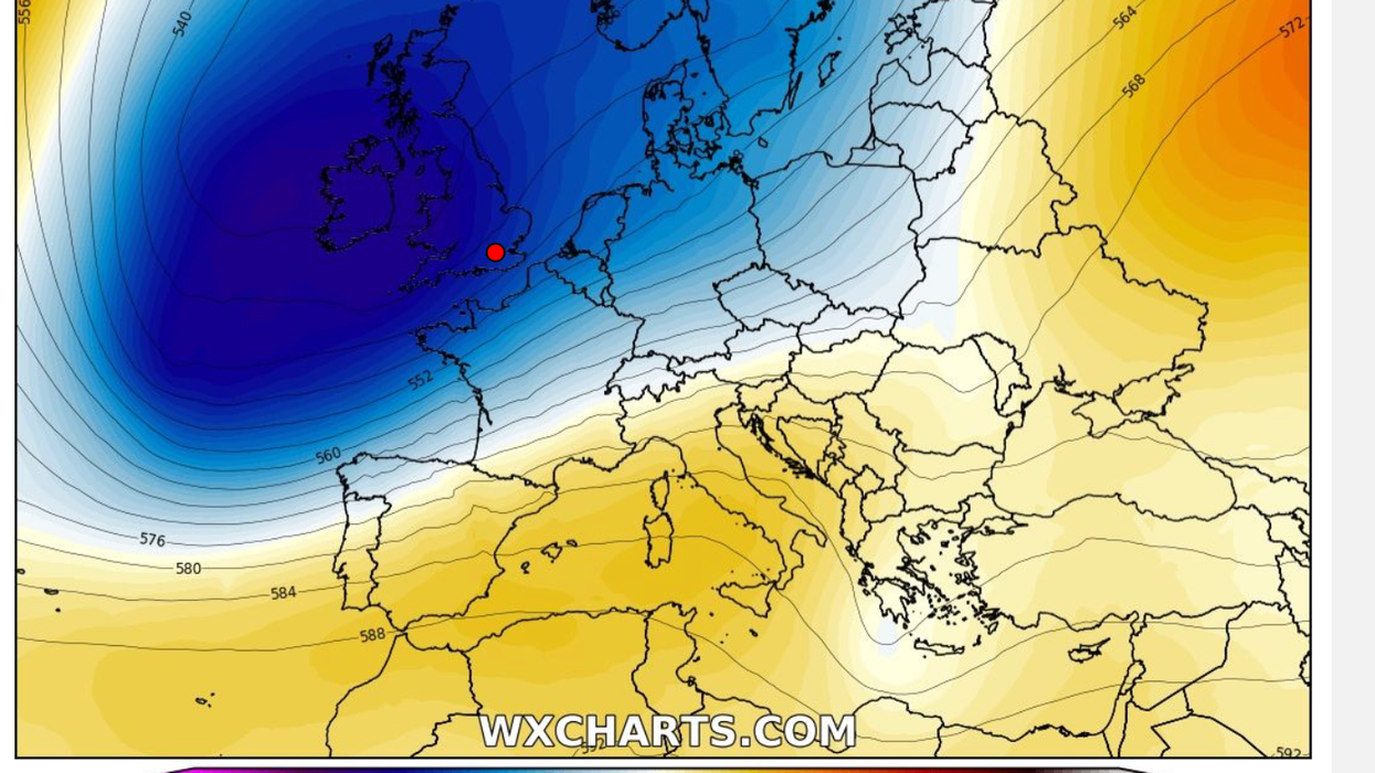
 Cold air will pour in to Britain following a change in the jet stream | WX CHARTS
“Going into the weekend, temperatures could recover in southern parts of the country, but generally, the weather is going to change.”
The topsy-turvy conditions are being driven by the jet stream which all summer has delivered a cocktail of strange weather.
Wedged north of the country, it has over the past few days steered bouts of wind and rain in from the Atlantic.
The jet is about to shift south, driving yet another shift in weather patterns as the nation braces for a turbulent start to autumn.
Met office meteorologist Alex Deakin said: “We are getting more of a classic jet steam picking up, and the jet stream is getting more lively and it is getting more south shifted, and that is likely to bring low-pressure systems our way.
“There may be a window on Tuesday where much of the UK is fine before this weather system arrives, but it is likely that low pressure will dominate, and the south will be more susceptible to wet and windy spells.
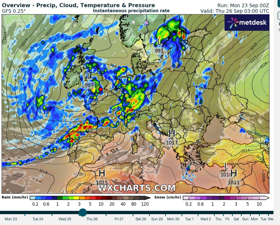
Low pressure ploughs in from the west
|WX CHARTS
“Generally, with low pressure nearby some heavy rain is likely and some gusty winds are also possible.”
Northern regions will see the biggest fall in temperatures through the coming days with snow possible over high ground.
Exacta Weather forecaster James Madden said: “This week will see a quite big U-turn as much colder and more unsettled weather takes over from around mid-week.
“We are expecting a more southerly driven jet stream over the next few days, and that will being low pressure, heavy rain and strong winds or gales in places.
“Additionally, it will also turn cold enough for wintry weather or snow across higher ground and some of the ski resorts.”
Drivers have been urged to take extra care over the coming days as changing weather sparks dangerous road conditions.
A raft of Met Office rain alerts were in force through the start of the week with more possible ahead of the weekend.
AA spokesman Chris Wood said: “If you do need to travel be aware driving conditions can quickly deteriorate during very heavy rainfall, with drains becoming swamped or blocked and standing water causing problems such as surface spray, reduced visibility and potentially leading to flooding.”