


An arctic blast is set to batter Britain in just days, as the remnants of Hurricane Kirk bring unsettled weather to UK shores.
According to data from the Met Office, the middle of October is set to see unsettled weather, with frequent bouts of wind and rain.
Low pressure systems tracking in from the Atlantic via the hurricane are expected to bring difficult conditions to much of the country, with Scotland and Northern Ireland bearing the brunt of the harsher weather.
Colder air from the Arctic will also blow over as the week progresses, with some snow expected,that ravaged the US coast, Netweather has forecast.
 Arctic blast to strike in days as Hurricane Kirk sweeps in snow - temperatures to plummet | Netweather
The hurricane is currently producing winds of 145 miles per hour.
It remains a major hurricane over open waters, but is expected to pivot to the UK and could heavily influence weather in the region by the middle of the week.
Jo Farrow, Senior Forecaster at Netweather, said: “Occluded fronts will settle over the far north of Scotland in a fresh easterly wind.
“There is cooler air to the north of these rainbands and colder air from the Arctic will feature for the UK later this week, with a bit of snow in the forecast. The change from a mild southerly to a chilly northerly will happen as ex-Hurricane Kirk moves by.”
WEATHER LATEST:
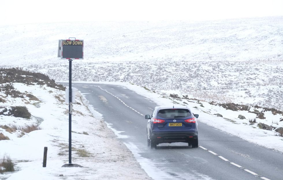 Scotland and Northern Ireland will bear the brunt of the harsher weather, with snow in the mountains | PA
The mercury will plunge to as low as -2C on October 13 according to WXCharts.
Farrow continued: “Hurricane Kirk is way out in the Atlantic on Monday and changing from a tropical cyclone to an extratropical low. This low, ex-Kirk, will get caught up in the mid-Latitude westerly flow, move to the north of the Azores on Tuesday and then head towards the Bay of Biscay.
“As the low swings up through Europe, the UK experiences a cold northerly flow. Many places will see autumn sunshine but with a nip in the air.
“There will be scattered showers and these will include settling snow on the hills of Northern Scotland and the tops of the Pennines, as well as wintry flurries perhaps reaching Eryri National Park (Snowdonia) and Exmoor.
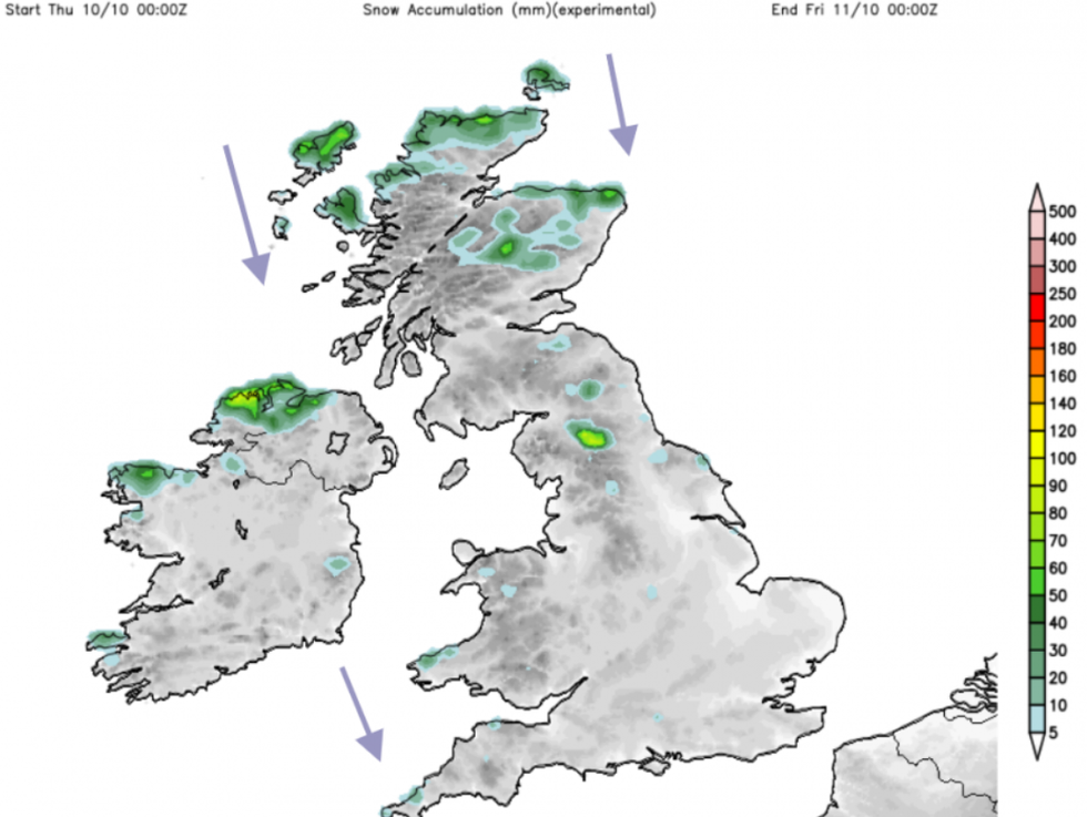
Snow accumulation coming down from the arctic
|Netweather
“Nighttime temperatures will fall, and there will be a frost for some by Thursday night. We miss ex-Hurricane Kirk but end the week in colder air behind that low pressure.”
Whilst the hurricane will have weakened by the time it reaches the UK, it is predicted to continue as a “moderately deep low pressure system”, according to forecasters.
The Met Office's Deputy Chief Meteorologist Tony Wisson said: “Hurricane Kirk is currently in the tropical Atlantic.
“It is expected to move north into cooler waters, where it will lose a lot of its strength, but maintain its identity as a moderately deep low pressure system.”