
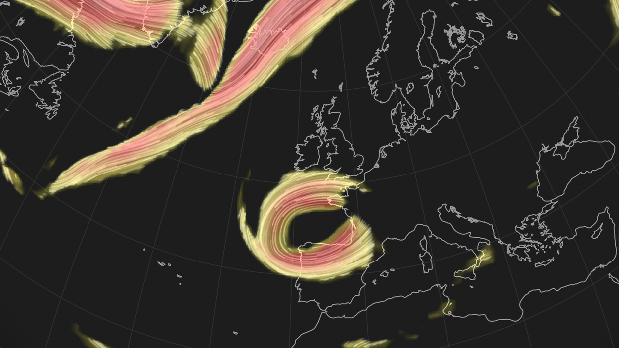


The jet stream has fractured leaving a severed appendage spinning near the UK threatening a tropical deluge.
Britain’s weather is about to descend into madness, baking parts of the country in the hottest temperatures for five months while elsewhere braves a four-inch deluge.
In a bizarre twist, north-western regions will sizzle in the best of the heat while cooler downpours target the south.
Weather through the coming days will be driven by changes in the pattern of the jet stream and humid air flooding in from France.
Met Office meteorologist Aidan McGivern said: “The jet stream is extending south across the UK in a very elongated set up, but it can cut off from the main flow into an entirely separate circulation known as a cut-off low.
“It looks likely that it is going to stick to the south of the UK even into Monday, and that means some very heavy rainfall pushing into southern parts off the UK and that is of key concern over the next few days.
 Cut-off low from the fractured jet stream | WX CHARTS
“It all depends on the instability over northern France and how thundery outbreaks of rain develop there, and those can be very uncertain.”
Warm air sweeping the coast of Britain will head to Scotland and the north pushing temperatures on Friday into the mid-20Cs.
Dry air falling over the hills and warming – the foehn effect – will drive the mercury even higher, McGivern explained.
He said: “It’s not just the northwest that will see the warmest air, it will also be relatively warm in North Wales and into the midlands and east Anglia.
“If we see 25C or so, then it would be the warmest day since May.
“There will be some very warm nights coming up, heading into the weekend.”
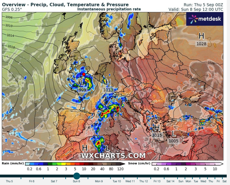
Cut off low douses the south
|WX CHARTS
Up to four inches of rain will hit southern Britain and the West Country through the end of the week.
This threatens localised flooding, river flooding and transport disruption, according to the Met Office. A yellow weather warning is in force across southern England and southern Wales for the whole of Friday.
McGivern added: “The rain is going to be so heavy because of instability in the atmosphere because of the cut-off low and surface low over France and because of humidity in the atmosphere.
“As that low pressure forms over France, circulation will drag very warm and humid air from Central Europe over the North Sea and into the UK.”
It is the latest turn in Britain’s freakish weather after government forecasters revealed summer was the coldest for almost 10 years.
Despite the odd burst of heat along the way, temperatures have been below average across the country.
Met Office scientist Emily Carlisle said: “I don’t think it will surprise anyone that this summer has been cooler than average for the UK.
“Mean temperatures in both June and July were below average, with temperatures in August only slightly above.
“This was largely due to northerly winds bringing cold Arctic air to the UK in June and July, while August saw an increase in westerly winds bringing slightly warmer Atlantic air.”
The weather will ‘yo-yo’ through the start of the month as unstable air wafts in from the Bay of Biscay.
Jim Dale, meteorologist for British Weather Services and social commentator, said: “There will be a mix of warm, very warm, humid and stormy conditions through the first half of the month as the weather yo-yos between quiet and tranquil and humid and unstable.
“There will be some quite long stretches of dry weather in parts of the country, while elsewhere will see more rainfall.
“Into this weekend, there will be the risk of thunderstorms.”