UK weather: Britain to be smashed by -10C Arctic gusts and volatile storms driven by 150mph jet stream

A deluge of storms driven by a 150-mph jet stream will keep Britain’s brollies up into April.
Don't Miss
Most Read
Trending on GB News
A deluge of storms driven by a 150-mph jet stream will keep Britain’s brollies up into April.
Sun lovers will be out of luck most of this week amid forecasts for bitter winds, rain, snow and thunder.
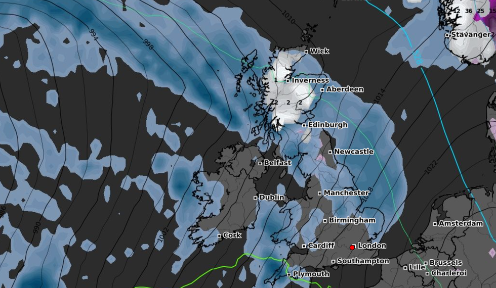
Temperatures will nosedive in the run-up to mid-week as -10C Arctic gusts bring wintry downpours to parts.
It will turn milder from Wednesday, although a furious jet stream will hurl bouts of rain in from the Atlantic.

Temperatures will nosedive in the run-up to mid-week as -10C Arctic gusts bring wintry downpours to parts.
WXCHARTS
Jim Dale, meteorologist for British Weather Services, said: “It is going to feel far from spring-like for much of this week, and amid the rain and wind there is going to be a risk of storms.
“I expect this to carry on through the week and into the start of April, with the odd day around the middle of this week when it will possibly be calmer.
“Aside from that, it is going to be wet and windy through the rest of the month with the potential for storms.”
Foul weather will be driven by the jet stream ploughing across Britain at 150 mph–around 40mph faster than average, according to weather models.
While much of the UK is in the firing line for wet and windy weather, Scotland is braced for snow.
Mr Dale said: “The jet stream is running right across the UK, with Scotland on the northern edge, so here it will be cold in Arctic air.
“This cold air will affect much of the country through the start of the week with temperatures of -6C in parts which could feel closer to -10C with the wind chill.
“Even further south, we could be dipping to freezing or not much above.
“Later in the week, we are into the wetter, windier and stormier weather, and this is going to be largely the pattern through the rest of the month and into the start of April.”
Although weather models are flip-flopping ‘all over the place’, Easter could bring home the sunshine, he added.
“It is very early days, though,” he warned.
“The charts are flipping all over the place and so it is a case of wait and see, and it could go either way.
“One minute Easter looks like it could kick off summer, and the next it’s cold and wet. We will have to watch this space.”
Snow in parts of northern Scotland could settle through the early hours of Monday, according to the Met Office.
Meteorologist Aidan McGivern said: “The showers will be distributed mainly in the north and along the North Sea coast, although it will be a cold start for Monday.
“We keep that chilly air, albeit with drier conditions on Tuesday.
“On Wednesday, it is likely to change again with low pressure pushing in from the West and the initial band of rain will likely fall as snow in places, mainly northern hills, before it turns back to rain because we will be seeing milder south-westerly winds return.
“It will be an unsettled end to next week but with temperatures recovering.”
The soggy forecast has prompted Ladbrokes to slash the odds to 5-2 on the wettest spring ever.
The bookies’ spokesman Alex Apati said: “It looks as though we're set for even more brutal weather conditions over the next few weeks, and with spring around the corner, we're strapping in for a potentially record-breaking season of rain."


