


A jet stream bringing Arctic breezes will bring colder temperatures across the UK, even dropping to as low as below freezing across parts of the country.
Next weekend, temperatures will go as low as -4C across Scotland, according to NetWeather.
The Met Office has warned of a "brisk westerly flow" with "breezier conditions" over the next few weeks, according to its long-range forecast.
Additionally, the forecaster has issued an "increased chance of frost and fog" between October 27 and November 5.
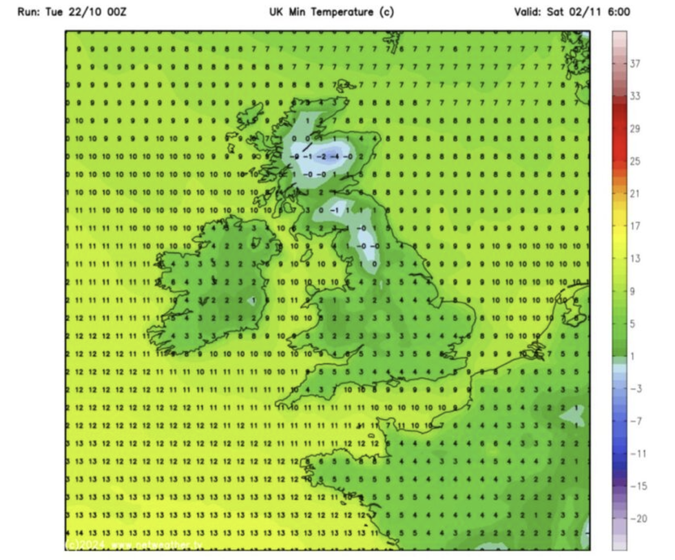
Next weekend, temperatures will go as low as -4C across Scotland, according to NetWeather
|WXCharts
The drop in temperatures follows Storm Ashley, which has substantial travel disruption throughout Britain, with London flights delayed while, in Scotland, average wind speeds hit 85mph over the weekend.
This week, speed restrictions have been put in place as high winds continue to batter Scotland, as flights still face delays across major airports in the region.
The Environment Agency had issued approximately 45 flood warnings across England, including the south Cornwall coast and the River Severn.
Meanwhile, the Scottish Environment Protection Agency issued 47 flood warnings.
LATEST WEATHER UPDATES:
- UK weather: ‘Tropical’ Azores High to send UK into high-teens following Storm Ashley assault
- US weather: America left ‘abnormally’ arid as ‘bone-dry’ winds threaten to spark deadly wildfires
- Weather journalist warns Brits ‘you are in for a bumpy ride’ as EXPLOSIVE winds BATTER the UK - ‘The south will feel it!’
ExactaWeather's James Madden said Britons should expect "a day or two of warm to hot and summery weather" which would then "be quickly replaced with more cooler and unsettled weather in the days to follow as the jet stream looks to go a little erratic, which in turn makes the weather much harder to predict and further analysis is required over the coming days".
He added: "This will also send the apps and third-party forecasters into total disarray over the coming weeks, and expect no consistency from them."
According to the Met Office, a jet stream is a "core of strong winds five to seven miles above the Earth's surface, blowing from west to east".
Generally, the stream affects wind and pressure and, therefore, impacts the weather on a daily basis.
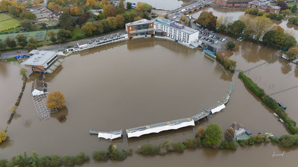
The Environment Agency had issued approximately 45 flood warnings across England, including the south Cornwall coast and the River Severn
|PA
In its forecast between October 27 and November 5, the Met Office forecast has said: "Initially breezy or windy with large amounts of cloud and some outbreaks of rain, especially in northern and western areas, with generally drier conditions farther southeast.
"However, high pressure is likely to build more strongly across southern UK into next week, tending to restrict the majority of any wet and windy weather to the far northwest.
"That said, areas of cloud trapped underneath this area of high pressure may still produce some drizzly rain in places, with an increased chance of frost and fog under any lengthier clear spells, perhaps slow to clear.
"Later next week and into the following weekend there may be a tendency for high pressure to retreat, bringing an increased chance of breezier conditions and some rain in places. Temperatures near-average for much of this period."