


Britons will be able to don their T-shirts at the start of autumn with temperatures to rise under a lid of high pressure.
Sometimes known as a ‘heat dome’, a high-pressure ‘anticyclone’ of dry, settled weather will creep in from the west next week.
Although weather models vary, meteorologists generally agree the start of September promises to make up for what has been lacking through much of summer.
After a wet and thundery weekend in parts, thermometers will rise early next week with highs in the south pushing above average for the time of year.
Jim Dale, meteorologist for British Weather Services and social commentator, said: “There is a lot of T-shirt weather to come for some parts of the country as we go through the end of summer and the start of September.
“Temperatures in the high-20Cs or higher are possible particularly to the south, with some very pleasant weather around under the influence of high pressure.
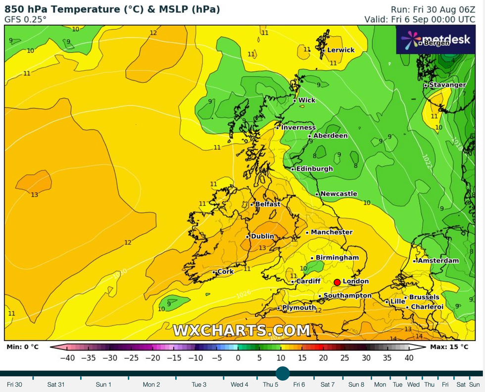
UK temperatures will remain in the high 20s next week
WX CHARTS
“There will be a risk of thunderstorms, however, and with these some heavy rainfall.”
High pressure, the driver for hot weather during summer months, will nudge from the west this weekend.
Britain’s weather so far this summer has been blighted by low pressure pulled in by an active jet stream.
Some weather models show high pressure hovering to the west of the UK, while others predict it moving across the country.
Either way, experts agree the start of autumn will kick off with higher-than-average temperatures and sunshine.
Met Office meteorologist Alex Burkill said: “Higher pressure is more likely and high pressure generally means more settled drier conditions.
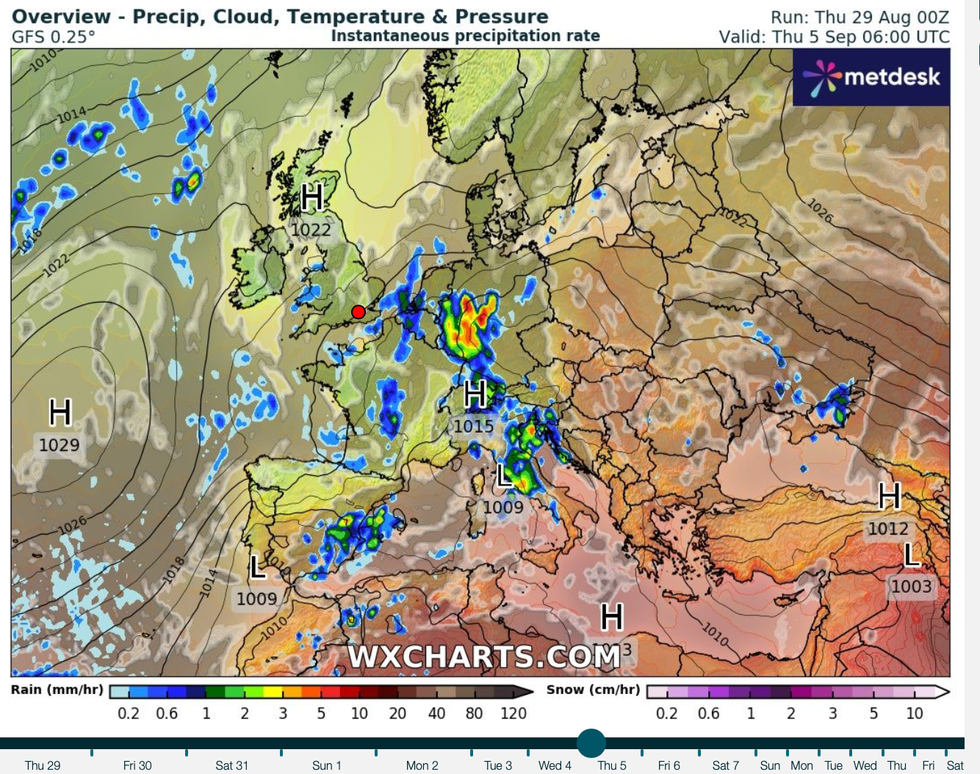
Experts agree the start of autumn will kick off with higher-than-average temperatures and sunshine
WX CHARTS
“Generally, the trend as we go through the start of autumn is for high pressure to be most dominant.
“It’s unlikely that we will see any major warmth or any heat, but with some decent fine weather around many people after the summer we have had won’t be complaining.”
This weekend is looking largely dry, he said, although there will be a risk of thundery downpours in parts.
Sunday will bring the risk of more intense showers, he added, before things dry up after the start of next week.
He said: “Most likely is higher pressure and generally drier weather as we go through next week, and in London for example, temperatures pick up again early next week.
“By Sunday, and even into Monday, despite the cloud we could have some relatively high temperatures, and for some in the south temperatures will be several degrees above average.
“And then temperatures do stay on the above-average side, but there Is a relatively large spread as we go through next week.”
It follows a choppy end to summer which brought the twelfth storm of the season–Lilian–at the end of last week.
Lilian followed on the heels of Hurricane Ernesto, whose remains clipped the UK on their path across the Atlantic from the tropics.
The Met Office this week released the list of storm names for the 2024/24 season, including gems such as ‘Floris’, ‘Gerben’, and ‘Mavis’.
Will Lang, the Met Office’s head of situational awareness, said: “This is the tenth year of us naming storms.
“Naming storms helps to make communication of severe weather easier and provides clarity when people could be impacted by the weather.”
