Britain will be blasted with scorching temperatures before the end of September following heavy rain and gale force winds
NetWeather
The unseasonably hot Mediterranean weather is likely to be the last of the hot temperatures before the Autumn
Don't Miss
Most Read
Trending on GB News
Britain will be blasted with scorching temperatures before the end of September following heavy rain and gale force winds.
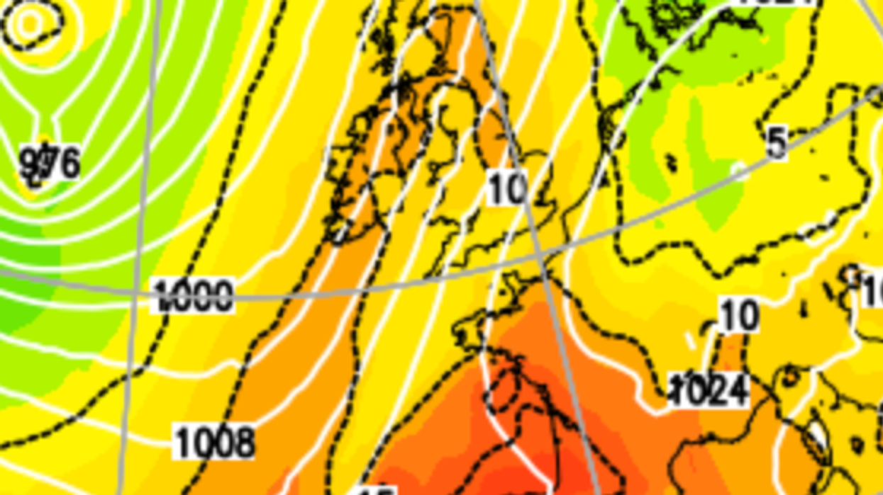
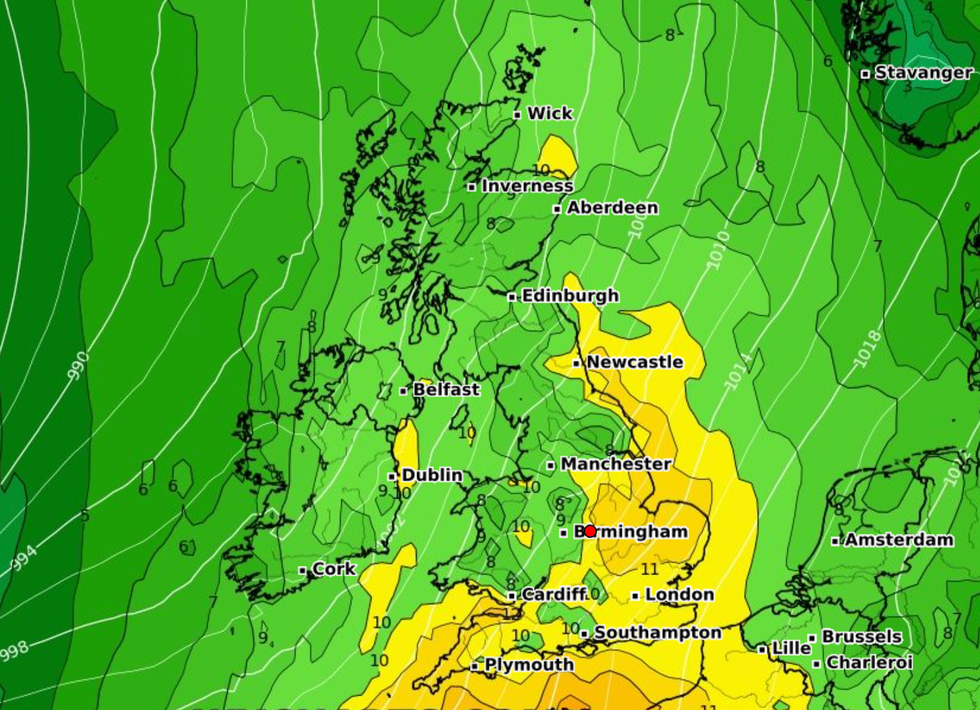
Warm weather is forecast across the UK on Saturday, September 30 with temperatures expected to reach 23C.
The unseasonably hot Mediterranean weather is likely to be the last of the hot temperatures before the Autumn.
Warmer conditions are expected to hit East England, while London, Liverpool, Manchester, Leeds, Hull, and Birmingham are also forecast to see 20C.
WATCH NOW: Hurricane Nigel explained
The last day of September is likely to be largely dry with only north-west Scotland expected to see downpours.
According to the Met Office long-range forecast for Friday, September 22, to Sunday, October 1, it looks the very last sighting of summer.
A Met Office: "The showers are likely to ease from the west leading to a mainly dry start to the weekend (September 30 and October 31).
"Conditions will probably become more unsettled later in the weekend and into the following week as low pressure systems lie to the west or northwest of the UK.
LATEST DEVELOPMENTS:
"This will bring showers or outbreaks of rain across many areas, with some heavy bursts at times, especially in the north and west.
"It will often be windy, with a small chance of a spell of very strong winds around the middle of the period. Temperatures are likely to remain near normal."
The warm conditions come after Britain is hit with extratropical cyclone which is set to bring heavy rain and high winds.
Hurricane Nigel, which formed in the Atlantic late on Saturday, has intensified into a Category 1 hurricane early on Monday.

Warmer conditions are expected to hit East England while London, Liverpool, Manchester, Leeds, Hull, and Birmingham are also forecast to see 20C
WXCHARTS
But Founder and Senior Meteorological Consultant at British Weather Services, Jim Dale explained that it won't be a hurricane by time it reaches Britain, but will hit as a extratropical storm.
Speaking to GB News, he said: "Currently there are sustained winds of around 70mph in the mid Atlantic and the course of it is not expected to make landfall.
"By the weekend it was have passed the jet stream and will push through Ireland and will bring characteristics of a normal storm such as strong winds and heavy rain.
"The storm will likely impact the North West England and Scotland the worst, this is where it will be felt most.


