North-Atlantic sea temperatures are set to be 4C or 5C above average
Don't Miss
Most Read
Trending on GB News
‘Zooming’ Atlantic sea temperatures could risk Britain taking a swipe from an unusually fierce Atlantic hurricane season.
American forecasters are warning parts of the United States to brace this summer for abnormally frequent tropical storms.
Some could head north-eastwards towards the UK later this year, experts say, putting our weather through the wringer.
The Atlantic hurricane season kicked off at the start of this month, although the threat to the UK is expected later this summer.
Jim Dale, meteorologist for British Weather Services, said: “North-Atlantic temperatures are zooming, and are around 4C or 5C above average for the time of year.
“This is going to provide energy to drive the hurricane season, and we are expecting not only more hurricanes than usual this year, but a trend for them to be stronger than usual.
“This could end up affecting the UK later in the season, as some of these systems enter the north Atlantic and change our weather patterns.”

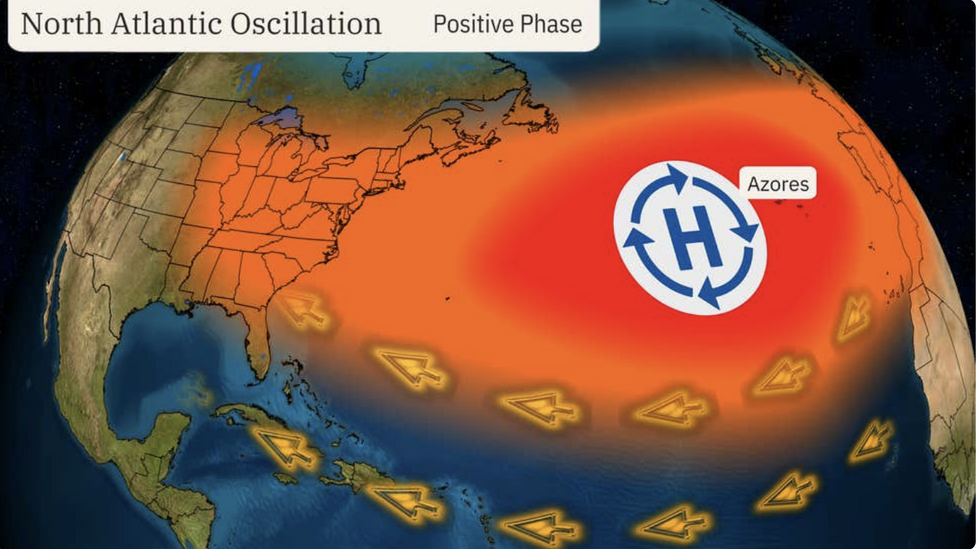
The North Atlantic Oscillation could help drive the hurricane season
The Weather Channel
Although hurricanes are unable to hit Britain directly, the UK can be affected by their remnants.
Energy carried within the storm is steered by the jet stream into the North Atlantic, usually during late summer or autumn.
This either supercharges regular storms heading or, if the ex-hurricane moves northwards, drives high pressure and unseasonable warmth.
It is almost a decade since Hurricane Bertha, which spawned as a tropical storm near Barbados in July 2014, unleashed havoc across the UK.
A few weeks later, Hurricane Cristobal took a similar path, but as it passed over northern Britain, it brought calmer, warmer weather.
US meteorological services predict this year will see around 25 named storms, 13 hurricanes and seven major hurricanes.
Although the six-month hurricane season starts in June, the largest threat arrives during the autumn.
Weather Channel spokesman Chris DeWeese said: “The 2024 Atlantic hurricane season starts on the first of June and is forecast to be one of the most active seasons on record.
“The US National Weather Service’s (NOAA) recent outlook was its highest outlook ever, anticipating up to 25 named storms, 13 hurricanes and seven major hurricanes.”
The predicted increase in tropical storms is being blamed on unusually high sea temperatures and a transition from El Nino to La Nina.
El Nino–a warming of the South American Pacific coast–set in last year and was one of the strongest on record.

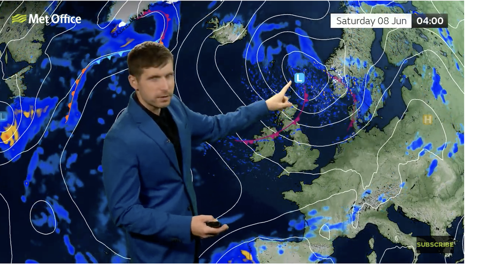
Low pressure to affect the weather this weekend according to Met Office’s Alex Burkill
Met Office
A pendulum swing is now expected to El Nino’s counterpart, La Nina, which would drive further instability in global weather patterns.
A stronger than average ‘Bermuda High’ pressure system will pep the North Atlantic Oscillation (NOA)–a balance of atmospheric pressure which affects the path of tropical storms.
Weather Channel meteorologist Jonathan Belles said: “A pattern called the positive North Atlantic Oscillation is expected across the Atlantic.
“This may steer more systems west while also trapping them in the tropics with no safe escape route.”
In the meantime, Britain’s weather will remain changeable as a battle ensues between high and low pressure.
High pressure bringing drier warmer weather is expected to set in after the weekend although rain will be close behind.
Met Office meteorologist Alex Burkill said: “There are hints of high-pressure building as we go through next week, and high pressure to the west of us becomes more dominant which means largely settled conditions.
“It is likely to turn dry with more fine weather ahead although it may become a bit more changeable as we go through next weekend.
“After that, there are signs that we could see high-pressure building again, but that’s a bit more uncertain, and it’s a bit more likely that it will stay changeable as we go through the following week.”
However, low pressure will bring further outbreaks of rain through the weekend and the start of next week, he added.


